 After our Sunday morning walk on the Mendocino Headlands, we started driving south for what became a very long drive day. We were heading to LA for our Tuesday departing flights, or as Neil says “we were heading back to the barn.” Our plan was to drive straight through San Francisco and on to San Luis Obispo for the night. That became easier said than done. Even on a Sunday, I couldn’t believe the traffic!
Marin Headlands
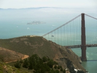
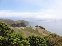
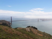
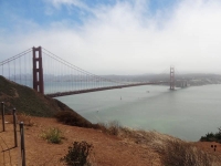 Heading south toward the Golden Gate Bridge we took the last exit north of the bridge which took us into the Golden Gate National Recreation Area. Neil wanted to get a view of the Golden Gate Bridge before we crossed it. When I would drive up to Sausalito or beyond I used to take the first exit coming north off the bridge to enjoy the vista of SF and the bridge from the overlook (you can’t get to that overlook parking area going south onto the bridge, and from that overlook you can’t go west onto the headlands). How could I have lived in the Bay area so long and not driven or hiked around in this large Recreation Area (it would have been the second exit going north)?
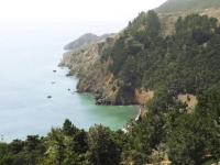
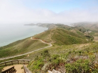 The exit took us onto Conzelman Rd. and into the midst of a swarm of other Sunday excursionists, all of us looking for a place to park. The area we were exploring I later read is called the Marin Headlands. We enjoyed beautiful views of the bridge and Pacific Ocean as we drove.
“Welcome to the Marin Headlands! One of the most unique areas in the Golden Gate National Recreation Area, the Marin Headlands covers various types of histories from the Miwok Indians to the Military,
including historic Fort Barry and Fort Cronkhite, the NIKE Missile site and the 150 year-old Point Bonita lighthouse. Other attractions include varied hiking trails, dog friendly Rodeo Beach, and astonishing views of the coast and San Francisco. The explosion of wildflowers in the spring and raptor migration in the fall fill the headlands with year round excitement. The Marin Headlands is an example of open spaces still available in the Bay Area for visitors to enjoy.” NPS website Marin Headlands
It appears this is an area to explore when we next travel through the Bay Area!
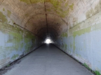
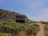 We got out at a few viewpoints where I bundled up against the cold wind. People didn’t spend too much time in the chilly wind after taking in the views so parking spots frequently opened but were rapidly taken. The first viewpoint we stopped at turned out to be the highest point in the Recreational Area: Hawk Hill. It is now known as a conservation site for the Mission Blue Butterfly (endangered) and for raptor migration viewing, but it has a military history from World War II and through the Cold War. There was a big tunnel at the viewpoint which Neil explored. It turns out have been built to house anti-aircraft guns but was never completed and was left with the simple name Battery 129. It wasn’t until I was researching this that I read that sitting on top of the hill above the tunnel had been a Nike missile site built in 1954. The radar buildings have been removed but you can see the concrete pads from Google Earth.
“Hawk Hill, or Battery Construction 129, has been a silent witness to the ecological and cultural changes in and around the San Francisco Bay for eons. It is the story of soldiers waiting for an enemy that never came. Although most of the World War II fortifications built in the park were intended to keep the newest battleships from reaching striking range, the war was fought and ultimately won from the air. Built into the highest point at the Golden Gate, Battery Construction 129 had two large guns mounted under thick concrete shields covered with native vegetation for camouflage and virtually invisible from above. NPS Hawk Hill
Henry Cowell Redwoods
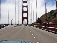 Back on the road, we crossed the always impressive Golden Gate Bridge. Neil took lots of photos through the windshield as I drove. I thought Sunday might be an easy day to get thorough the city that has no freeway crossing through it. I forgot there is always something going on in the City! We crawled through the Presidio, past Golden Gate Park, and along 19th street until we finally reached Interstate 280. Our next destination was Henry Cowell Redwoods.
On Maui, we sometimes use Google Maps on our phone to locate an address but we don’t need the navigation or traffic features. That Sunday I found their value and can understand what a great feature it is for urbanites! We would see lots of red areas along our route telling us the traffics was heavy. We hit a standstill when we turned onto Hwy 17 toward Santa Cruz and there was a long red line on Google Maps (two hour estimated delay). We were able to ease over and get off at the next exit, double back and get on Hwy 9 that was still slow but at least moving.
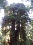
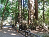
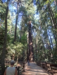 As we turned into the Henry Cowell Redwoods State Park entrance, it felt very commercial. There is the visitors center, retail store, and Roaring Camp railroad train depot all surrounding the parking area. However, it had very easy access to the Redwood Grove Loop Trail which starts at the Visitors Center and loops .8 miles through the section of old growth redwoods.
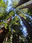
“Henry Cowell’s redwood grove is the only remaining old-growth grove in the Santa Cruz area and is an intriguing glimpse into what the region’s extensive redwood forests might have once looked like.
In many ways the grove has a typical old-growth feel; it’s remarkably cool and lush, with a groundcover of ferns and redwood sorrel, and there’s a characteristic hush from all the sound-dampening foliage. However, typically for southern groves near the ocean, there aren’t a lot of big redwoods here, and an unusual number of the trees are oddly mishhapen. Also, mixed in with the redwoods is a thick understory of tanoak and bay trees that obscures the redwoods and makes the grove look like a dense deciduous forest. The broadleaf growth is densest within the redwood loop; the old growth just outside the loop is much more open, suggesting that the grove’s appearance may be partly the result of fire suppression or other land management practices. …
The old growth was the first coast redwood grove to be saved from logging, having been purchased in 1867 by San Francisco entrepreneur Joseph Welch. A sawmill had existed near the grove since 1841, but the town of Felton and the railroad had not yet been built. Welch’s Big Trees Resort remained in operation until Santa Cruz County purchased the resort in 1930. In 1952, the Cowell family donated the adjacent land, which had been logged to support the nearby lime kilns, to the state.” The Redwood Grove Loop Trail
The Park brochure is very informative including a summary of the Geology, Native People, and additional History. I found the full brochure online if you are interested in reading further.
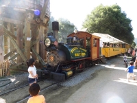
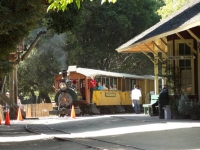 “Adjoining the park is Roaring Camp Railroad, offering visitors a chance to journey back in time on an old steam locomotive.” (Friends of Santa Cruz State Parks) The train chugs up from Santa Cruz through the mountains with part of the route actually traveling through the Henry Cowell Redwoods State Park although the train depot is on private land connected by a walkway to the parking area of the State Park. After walking the redwood loop trail, we crossed the tracks to view the vintage steam engines in Roaring Camp. There seemed to be a lot of activities going on for children but nothing we saw that we could participate in.
“Ride into the Past on 19th Century Steam Trains: Travel over trestles, through towering redwood groves and up a winding narrow-gauge grade to the summit of Bear Mountain as conductors narrate the history of Roaring Camp, the railroad and the forest.
In the 1880s, narrow-gauge steam locomotives were used to haul giant redwood logs out of the mountains. Roaring Camp’s steam engines date from 1890 and are among the oldest and most authentically preserved narrow-gauge steam engines providing regularly scheduled passenger service in America.” Roaring Camp Railroad Redwood Train
San Luis Obispo
Back on the road again, we drove straight down Hwy 101 toward our hotel in San Luis Obispo, stopping only for gas and food in Paso Robles where the county fair was going on. We watched the colorful lights of midway carnival rides as we found our way back onto the highway. Yes, it was past dark by then and past 10 when we arrived at our comfortable, basic Motel 6 room for a shower and luscious sleep in a queen bed.
It felt like double luxury with no need to roll up sleeping bags nor pack the tent the next morning before we met our friend Ken near Madonna Inn at a local coffee shop for breakfast where we enjoyed catching up. My memory of the area from 20 to 30 years ago was all open ranch land along lower Madonna Road and Los Osos Valley Road; now it is all paved with shopping malls!
Departing LA
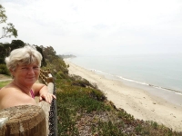 We drove our final leg to LA, timing our arrival at Pamela and Chris’ in Lawndale for Monday midday to avoid the worst of rush hour traffic (worked out well.) We took a rest stop in Santa Barbara at a small little park overlooking the Pacific Ocean. I have to memorize the exit name for next time because it is not visible from the highway before taking the exit. Thank you again Google Maps.
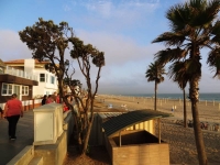
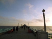
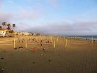
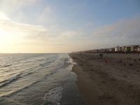
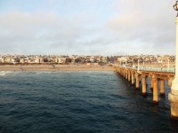
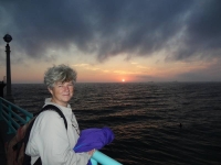
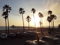 The afternoon was spent unpacking and cleaning the car, sorting what would stay with mom or Pamela and what we would take back to Maui. We enjoyed a home cooked evening meal with Pamela and Chris before driving to Manhattan Beach pier to walk along the strand and on the pier. I saw all these people with ice cream cones and I just had to ask where. Just up a block on the avenue is the Manhattan Beach Creamery. It was hard to decide on a flavor but I am sure I had something with chocolate in it! Enjoying the sunset over the ocean as we stood on the end of the pier was a wonderful way to close our summer adventure together.
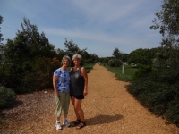 On our departure day, Tuesday July 29, we packed our bags for our flights and fit everything else in Mom and Bill’s car trunk to return to Ridgecrest. We had time to walk with Pamela along the Veterans Parkway (an old rail line converted into a parkway through Manhattan Beach) before enjoying a Mediterranean lunch at the Hummus House near their home before she went to work.
Chris kindly took a break in his work day to drop us at the LAX airport late afternoon. Neil and I had separate flights! He was returning home to Maui while I was flying to Ohio to visit with my dad and extended family. 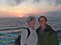 He took our one checked bag freeing me to just a carry-on for the rest of my trip. We had been able to work out our departures to within 45 minutes of each other and while Neil would arrive in Maui yet that night, I settled in for my red eye flight. It was one month ago we took the red eye from Maui to LA. What a great adventure!
Thank you for joining us as we relived our 2014 summer trip. We don’t know when our next adventure might be, but we hope to take you along with us.
Aloha, Nan and Neil


