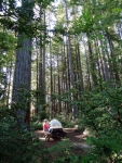
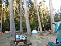
 We reached the California Redwoods on Friday night July 25, 2014. The first campground we tried, Jedediah Smith State Park, was not only completely full but it was $35 a night! Welcome to California! The ranger was very helpful providing us with a list of the Redwood campgrounds and marking the nearest ones. We found a great little spot in Florence Keller County Park, a second growth redwood forest, five miles north of Crescent City (and only $10 a night!) We decided to treat ourselves to a seafood dinner now that we were on the coast but so did all the other tourists on their summer vacations. The few places we tried had very long waits.
 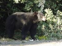 We settled on a Mexican restaurant that had some good spicy seafood entrees. 😉 This was the first time we had ventured into a Mexican restaurant since our bad experience in Eastern Washington. Being able to eat Mexican food again was one of the good things about being back in California!
Crescent City
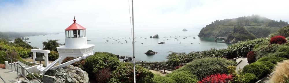
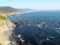
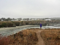
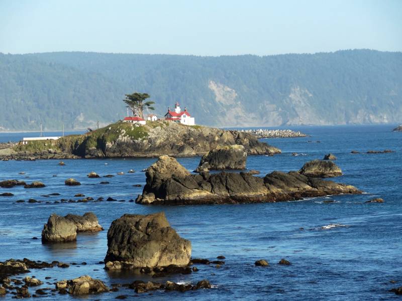
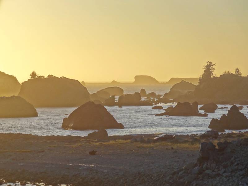
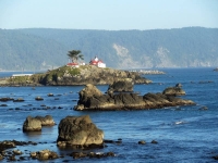 We cut over to the coast as soon as we could upon entering Crescent City and drove along Pebble Beach Drive. We came to a beautiful spot to park overlooking Crescent Bay at Brother Jonathan Park. The bay is full of small rock islands with the largest containing the picturesque Battery Point Lighthouse. We watched whales swimming beyond the rock island as we visited with a few locals and visitors also enjoying the view. We returned to the overlook after dinner to enjoy the sunset over the bay but by dark we were settled into our tent among the redwoods.
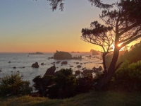
“The first American to explore the [Del Norte] country overland was Jedediah Strong Smith, for whom the Smith River is named. In 1828, Smith and his party of trappers traded with Native Americans, came upon Lake Earl, and camped at Crescent City.
In 1848, Major Pierson B. Reading discovered gold on the Trinity River, and by 1850, northwestern California was teeming with miners. The town of Crescent City was established in 1853 by J. F. Wendell … Crescent City became a bustling shipping and trade center, catering to and supplying the miners. …  [T]he area experienced a boom in settlement as a result of lumbering activity that followed the mining industry … To facilitate the use of Crescent Bay as a harbor, the Battery Point Lighthouse was erected in 1856. It survived the 1964 tsunami …
On, March 27, 1964 the Good Friday [Alaska] Earthquake (measuring 9.2 on the Richter scale) set in motion a tsunami down the west coast of the U.S. Crescent City was struck with four waves destroying hundreds of buildings (including most of the downtown area) and killing 12 people.” History of Crescent City
Redwood National Park
 A bright sunny Saturday morning greeted us as we drove out of our shaded forest campground. We arrived at the Redwood Park Information Center in Crescent City just as it opened. We had located it the previous evening but it was already closed. There were numerous brochures for us to collect while we waited our turn to speak with the ranger. We asked about the best driving routes, hiking areas, and any waterfalls.
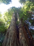
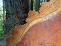
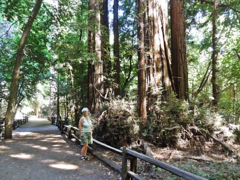
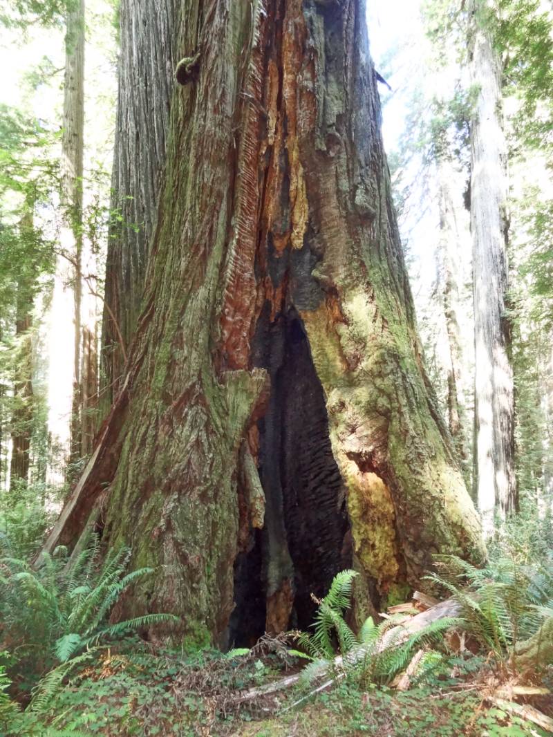
 The National Park and three State Parks protect much of the state’s last remaining old growth redwood forests. A great number of people worked to protect these redwoods from falling to the ax. Logging felled many of the most ancient of trees, but I continue to be impressed with the dedication of early 1900s conservation visionaries who recognized the importance of protecting this heritage. Many individuals used their own funds to purchase land to protect it from logging and later donate it to the Parks.
 “Paleontologists Henry Fairfield Osborn of the American Museum of Natural History, Madison Grant of the New York Zoological Society, and John C. Merriam of the University of California at Berkeley founded Save the Redwoods League in 1918. The League was formed as a nonprofit organization dedicated to buying redwood tracts for preservation. Through donations and matching state funds, the League bought over 100,000 acres of redwood forest between 1920 and 1960.” Redwood Area History
The park brochure notes that of the estimated original 2 million acres of coast redwood habitat, only 118,000 acres remain of older and old-growth redwoods (that’s only 5.9%).
The Indigenous People
 “The native people of the North Coast region have made the redwood forests and associated ecosystems their home for thousands of years. … Prior to Euro-American contact, American Indians had adapted well to this environment. Their profound religious beliefs, extensive knowledge of the natural world, languages, customs, and perseverance continue to be a source of admiration for other cultures.
American Indians in the region belonged to many tribes, although no one tribe dominated. Indeed, the concept of “tribe” does not describe very well the traditional political complexity of the area. There were scores of villages that dotted the coast and lined the major rivers; each of these villages was more or less politically independent, yet linked to one another by intricate networks of economic, social, and religious ties.
 … Efficient and reliable hunting, fishing, and gathering methods were always paired with a deep spiritual awareness of nature’s balance. Traditional homes of the region’s American Indians usually were constructed of planks split from fallen redwoods. … A house was understood to be a living being. The redwood that formed its planks was itself the body of one of the Spirit Beings.
Once gold was discovered along northwestern California’s Trinity River in 1850, outsiders moved into the area in overwhelming numbers. The initial contact with native peoples was gruesome.
 The newcomers pushed the American Indians off their land, hunted them down, scorned, raped, and enslaved them. Resistance – and many of the American Indians did resist – was often met with massacres. Militia units composed of unemployed miners and homesteaders set forth to rid the countryside of “hostile” Indians, attacking villages and, in many documented cases, slaughtering men, women, and even infants. Upon their return, these killers were treated as heroes, and paid by the state government for their work.” Text based on Living in a Well-Ordered World NPS Redwoods History
 The past treatment of indigenous peoples by “newcomers” has often been appalling, and I can’t say we are any better today trying to impose “The American Way” on other cultures. I want to end on a more positive note so I will add a quote from the next section of the NPS History: “Despite the dreadful history of the past 150 years, the American Indian community of northwestern California has persisted. It has, in fact, done more than persist. Whether in politics, art, religion, or any other area of life, the community exhibits great variety and astounding vigor.”
Hikes
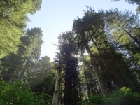
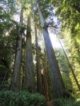
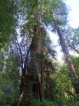
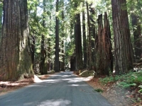
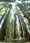
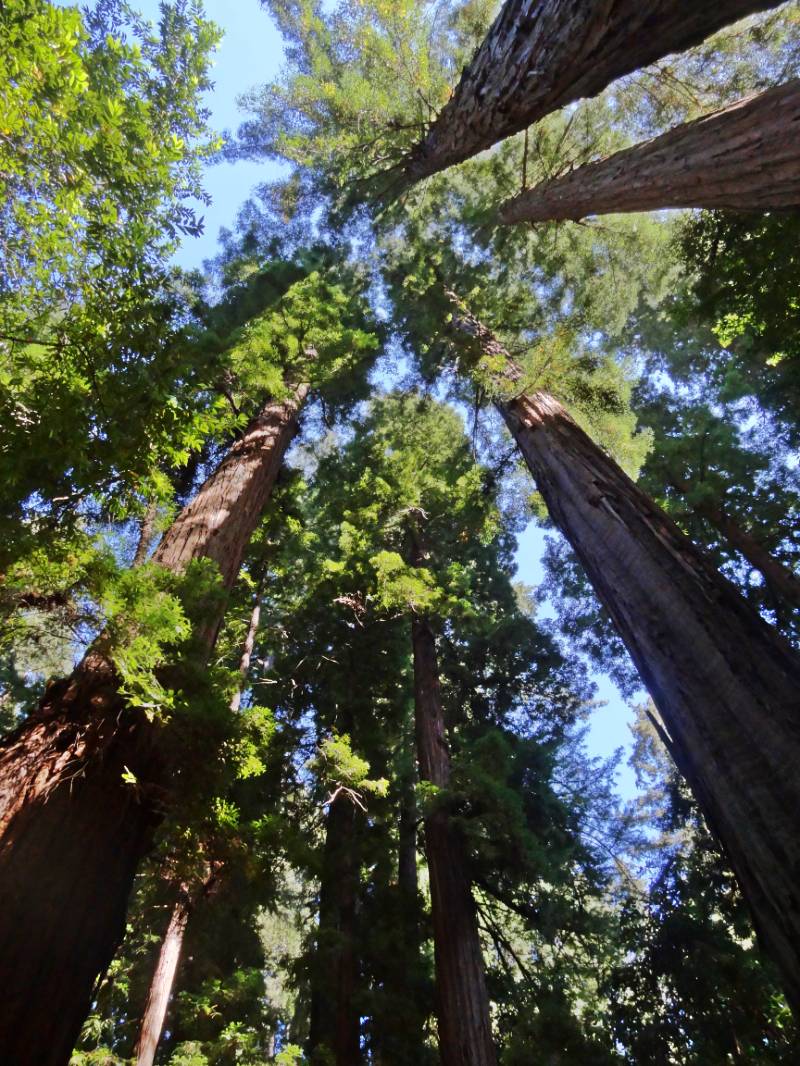
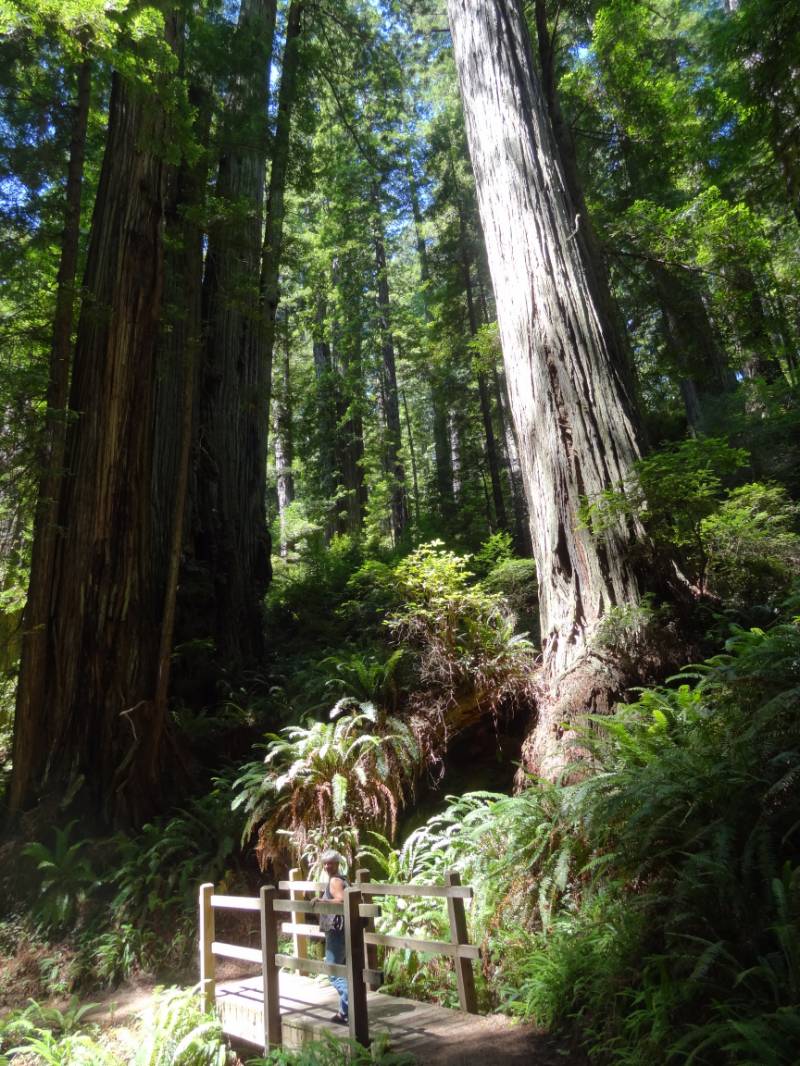
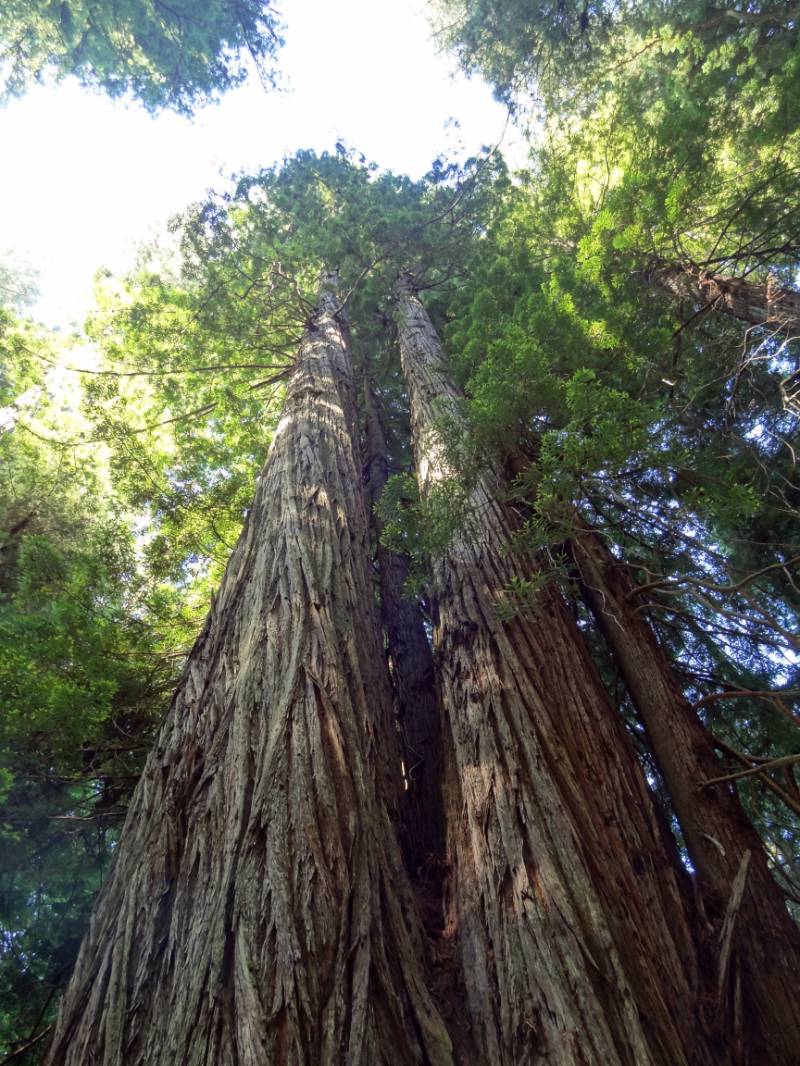
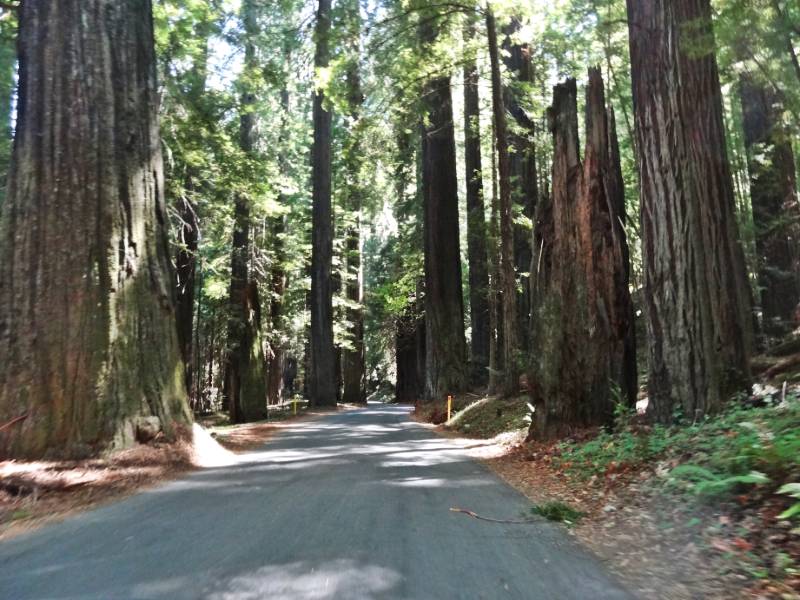
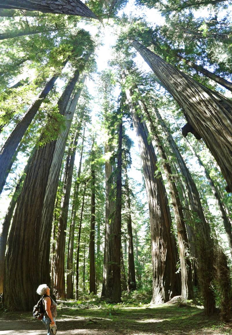
 We drove down Highway 101 along ocean vistas, through forested sections and the flats of Klamath River basin before reaching the turn off to the recommended Newton B. Drury Scenic Parkway. The Parkway took us through a dense section of old growth redwoods in the Prairie Creek Redwoods State Park. It was amazing to drive and walk among the tallest trees in the world.
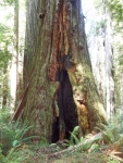
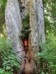
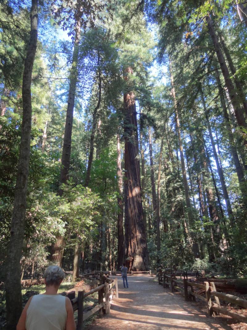
 We decided on several shorter hikes rather than one long one to see more variety. The first stop took us just a short way off the parkway when we saw the roadside sign for Corkscrew Tree. Many redwoods grow somewhat twisted but this was the crookedest I had ever seen! Next stop was at Big Tree! The sign in front says Height 304 ft., Diameter 21.6 ft., Circumference 68 ft., and Estimated Age 1500 years! We continued hiking beyond Big Tree on the Cathedral Trees Trail enjoying being in the in the majesty of the forest.
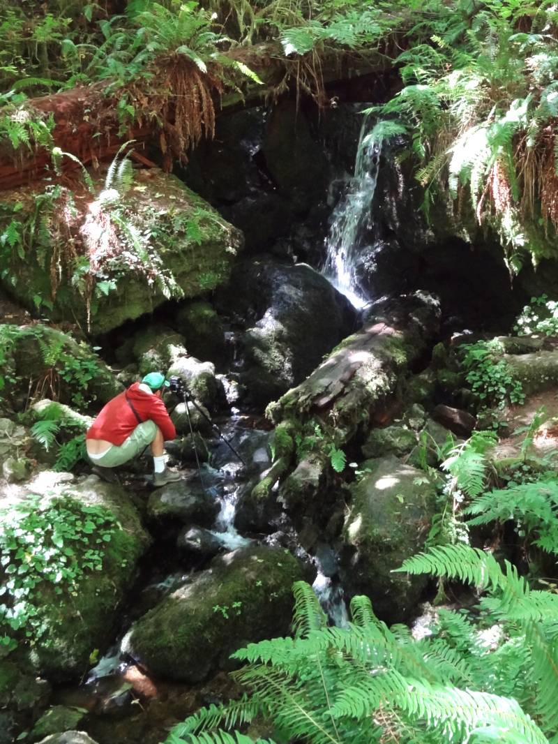
 Our next hike was to Trillium Falls, a 10-foot cascade flowing over rocks covered in deep-green moss. Quoting from the Trailhead sign, “The trail leads you through the misty hallways of an ancient redwood forest. Along the path, families of Douglas-fir, western hemlock, and Sitka spruce reside beneath the shade of the world’s tallest trees.” The trailhead overlooked Elk Meadow, where we paused for a snack watching a herd of Roosevelt Elk graze.
“Redwood Parks is home to a subspecies of elk known as Roosevelt elk (Cervis elaphus roosevelti). Herds of these magnificent Animals once ranged from San Francisco Bay to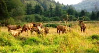 Vancouver Island, British Columbia and east to the Cascade Range in Oregon and Washington. … By 1925, the number of Roosevelt elk in California had dropped to as few as 15. One of the last elk herds was located in Prairie Creek State Park. Fortunately, protection of the habitat in the park and surrounding areas has allowed the California Roosevelt elk population so rebound to more than 1,000 animals.” NPS Elk in the Redwoods
The Avenue of the Giants
 We continued driving south on Hwy 101 and stopped at the village of Trinidad for lunch. Our hostesses and servers were all college age and I realized we were near Humboldt University where I did my six week science program during one of my high school summers. I have very fond memories of this area.
“Trinidad is a seaside town in Humboldt County, located on the Pacific Ocean 8 miles north of the Arcata-Eureka Airport and 15 miles north of the college town of Arcata. Situated directly above its own natural harbor, Trinidad is one of California’s smallest incorporated cities, (with a 2010 population of 367) and is noted for its spectacular coastline with ten public beaches and offshore rocks. 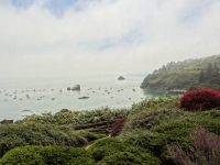 These rocks are part of the California Coastal National Monument of which Trinidad is a Gateway City. This natural landmark is joined by three additional marine landmarks – the historic Trinidad Head Light, the Trinidad Memorial Lighthouse, and Humboldt State University’s Fred Telonicher Marine Laboratory. Fishing operations related to Trinidad Harbor are vital to both local tourism and commercial fishery interests in the region. In addition to its coastal assets, the city honors and works to protect its Native American cultural and historic heritage.” City of Trinidad
 We chose to travel down the coast route on our way to LA specifically to drive the Avenue of the Giants because we had missed it last time we drove Hwy 101. “This world-famous scenic drive is a 31-mile portion of old Highway 101, which parallels Freeway 101 with its 51,222 acres of redwood groves. … The Avenue of the Giants is surrounded by Humboldt Redwoods State Park which has the largest remaining stand of virgin redwoods in the world.” AvenueoftheGiants.net
 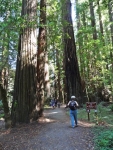 My suggestion is if you are driving up Hwy 101, it is worth taking the exit to travel State Route 254 (old 101) for the drive through patches of redwood groves along the route, but I wouldn’t go out of my way specifically to make it a destination, especially after we had just driven the densely forested beautiful Newton B. Drury Scenic Parkway!
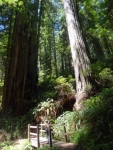
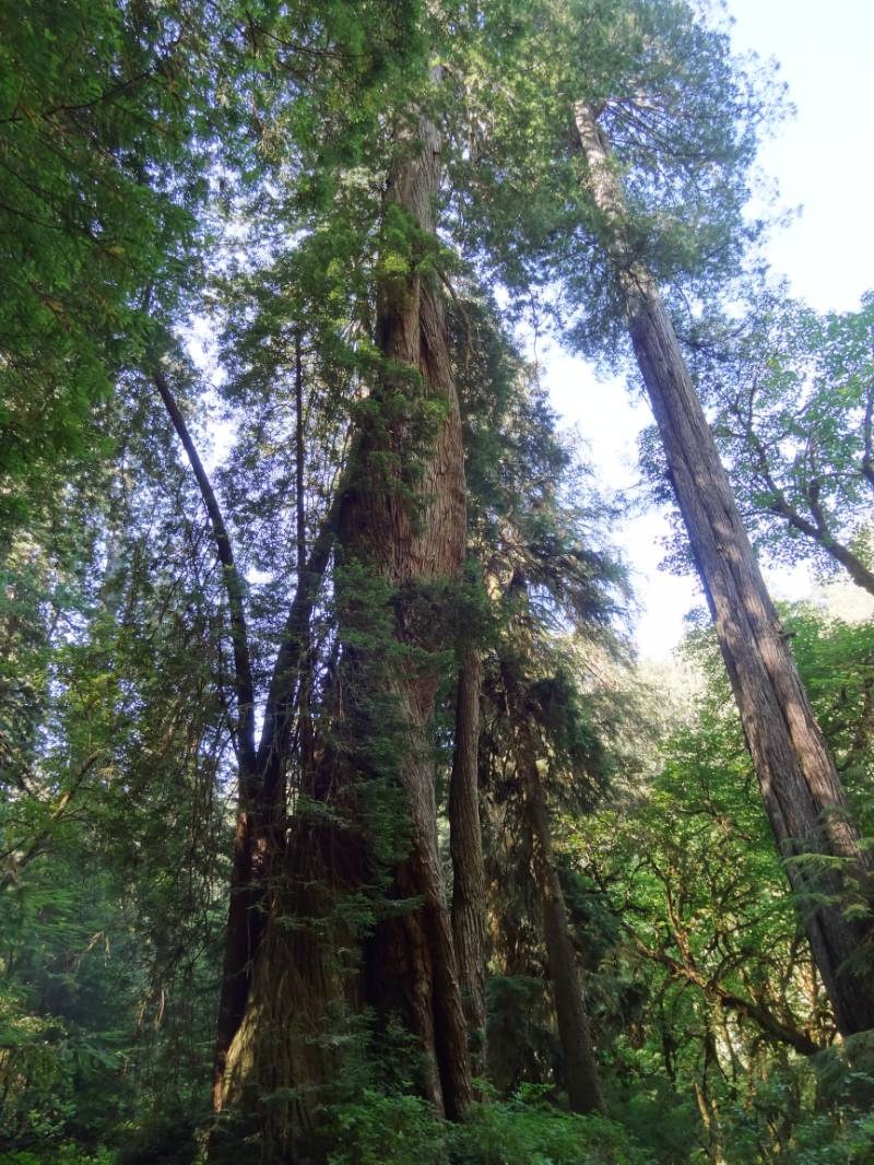
 Reading the drive guide, the best hike for our time sounded like the two-thirds of a mile Rockefeller Loop in Rockefeller Forest. In this short distance, 17 of the world’s tallest trees are found according to the brochure. I have to admit that standing at ground level and looking straight up, it is hard to tell that one of the redwood trees is that much taller than the next one! It was a well-trodden wide path through the grove and served a nice place to stretch our legs.
Mendocino
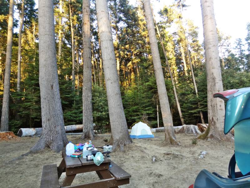
 We continued south and decided to take Hwy 1 to Mendocino for our last night of camping. Mendocino was always a favorite getaway weekend destination for me when I lived in the Bay Area. The campground we found even had showers! We cooked our last dinner on our camp stove and settled into to our sleeping bags after the sunset pink tinge had left the high overhead clouds.
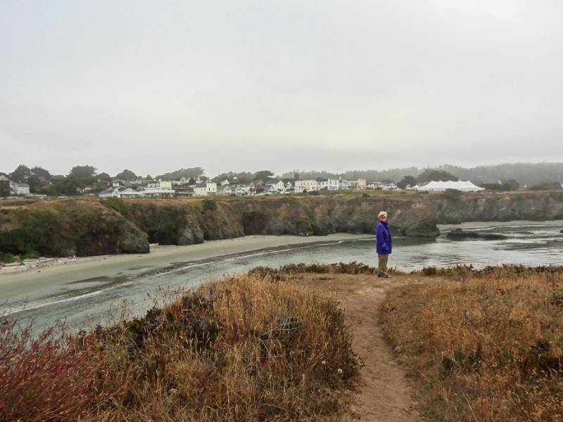
 The usual morning fog greeted us as we enjoyed our green matcha tea and granola, packed the car, and headed into town to walk the Mendocino Headlands coastal bluffs. I highly recommend a previous Mendocino Coast webpage from a trip we took February 2007 because the lighting conditions resulted in prettier pictures on that visit.
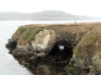
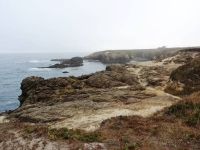
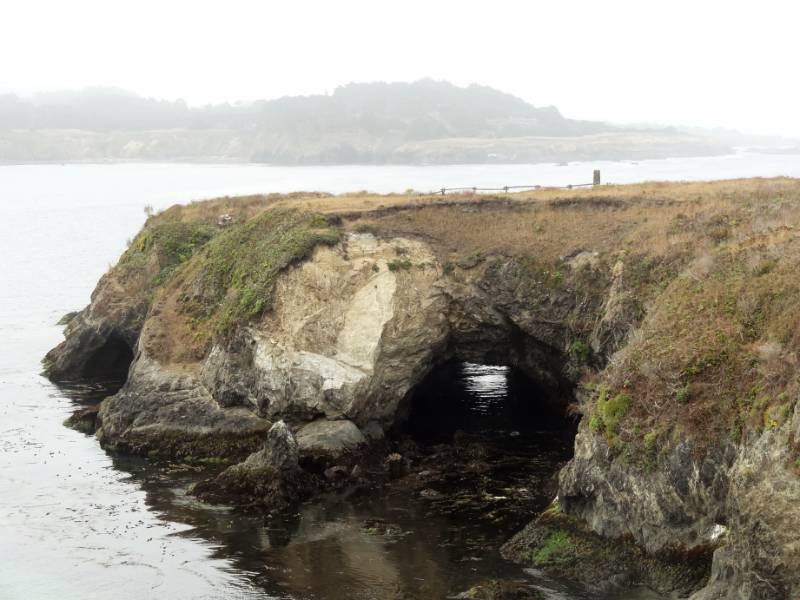
“Mendocino Headlands State Park with its unique blend of gentle trails, rugged coastline, secluded beaches and timeless history surrounds the picturesque Village of Mendocino on three sides. Miles of trails wind along the cliffs, giving the casual explorer spectacular views of sea arches and hidden grottos.” Mendocino Headlands SP
 “Mendocino, the only town on the California Coast that is designated as an Historical Landmark. Established in the 1850’s, the architecture is reminiscent of Maine with its grand Victorians and quaint Saltbox cottages.” Mendocino.com
I had no idea until I was reading some websites about Mendocino that Murder She Wrote was filmed in Mendocino County and that “Cabot Cove” is actually Mendocino Village!
 “Mendocino was discovered by mistake. Scouts were sent to salvage the remains of the Frolic shipwreck. By the time they arrived, the ship was demolished by the sea, but they noticed the huge redwood trees and [the logging began.] …Their mill set-up at Big River yielded 1 billion board-feet of timber during its 50-year run. Almost all of which was used to build San Francisco, and rebuild it again after the Great Earthquake and Fire in 1906.” Mendocino.com
 Looking to the hills around Mendocino today, there is no evidence of the once lush redwood forests that covered the coastal mountains. After walking the bluffs, we drove to Café Beaujolais brickery for a bakery treat, but the bakery is no longer there, just the restaurant. We found a busy bakery café on Langsing Street for a mid-morning snack before taking to the road again.
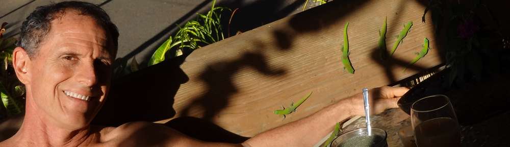
Photo Credit: Neil Rhoads, Roosevelt Elk by Mat Honan
Photo Slider: This post has a unique slider with pictures from this adventure only. I hope you click into the webpage so you can see the slider in action.
Photo gallery below:
Clicking on any photo thumbnail brings up the full size photo with a description. To easily see them all, use the arrow buttons or keys to move through the full size gallery photos with descriptions. If you are receiving this in an email and don’t see a photo gallery below, please click into my webpage to view all the photos!


 Patrick Hayden Schultz was born January 9, 2016, at 4:58 am to Ariann (Neil’s youngest daughter) and Eric Schutz in Missoula, Montana. He was 8 lbs 0.9 ounces with a 14 inch head and 21 inches long. We enjoyed getting to watch him grow through lots of photos and finally got to meet the precious little guy in May and June of 2016 as he turned 5 months old. Neil flew in to Missoula the end of May and spent two weeks with Patrick, Ariann, and Eric in their new home.
 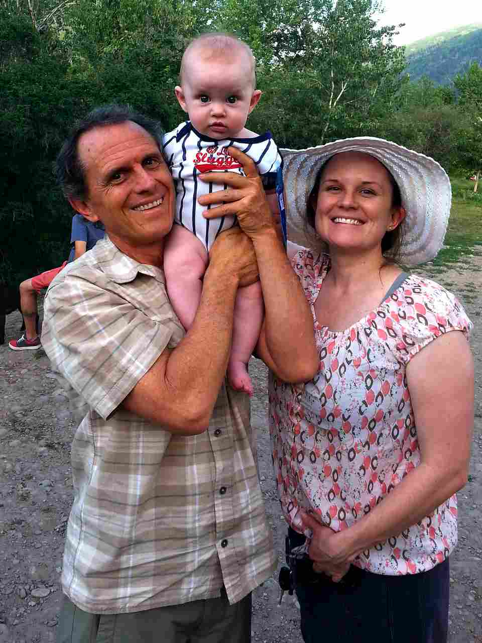 They had just moved into their new house and Neil was able to help with a few handyman projects in addition to spending quality time getting to know Patrick and being Granddad Neil. I flew in for the last 4 days of his stay to get to be Grandma Nan and love the special little man.
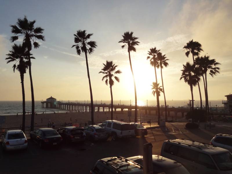
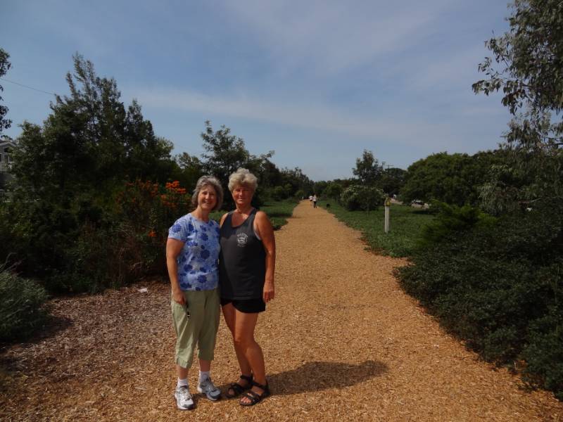
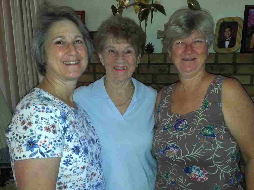 I started my trip in May landing in LA for 5 days visiting Pamela and Chris and then going up to Ridgecrest with Pamela to visit Mom and Bill. It was a relaxing low-key time. I flew to Missoula late Friday night and the following morning we spent at the downtown farmers market. The weather was beautiful and Patrick was happy in his stroller. We met up with our friends Sunni and Merrill for tea and walking about the downtown looking at some of Merrill’s incredible handmade wood projects installed in several business.
 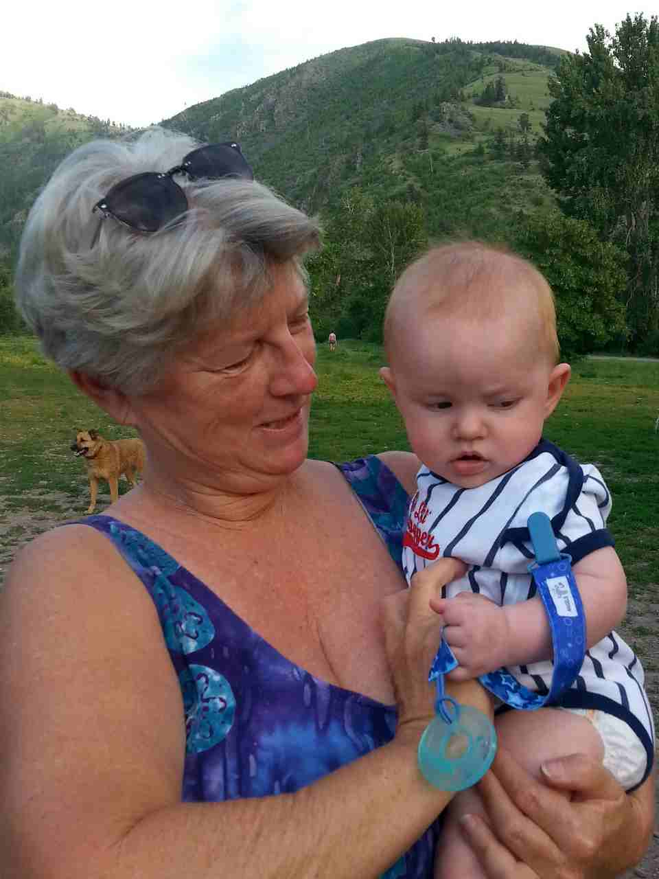 Our days were spent working on yard projects and playing with Patrick. Evenings were spent with Eric using his smoker making wonderful meals and I enjoyed their deck hot tub! It ended much too soon and I headed off to Ohio.
 My time there happened to overlap with Mom in Ohio visiting her family. We had some fun afternoon gatherings and I even showed Aunt Janet how I make my organic scones. Melanie drove up from Maryland in time for our Kreischer family gathering Sunday afternoon. It was great to see all my Uncles and Aunts, cousins and many of their children and grandchildren.
  Thanks Cindy and Clare for hosting us at your Special Occasions event center.


