Last Leg 2014

Golden Gate Bridge
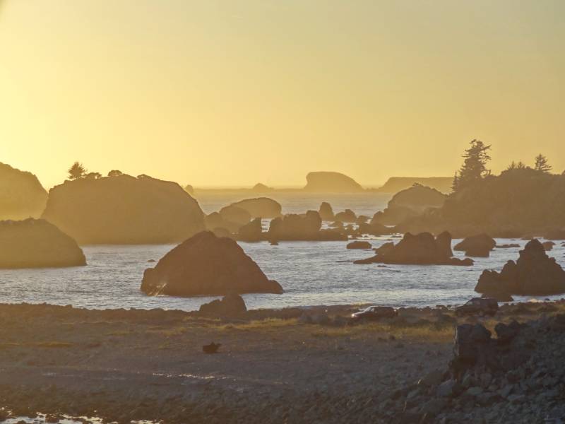
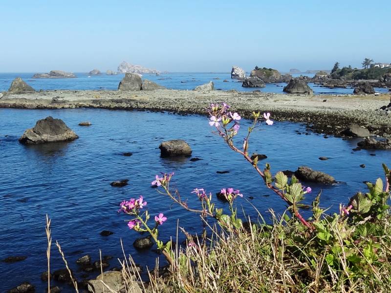
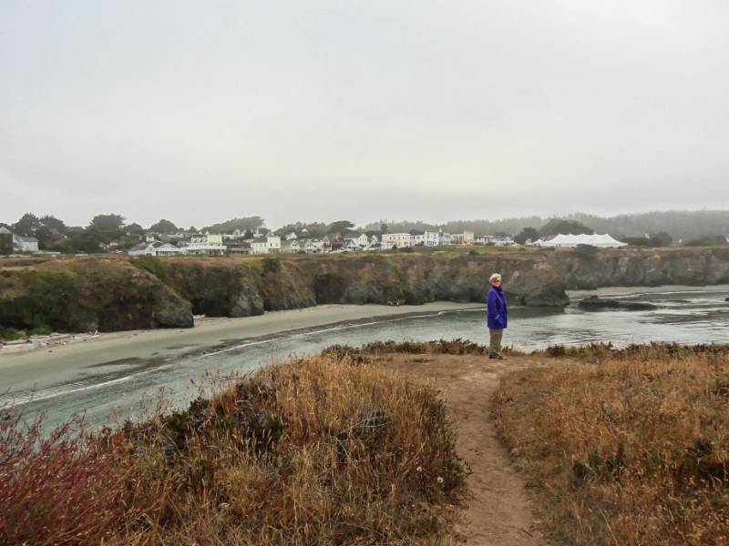
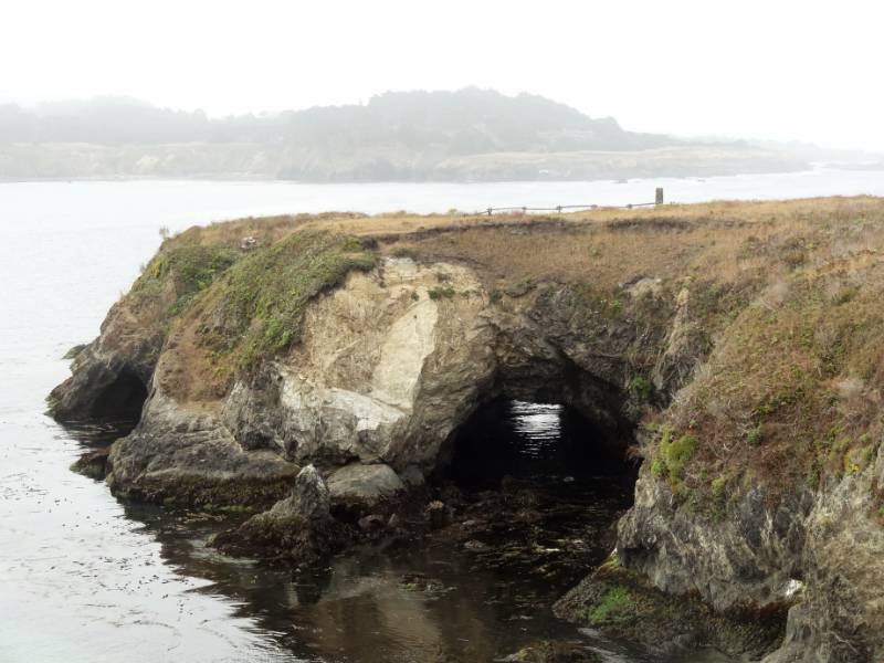
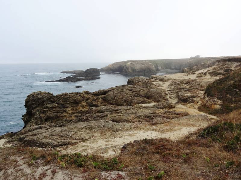
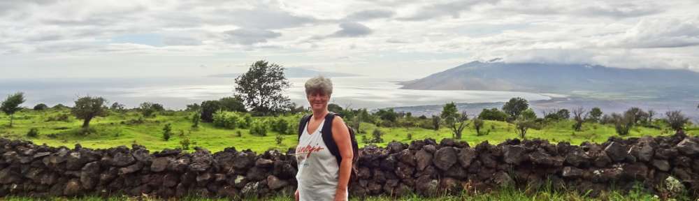
After our Sunday morning walk on the Mendocino Headlands, we started driving south for what became a very long drive day. We were heading to LA for our Tuesday departing flights, or as Neil says “we were heading back to the barn.” Our plan was to drive straight through San Francisco and on to San Luis Obispo for the night. That became easier said than done. Even on a Sunday, I couldn’t believe the traffic!
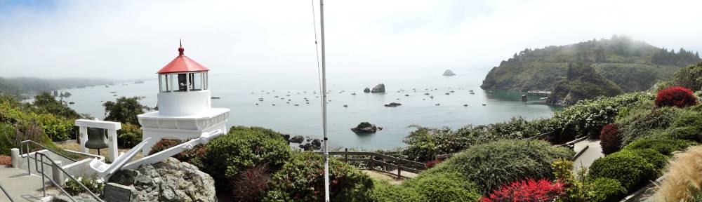
Marin Headlands

Close up of Bridge
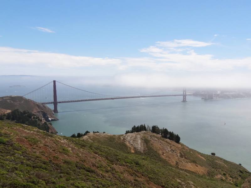
Heading south toward the Golden Gate Bridge we took the last exit north of the bridge which took us into the Golden Gate National Recreation Area. Neil wanted to get a view of the Golden Gate Bridge before we crossed it. When I would drive up to Sausalito or beyond I used to take the first exit coming north off the bridge to enjoy the vista of SF and the bridge from the overlook (you can’t get to that overlook parking area going south onto the bridge, and from that overlook you can’t go west onto the headlands). How could I have lived in the Bay area so long and not driven or hiked around in this large Recreation Area (it would have been the second exit going north)?

Marin Headlands
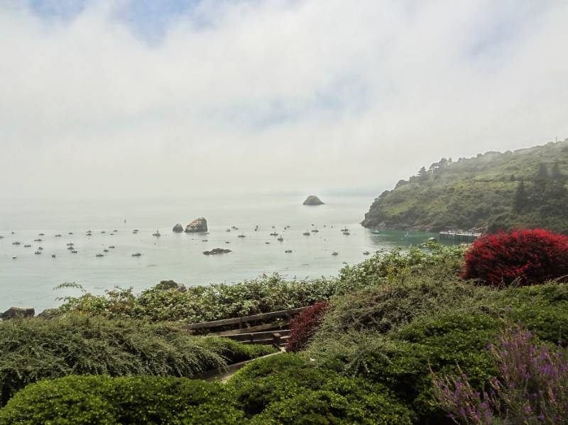
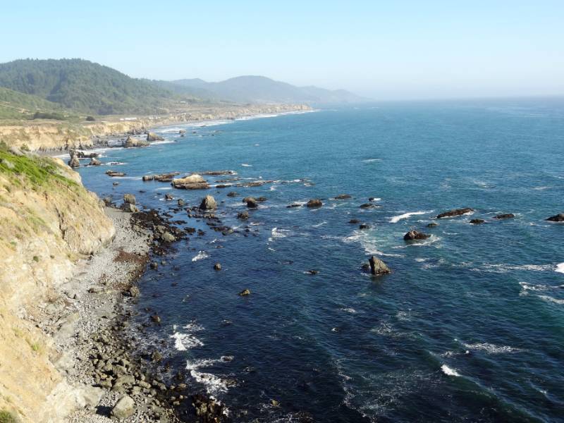
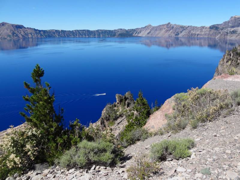
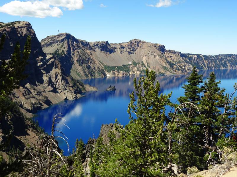
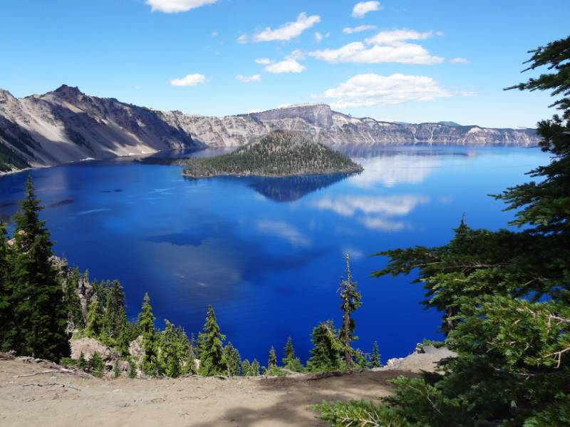
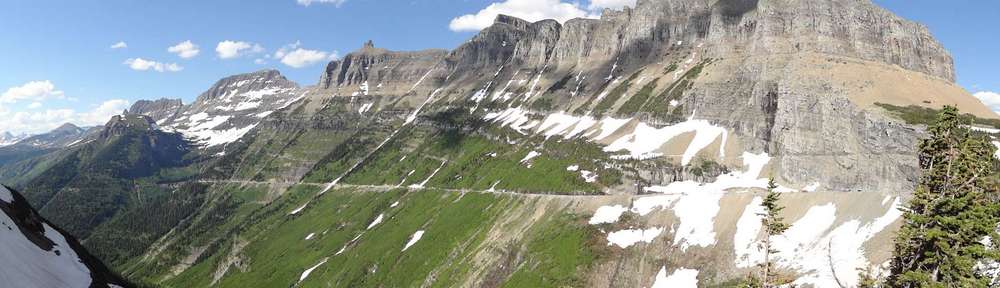
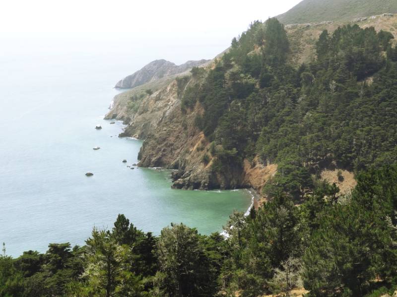
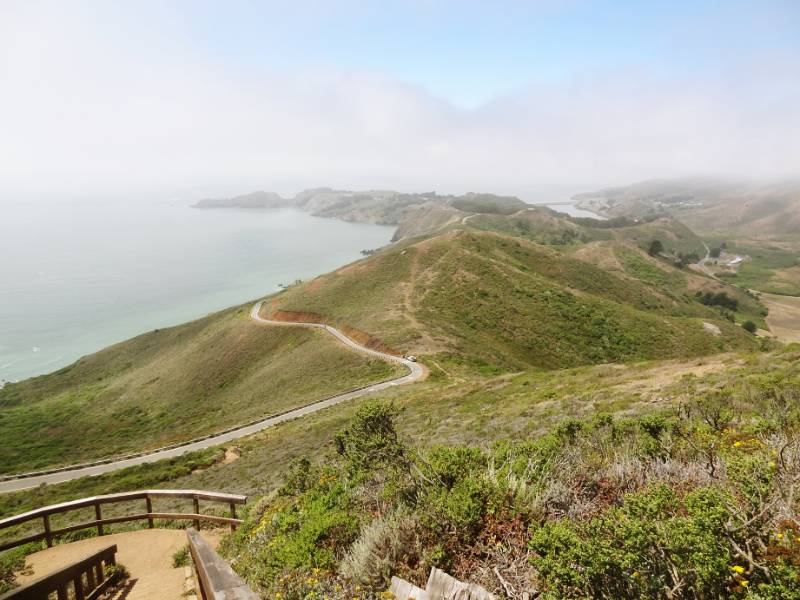
The exit took us onto Conzelman Rd. and into the midst of a swarm of other Sunday excursionists, all of us looking for a place to park. The area we were exploring I later read is called the Marin Headlands. We enjoyed beautiful views of the bridge and Pacific Ocean as we drove.

“Welcome to the Marin Headlands! One of the most unique areas in the Golden Gate National Recreation Area, the Marin Headlands covers various types of histories from the Miwok Indians to the Military,Marin Headlands Coast including historic Fort Barry and Fort Cronkhite, the NIKE Missile site and the 150 year-old Point Bonita lighthouse. Other attractions include varied hiking trails, dog friendly Rodeo Beach, and astonishing views of the coast and San Francisco. The explosion of wildflowers in the spring and raptor migration in the fall fill the headlands with year round excitement. The Marin Headlands is an example of open spaces still available in the Bay Area for visitors to enjoy.” NPS website Marin Headlands

It appears this is an area to explore when we next travel through the Bay Area!

Battery 129 Tunnel entrance
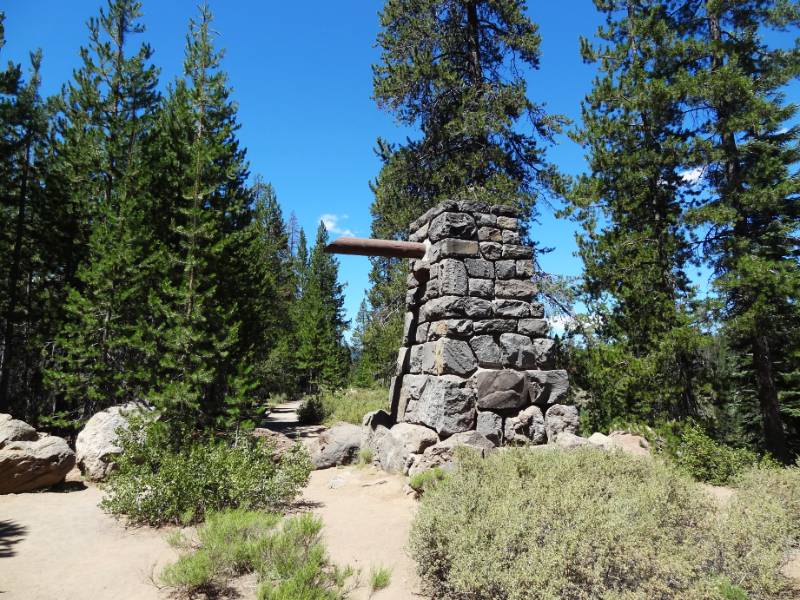
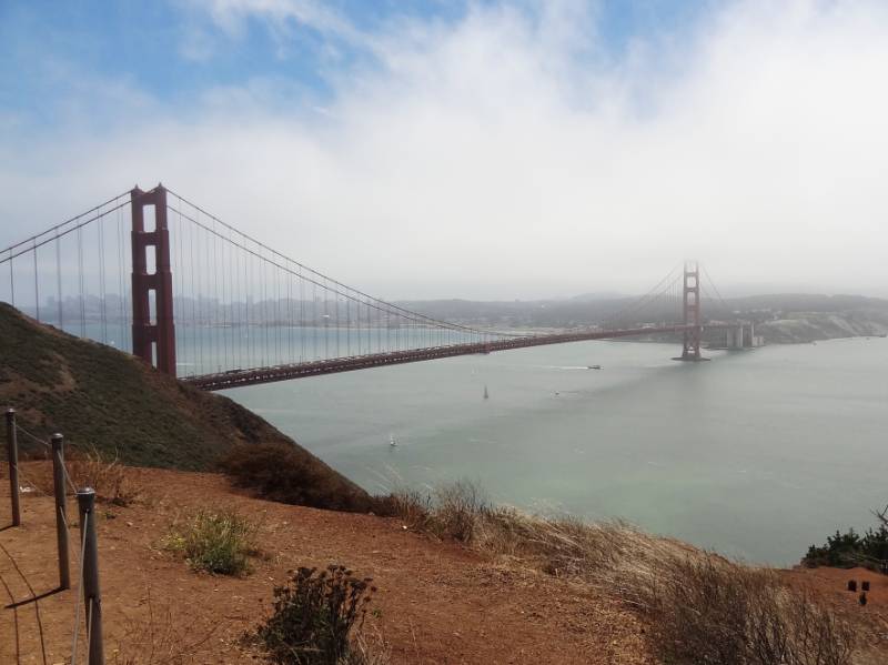
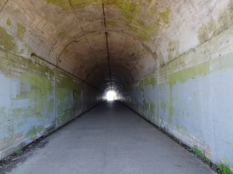
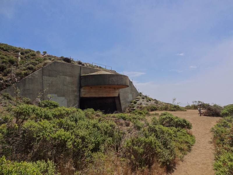
We got out at a few viewpoints where I bundled up against the cold wind. People didn’t spend too much time in the chilly wind after taking in the views so parking spots frequently opened but were rapidly taken. The first viewpoint we stopped at turned out to be the highest point in the Recreational Area: Hawk Hill.  It is now known as a conservation site for the Mission Blue Butterfly (endangered) and for raptor migration viewing, but it has a military history from World War II and through the Cold War. There was a big tunnel at the viewpoint which Neil explored. It turns out have been built to house anti-aircraft guns but was never completed and was left with the simple name Battery 129. It wasn’t until I was researching this that I read that sitting on top of the hill above the tunnel had been a Nike missile site built in 1954. The radar buildings have been removed but you can see the concrete pads from Google Earth.

Battery 129 Tunnel“Hawk Hill, or Battery Construction 129, has been a silent witness to the ecological and cultural changes in and around the San Francisco Bay for eons. It is the story of soldiers waiting for an enemy that never came. Although most of the World War II fortifications built in the park were intended to keep the newest battleships from reaching striking range, the war was fought and ultimately won from the air. Built into the highest point at the Golden Gate, Battery Construction 129 had two large guns mounted under thick concrete shields covered with native vegetation for camouflage and virtually invisible from above. NPS Hawk Hill

Henry Cowell Redwoods

On the Bridge
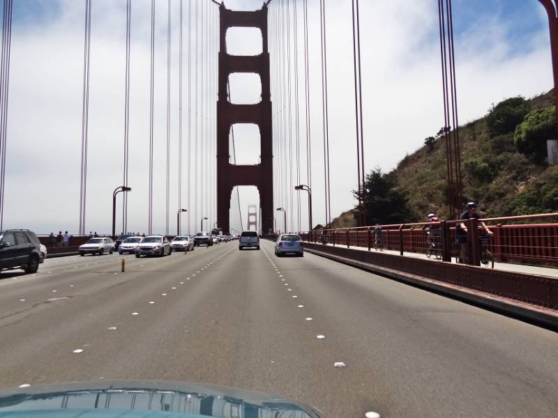
Back on the road, we crossed the always impressive Golden Gate Bridge. Neil took lots of photos through the windshield as I drove. I thought Sunday might be an easy day to get thorough the city that has no freeway crossing through it. I forgot there is always something going on in the City! We crawled through the Presidio, past Golden Gate Park, and along 19th street until we finally reached Interstate 280. Our next destination was Henry Cowell Redwoods.

On Maui, we sometimes use Google Maps on our phone to locate an address but we don’t need the navigation or traffic features. That Sunday I found their value and can understand what a great feature it is for urbanites! We would see lots of red areas along our route telling us the traffics was heavy. We hit a standstill when we turned onto Hwy 17 toward Santa Cruz and there was a long red line on Google Maps (two hour estimated delay). We were able to ease over and get off at the next exit, double back and get on Hwy 9 that was still slow but at least moving.

Redwood Grove Loop
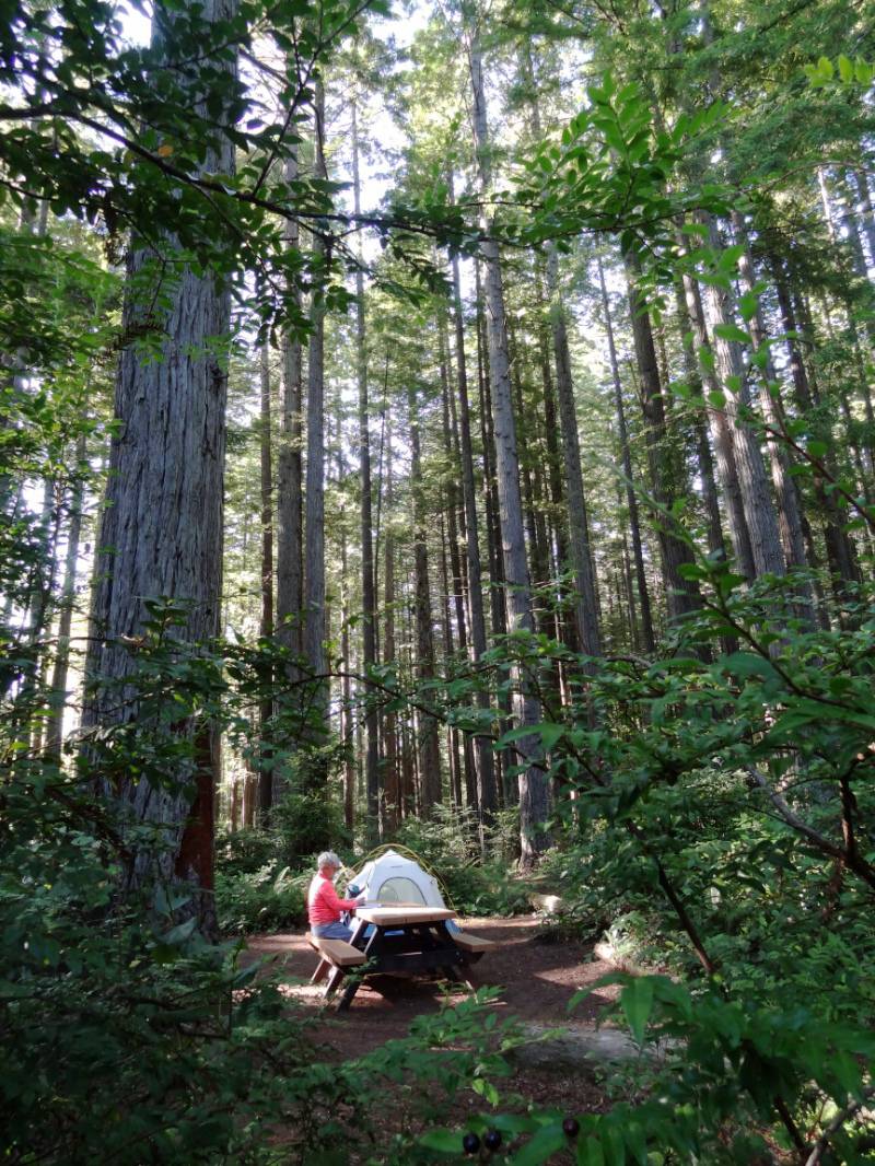
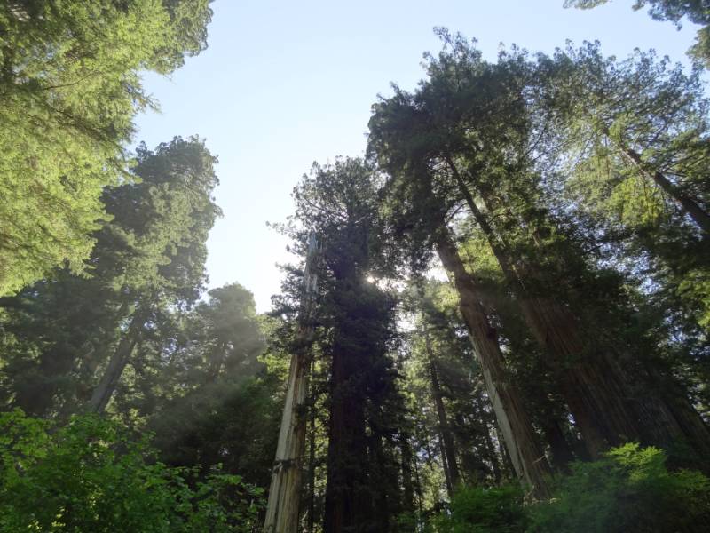
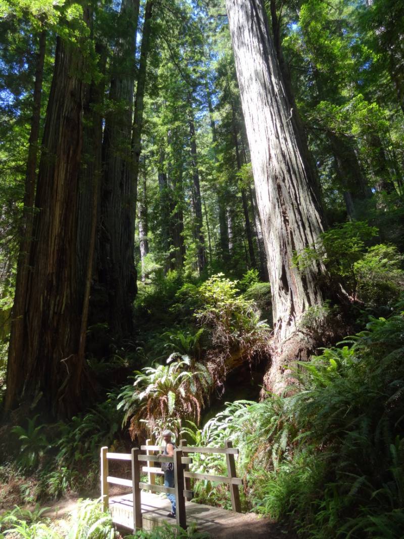
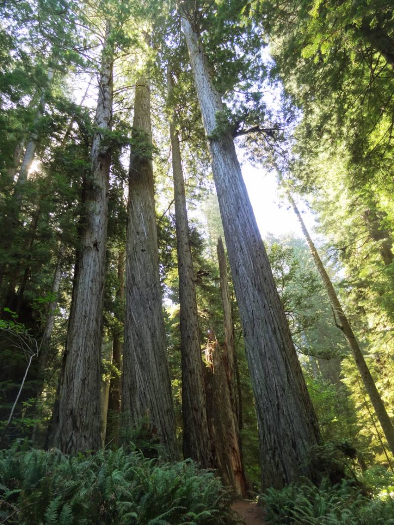
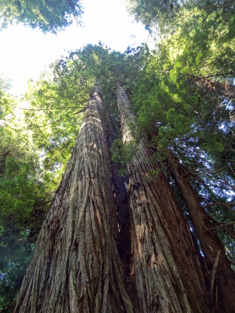
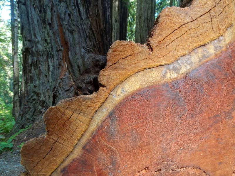
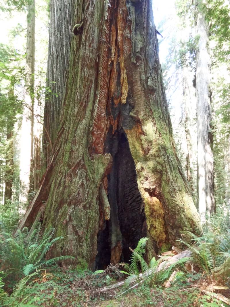
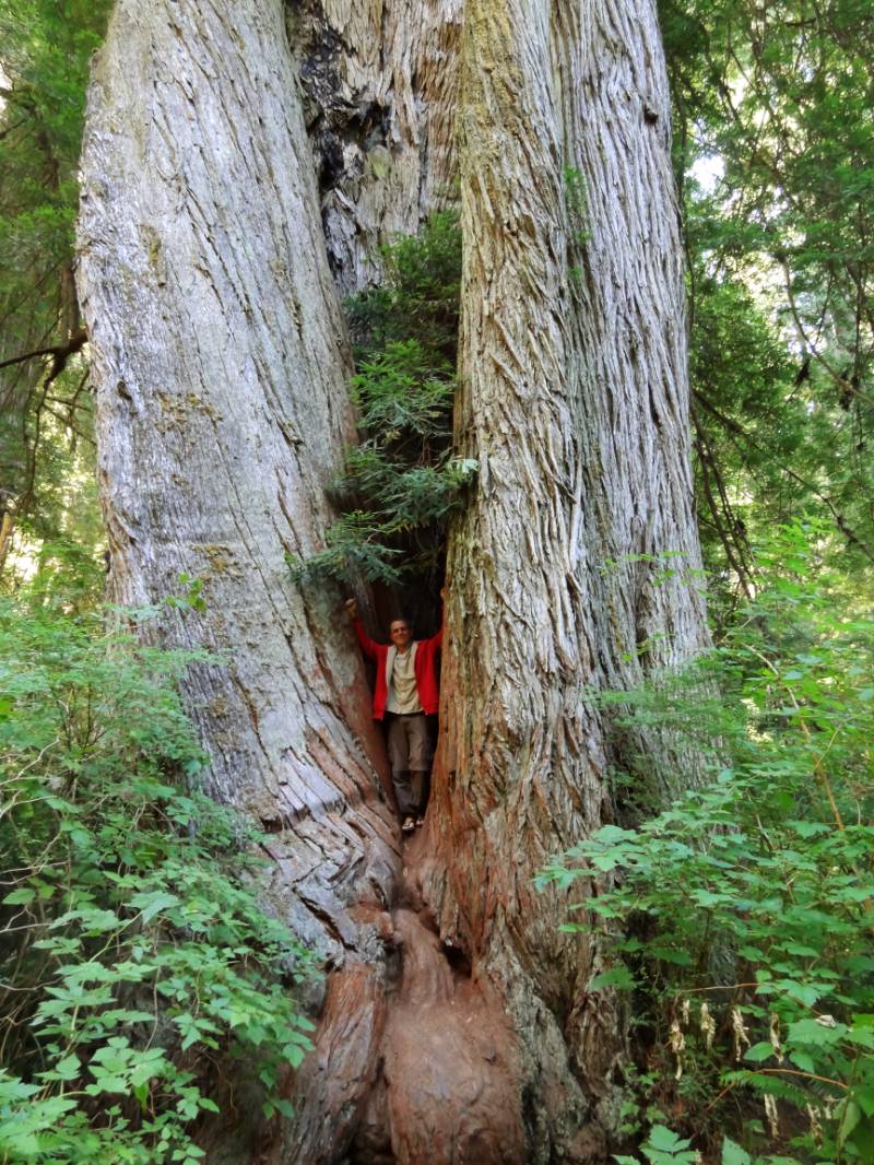
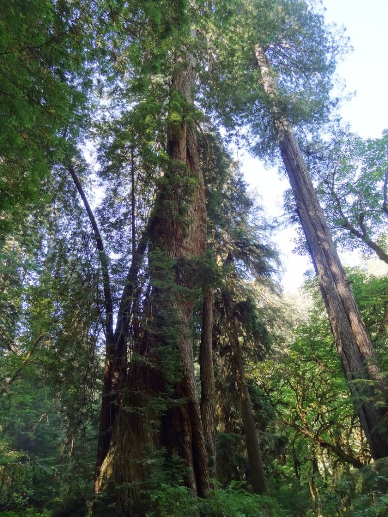
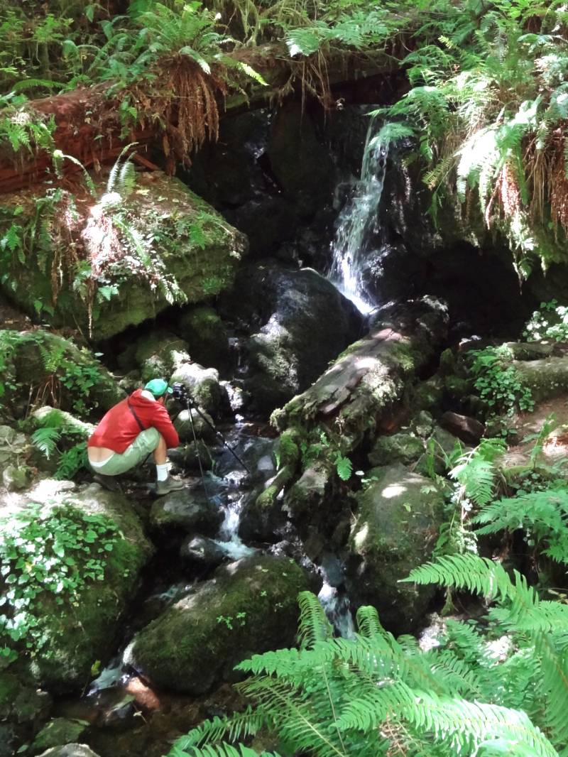
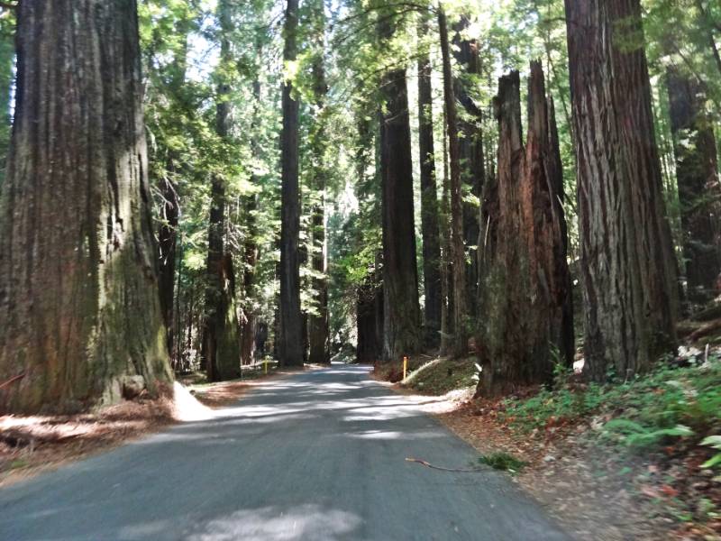
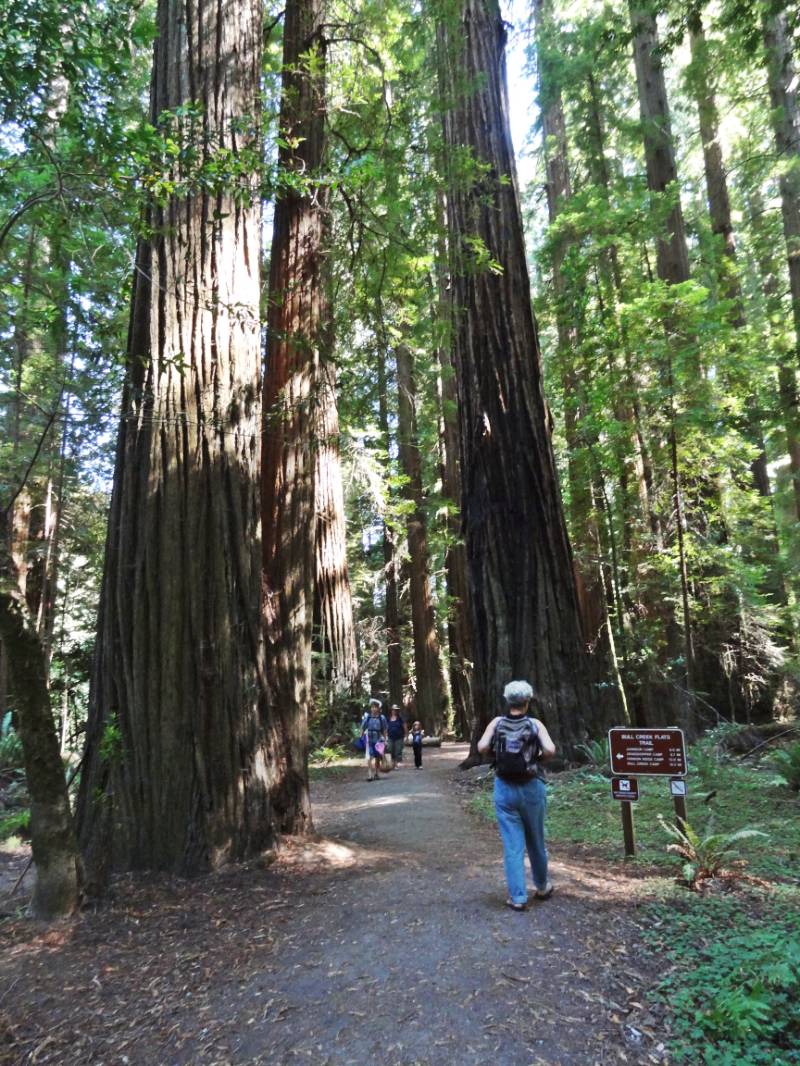
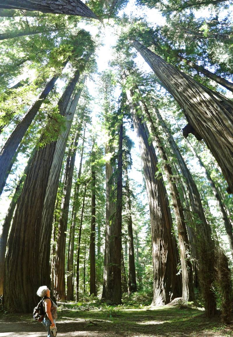
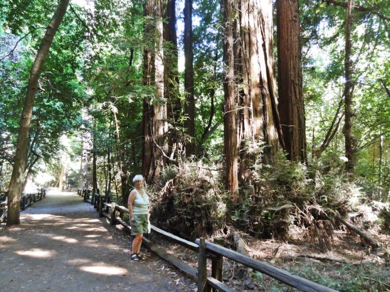
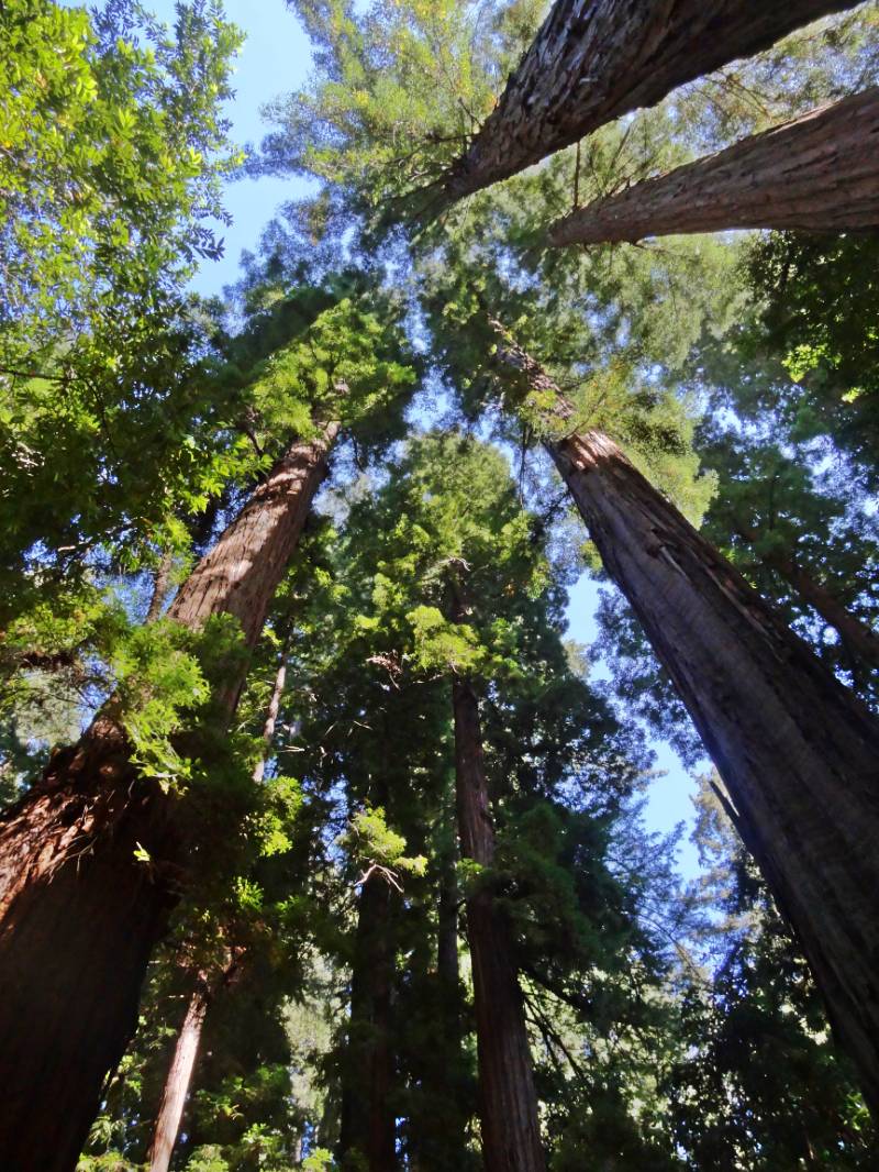
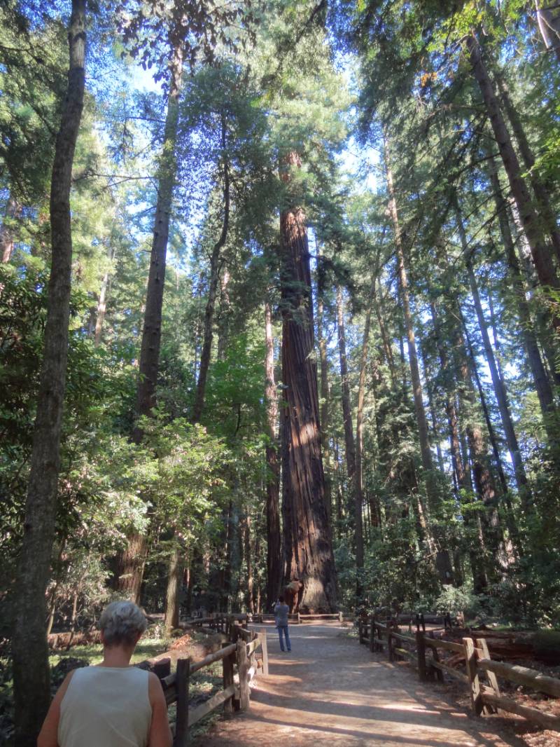
As we turned into the Henry Cowell Redwoods State Park entrance, it felt very commercial. There is the visitors center, retail store, and Roaring Camp railroad train depot all surrounding the parking area. However, it had very easy access to the Redwood Grove Loop Trail which starts at the Visitors Center and loops .8 miles through the section of old growth redwoods.

“Henry Cowell’s redwood grove is the only remaining old-growth grove in the Santa Cruz area and is an intriguing glimpse into what the region’s extensive redwood forests might have once looked like.

Albino LeavesIn many ways the grove has a typical old-growth feel; it’s remarkably cool and lush, with a groundcover of ferns and redwood sorrel, and there’s a characteristic hush from all the sound-dampening foliage. However, typically for southern groves near the ocean, there aren’t a lot of big redwoods here, and an unusual number of the trees are oddly mishhapen. Also, mixed in with the redwoods is a thick understory of tanoak and bay trees that obscures the redwoods and makes the grove look like a dense deciduous forest. The broadleaf growth is densest within the redwood loop; the old growth just outside the loop is much more open, suggesting that the grove’s appearance may be partly the result of fire suppression or other land management practices. …

Tall Redwood TreesThe old growth was the first coast redwood grove to be saved from logging, having been purchased in 1867 by San Francisco entrepreneur Joseph Welch. A sawmill had existed near the grove since 1841, but the town of Felton and the railroad had not yet been built. Welch’s Big Trees Resort remained in operation until Santa Cruz County purchased the resort in 1930. In 1952, the Cowell family donated the adjacent land, which had been logged to support the nearby lime kilns, to the state.” The Redwood Grove Loop Trail

The Park brochure is very informative including a summary of the Geology, Native People, and additional History. I found the full brochure online if you are interested in reading further.

Roaring Camp Train
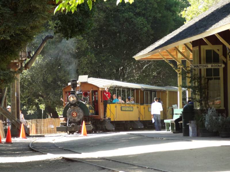
“Adjoining the park is Roaring Camp Railroad, offering visitors a chance to journey back in time on an old steam locomotive.” (Friends of Santa Cruz State Parks) The train chugs up from Santa Cruz through the mountains with part of the route actually traveling through the Henry Cowell Redwoods State Park although the train depot is on private land connected by a walkway to the parking area of the State Park. After walking the redwood loop trail, we crossed the tracks to view the vintage steam engines in Roaring Camp. There seemed to be a lot of activities going on for children but nothing we saw that we could participate in.

“Ride into the Past on 19th Century Steam Trains: Travel over trestles, through towering redwood groves and up a winding narrow-gauge grade to the summit of Bear Mountain as conductors narrate the history of Roaring Camp, the railroad and the forest.

In the 1880s, narrow-gauge steam locomotives were used to haul giant redwood logs out of the mountains. Roaring Camp’s steam engines date from 1890 and are among the oldest and most authentically preserved narrow-gauge steam engines providing regularly scheduled passenger service in America.” Roaring Camp Railroad Redwood Train

San Luis Obispo

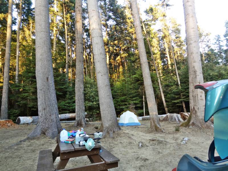
Back on the road again, we drove straight down Hwy 101 toward our hotel in San Luis Obispo, stopping only for gas and food in Paso Robles where the county fair was going on. We watched the colorful lights of midway carnival rides as we found our way back onto the highway. Yes, it was past dark by then and past 10 when we arrived at our comfortable, basic Motel 6 room for a shower and luscious sleep in a queen bed.

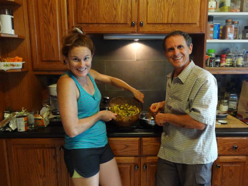
It felt like double luxury with no need to roll up sleeping bags nor pack the tent the next morning before we met our friend Ken near Madonna Inn at a local coffee shop for breakfast where we enjoyed catching up. My memory of the area from 20 to 30 years ago was all open ranch land along lower Madonna Road and Los Osos Valley Road; now it is all paved with shopping malls!

Departing LA

Santa Barbara Beach
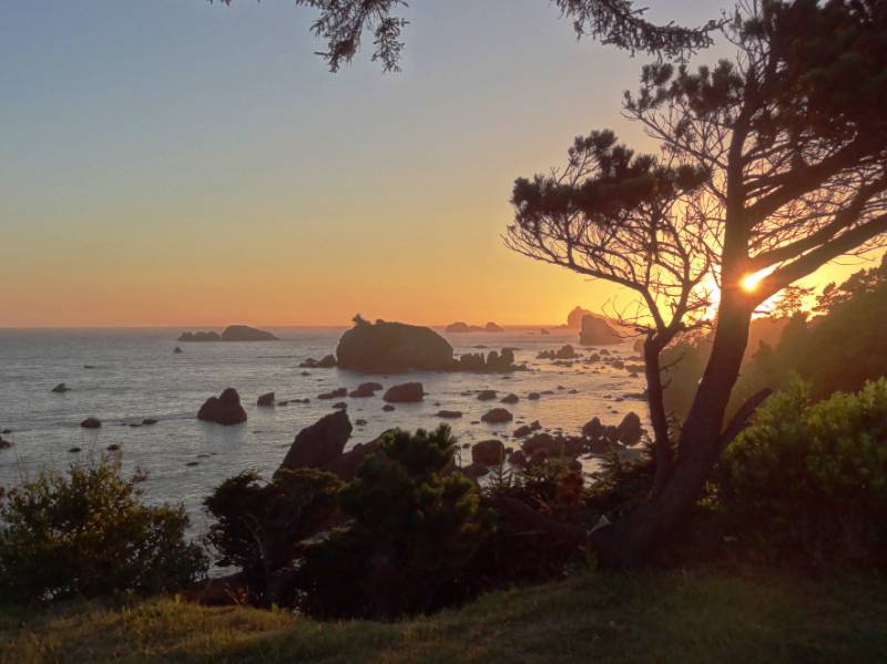
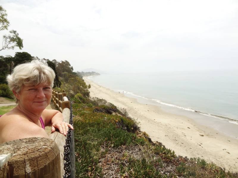
We drove our final leg to LA, timing our arrival at Pamela and Chris’ in Lawndale for Monday midday to avoid the worst of rush hour traffic (worked out well.) We took a rest stop in Santa Barbara at a small little park overlooking the Pacific Ocean. I have to memorize the exit name for next time because it is not visible from the highway before taking the exit. Thank you again Google Maps.

Sunset Manhattan Beach
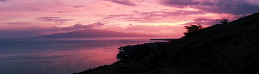
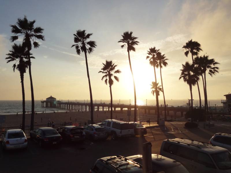
The afternoon was spent unpacking and cleaning the car, sorting what would stay with mom or Pamela and what we would take back to Maui. We enjoyed a home cooked evening meal with Pamela and Chris before driving to Manhattan Beach pier to walk along the strand and on the pier. I saw all these people with ice cream cones and I just had to ask where. Just up a block on the avenue is the Manhattan Beach Creamery. It was hard to decide on a flavor but I am sure I had something with chocolate in it! Enjoying the sunset over the ocean as we stood on the end of the pier was a wonderful way to close our summer adventure together.

Pamela and Nan
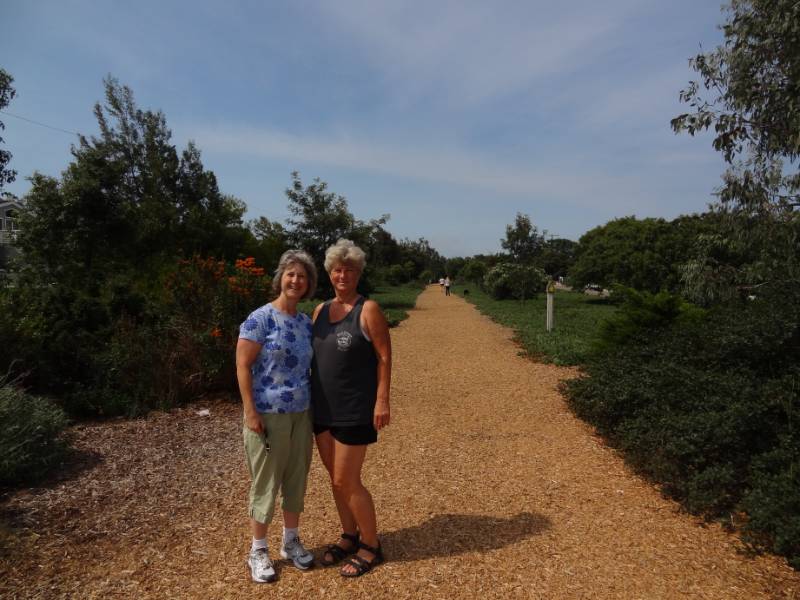
On our departure day, Tuesday July 29, we packed our bags for our flights and fit everything else in Mom and Bill’s car trunk to return to Ridgecrest. We had time to walk with Pamela along the Veterans Parkway (an old rail line converted into a parkway through Manhattan Beach) before enjoying a Mediterranean lunch at the Hummus House near their home before she went to work.

Chris kindly took a break in his work day to drop us at the LAX airport late afternoon. Neil and I had separate flights! He was returning home to Maui while I was flying to Ohio to visit with my dad and extended family. Nan and Neil Sunset
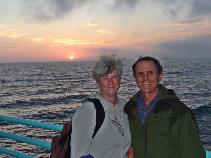
He took our one checked bag freeing me to just a carry-on for the rest of my trip. We had been able to work out our departures to within 45 minutes of each other and while Neil would arrive in Maui yet that night, I settled in for my red eye flight. It was one month ago we took the red eye from Maui to LA. What a great adventure!

Thank you for joining us as we relived our 2014 summer trip. We don’t know when our next adventure might be, but we hope to take you along with us.

Aloha, Nan and Neil

Redwoods 2014

Redwood CampsiteWe reached the California Redwoods on Friday night July 25, 2014. The first campground we tried, Jedediah Smith State Park, was not only completely full but it was $35 a night! Welcome to California! The ranger was very helpful providing us with a list of the Redwood campgrounds and marking the nearest ones. We found a great little spot in Florence Keller County Park, a second growth redwood forest, five miles north of Crescent City (and only $10 a night!) We decided to treat ourselves to a seafood dinner now that we were on the coast but so did all the other tourists on their summer vacations. The few places we tried had very long waits. Bear searching for dinnerWe settled on a Mexican restaurant that had some good spicy seafood entrees. 😉 This was the first time we had ventured into a Mexican restaurant since our bad experience in Eastern Washington. Being able to eat Mexican food again was one of the good things about being back in California!

Crescent City

Battery Point LighthouseWe cut over to the coast as soon as we could upon entering Crescent City and drove along Pebble Beach Drive. We came to a beautiful spot to park overlooking Crescent Bay at Brother Jonathan Park. The bay is full of small rock islands with the largest containing the picturesque Battery Point Lighthouse. We watched whales swimming beyond the rock island as we visited with a few locals and visitors also enjoying the view. We returned to the overlook after dinner to enjoy the sunset over the bay but by dark we were settled into our tent among the redwoods.Sunset through the trees

“The first American to explore the [Del Norte] country overland was Jedediah Strong Smith, for whom the Smith River is named. In 1828, Smith and his party of trappers traded with Native Americans, came upon Lake Earl, and camped at Crescent City.

In 1848, Major Pierson B. Reading discovered gold on the Trinity River, and by 1850, northwestern California was teeming with miners. The town of Crescent City was established in 1853 by J. F. Wendell … Crescent City became a bustling shipping and trade center, catering to and supplying the miners. … Crescent Bay Sunset[T]he area experienced a boom in settlement as a result of lumbering activity that followed the mining industry … To facilitate the use of Crescent Bay as a harbor, the Battery Point Lighthouse was erected in 1856. It survived the 1964 tsunami …

On, March 27, 1964 the Good Friday [Alaska] Earthquake (measuring 9.2 on the Richter scale) set in motion a tsunami down the west coast of the U.S. Crescent City was struck with four waves destroying hundreds of buildings (including most of the downtown area) and killing 12 people.” History of Crescent City

Redwood National Park

Flowers and Crescent BayA bright sunny Saturday morning greeted us as we drove out of our shaded forest campground. We arrived at the Redwood Park Information Center in Crescent City just as it opened. We had located it the previous evening but it was already closed. There were numerous brochures for us to collect while we waited our turn to speak with the ranger. We asked about the best driving routes, hiking areas, and any waterfalls.

Rays in the branchesThe National Park and three State Parks protect much of the state’s last remaining old growth redwood forests. A great number of people worked to protect these redwoods from falling to the ax. Logging felled many of the most ancient of trees, but I continue to be impressed with the dedication of early 1900s conservation visionaries who recognized the importance of protecting this heritage. Many individuals used their own funds to purchase land to protect it from logging and later donate it to the Parks.

Nan on Bridge“Paleontologists Henry Fairfield Osborn of the American Museum of Natural History, Madison Grant of the New York Zoological Society, and John C. Merriam of the University of California at Berkeley founded Save the Redwoods League in 1918. The League was formed as a nonprofit organization dedicated to buying redwood tracts for preservation. Through donations and matching state funds, the League bought over 100,000 acres of redwood forest between 1920 and 1960.” Redwood Area History

The park brochure notes that of the estimated original 2 million acres of coast redwood habitat, only 118,000 acres remain of older and old-growth redwoods (that’s only 5.9%).

The Indigenous People

Cathedral Trees“The native people of the North Coast region have made the redwood forests and associated ecosystems their home for thousands of years. … Prior to Euro-American contact, American Indians had adapted well to this environment. Their profound religious beliefs, extensive knowledge of the natural world, languages, customs, and perseverance continue to be a source of admiration for other cultures.

American Indians in the region belonged to many tribes, although no one tribe dominated. Indeed, the concept of “tribe” does not describe very well the traditional political complexity of the area. There were scores of villages that dotted the coast and lined the major rivers; each of these villages was more or less politically independent, yet linked to one another by intricate networks of economic, social, and religious ties.

Tall Trees… Efficient and reliable hunting, fishing, and gathering methods were always paired with a deep spiritual awareness of nature’s balance. Traditional homes of the region’s American Indians usually were constructed of planks split from fallen redwoods. … A house was understood to be a living being. The redwood that formed its planks was itself the body of one of the Spirit Beings.

Once gold was discovered along northwestern California’s Trinity River in 1850, outsiders moved into the area in overwhelming numbers. The initial contact with native peoples was gruesome.

Redwood RingsThe newcomers pushed the American Indians off their land, hunted them down, scorned, raped, and enslaved them. Resistance – and many of the American Indians did resist – was often met with massacres. Militia units composed of unemployed miners and homesteaders set forth to rid the countryside of “hostile” Indians, attacking villages and, in many documented cases, slaughtering men, women, and even infants. Upon their return, these killers were treated as heroes, and paid by the state government for their work.” Text based on Living in a Well-Ordered World NPS Redwoods History

Burn scarThe past treatment of indigenous peoples by “newcomers” has often been appalling, and I can’t say we are any better today trying to impose “The American Way” on other cultures. I want to end on a more positive note so I will add a quote from the next section of the NPS History: “Despite the dreadful history of the past 150 years, the American Indian community of northwestern California has persisted. It has, in fact, done more than persist. Whether in politics, art, religion, or any other area of life, the community exhibits great variety and astounding vigor.”

Hikes

Neil in Fork of TreeWe drove down Highway 101 along ocean vistas, through forested sections and the flats of Klamath River basin before reaching the turn off to the recommended Newton B. Drury Scenic Parkway. The Parkway took us through a dense section of old growth redwoods in the Prairie Creek Redwoods State Park. It was amazing to drive and walk among the tallest trees in the world.

Corkscrew TreeWe decided on several shorter hikes rather than one long one to see more variety. The first stop took us just a short way off the parkway when we saw the roadside sign for Corkscrew Tree. Many redwoods grow somewhat twisted but this was the crookedest I had ever seen! Next stop was at Big Tree! The sign in front says Height 304 ft., Diameter 21.6 ft., Circumference 68 ft., and Estimated Age 1500 years! We continued hiking beyond Big Tree on the Cathedral Trees Trail enjoying being in the in the majesty of the forest.

Trillium FallsOur next hike was to Trillium Falls, a 10-foot cascade flowing over rocks covered in deep-green moss. Quoting from the Trailhead sign, “The trail leads you through the misty hallways of an ancient redwood forest. Along the path, families of Douglas-fir, western hemlock, and Sitka spruce reside beneath the shade of the world’s tallest trees.” The trailhead overlooked Elk Meadow, where we paused for a snack watching a herd of Roosevelt Elk graze.

“Redwood Parks is home to a subspecies of elk known as Roosevelt elk (Cervis elaphus roosevelti). Herds of these magnificent Animals once ranged from San Francisco Bay toRoosevelt Elk Herd Vancouver Island, British Columbia and east to the Cascade Range in Oregon and Washington. … By 1925, the number of Roosevelt elk in California had dropped to as few as 15. One of the last elk herds was located in Prairie Creek State Park. Fortunately, protection of the habitat in the park and surrounding areas has allowed the California Roosevelt elk population so rebound to more than 1,000 animals.” NPS Elk in the Redwoods

The Avenue of the Giants

DSC03601-HeaderWe continued driving south on Hwy 101 and stopped at the village of Trinidad for lunch. Our hostesses and servers were all college age and I realized we were near Humboldt University where I did my six week science program during one of my high school summers. I have very fond memories of this area.

“Trinidad is a seaside town in Humboldt County, located on the Pacific Ocean 8 miles north of the Arcata-Eureka Airport and 15 miles north of the college town of Arcata. Situated directly above its own natural harbor, Trinidad is one of California’s smallest incorporated cities, (with a 2010 population of 367) and is noted for its spectacular coastline with ten public beaches and offshore rocks. Trinidad BayThese rocks are part of the California Coastal National Monument of which Trinidad is a Gateway City. This natural landmark is joined by three additional marine landmarks – the historic Trinidad Head Light, the Trinidad Memorial Lighthouse, and Humboldt State University’s Fred Telonicher Marine Laboratory. Fishing operations related to Trinidad Harbor are vital to both local tourism and commercial fishery interests in the region. In addition to its coastal assets, the city honors and works to protect its Native American cultural and historic heritage.” City of Trinidad

Avenue of the GiantsWe chose to travel down the coast route on our way to LA specifically to drive the Avenue of the Giants because we had missed it last time we drove Hwy 101. “This world-famous scenic drive is a 31-mile portion of old Highway 101, which parallels Freeway 101 with its 51,222 acres of redwood groves. … The Avenue of the Giants is surrounded by Humboldt Redwoods State Park which has the largest remaining stand of virgin redwoods in the world.” AvenueoftheGiants.net Rockefeller LoopMy suggestion is if you are driving up Hwy 101, it is worth taking the exit to travel State Route 254 (old 101) for the drive through patches of redwood groves along the route, but I wouldn’t go out of my way specifically to make it a destination, especially after we had just driven the densely forested beautiful Newton B. Drury Scenic Parkway!

Nan looking upReading the drive guide, the best hike for our time sounded like the two-thirds of a mile Rockefeller Loop in Rockefeller Forest. In this short distance, 17 of the world’s tallest trees are found according to the brochure. I have to admit that standing at ground level and looking straight up, it is hard to tell that one of the redwood trees is that much taller than the next one! It was a well-trodden wide path through the grove and served a nice place to stretch our legs.

Mendocino

Mendocino County CoastWe continued south and decided to take Hwy 1 to Mendocino for our last night of camping. Mendocino was always a favorite getaway weekend destination for me when I lived in the Bay Area. The campground we found even had showers! We cooked our last dinner on our camp stove and settled into to our sleeping bags after the sunset pink tinge had left the high overhead clouds.

CampsiteThe usual morning fog greeted us as we enjoyed our green matcha tea and granola, packed the car, and headed into town to walk the Mendocino Headlands coastal bluffs. I highly recommend a previous Mendocino Coast webpage from a trip we took February 2007 because the lighting conditions resulted in prettier pictures on that visit.

“Mendocino Headlands State Park with its unique blend of gentle trails, rugged coastline, secluded beaches and timeless history surrounds the picturesque Village of Mendocino on three sides.  Miles of trails wind along the cliffs, giving the casual explorer spectacular views of sea arches and hidden grottos.” Mendocino Headlands SP

Mendocino Village“Mendocino, the only town on the California Coast that is designated as an Historical Landmark. Established in the 1850’s, the architecture is reminiscent of Maine with its grand Victorians and quaint Saltbox cottages.” Mendocino.com

I had no idea until I was reading some websites about Mendocino that Murder She Wrote was filmed in Mendocino County and that “Cabot Cove” is actually Mendocino Village!

Mendocino arch“Mendocino was discovered by mistake. Scouts were sent to salvage the remains of the Frolic shipwreck. By the time they arrived, the ship was demolished by the sea, but they noticed the huge redwood trees and [the logging began.] …Their mill set-up at Big River yielded 1 billion board-feet of timber during its 50-year run. Almost all of which was used to build San Francisco, and rebuild it again after the Great Earthquake and Fire in 1906.” Mendocino.com

Mendocino HeadlandsLooking to the hills around Mendocino today, there is no evidence of the once lush redwood forests that covered the coastal mountains. After walking the bluffs, we drove to Café Beaujolais brickery for a bakery treat, but the bakery is no longer there, just the restaurant. We found a busy bakery café on Langsing Street for a mid-morning snack before taking to the road again.

Photo Credit: Neil Rhoads, Roosevelt Elk by Mat Honan

Photo Slider: This post has a unique slider with pictures from this adventure only. I hope you click into the webpage so you can see the slider in action.

Photo gallery below:
Clicking on any photo thumbnail brings up the full size photo with a description. To easily see them all, use the arrow buttons or keys to move through the full size gallery photos with descriptions. If you are receiving this in an email and don’t see a photo gallery below, please click into my webpage to view all the photos!

Crater Lake 2014

Nan at breakfastAll warm from soaking in Umpqua Hot Springs at dawn on the morning of Friday, July 25, we drove a short distance to Crater Lake National Park to have our breakfast.

We still have the receipt showing we entered Crater Lake north entrance at 10:01 on 7/25/14; it is taped to the Crater Lake National Park map. 😉 We opted to take East Rim Drive around the lake which is slightly longer but I don’t think I have ever been on this side of the lake before. Neil at breakfastAll along the crater rim road there are incredible views of the nation’s deepest lake—1,943 feet at its deepest point. We stopped in a pullout overlooking Steel Bay to make our breakfast tea. There at 7000 feet, we fired up our propane burner to boil the tea water and sat on the rock wall looking out over the sparkling blue lake.

Crater Lake’s caldera was formed 7,700 years ago as Mt. Mazama collapsed forming a deep crater after the volcano violently erupted. More information about the geology can be found at nps.gov Crater Lake Geology brochure and Crater Lake geology feature facts.

Park History

Crater overlook“Local Native Americans witnessed the collapse of Mount Mazama and kept the event alive in their legends. One ancient legend of the Klamath people closely parallels the geologic story which emerges from today’s scientific research. The legend tells of two Chiefs, Llao of the Below World and Skell of the Above World, pitted in a battle which ended up in the destruction of Llao’s home, Mt. Mazama. The battle was witnessed in the eruption of Mt. Mazama and the creation of Crater Lake.

Phantom Ship LookoutThe Klamaths revered the lake and the surrounding area, keeping it undiscovered by white explorers until 1853. That year, on June 12, three gold prospectors, John Wesley Hillman, Henry Klippel, and Isaac Skeeters, came upon a long, sloping mountain. Upon reaching its highest point, a huge, awe-inspiring lake was visible. “This is the bluest lake we’ve ever seen,” they reported, and named it Deep Blue Lake. But gold was more on the minds of settlers at the time and the discovery was soon forgotten.

Captain Clarence Dutton was the next [white] man to make a discovery at Crater Lake. Dutton commanded a U.S. Geological Survey party which carried the Cleetwood, a half-ton survey boat, up the steep slopes of the mountain then lowered it to the lake. From the stern of the Cleetwood, a piece of pipe on the end of a spool of piano wire sounded the depth of the lake at 168 different points. Wizard Island  and Crater LakeDutton’s soundings of 1,996 feet were amazingly close to the sonar readings made in 1959 that established the lake’s deepest point at 1,932 feet.

William Gladstone Steel devoted his life and fortune to the establishment and management of Crater Lake National Park. His preoccupation with the lake began in 1870. In his efforts to bring recognition to the park, he participated in lake surveys that provided scientific support. He named many of the lake’s landmarks, including Wizard Island, Llao Rock, and Skell Head. Steel’s dream was realized on May 22, 1902 when President Theodore Roosevelt signed the bill giving Crater Lake national park status.”
— Provided by the National Park Service on Oregon.com

Hike to the Pinnacles

Pinnacles closeupWe stopped at many of the overlooks to view the lake and various named geological features such as Pumice Castle, Sentinel Rock and Phantom Ship. Fun fact from the NPS website: “Seven different trees live on Phantom Ship, an island in Crater Lake. There are also colonies of violet green swallows, and several varieties of wildflowers and lichens living there.” There was a variety of park hikes listed in the guide and we settled on an easy one mile walk to the Pinnacles because of the unique description: “The Pinnacles are ‘fossil fumaroles’ where volcanic gases rose up through a layer of volcanic ash, cementing the ash into solid rock.” Old ParK EntranceThe softer loose ash has eroded away over the years leaving the chimneys and spires lining the side of the canyon. The trail goes right to the park boundary. A sign in front of a 10 foot constructed stone pillar said this trail was the original east side entrance to the Park where Teddy Roosevelt would enter on horseback. The wood pole still projected out pillar near the top where it would have held the National Park sign.

The Depths of Crater Lake

“Beneath Crater Lake National Park lies a reservoir of restless magma. … In the summers of 1988 and 1989, a one-person submarine made 47 separate dives to the bottom … [the] purpose was to collect data on the lakes’ hydrology, biology, and geology, and to resolve a controversy over geothermal energy development that was brewing on the borders of the national park. … Underwater Rover[The Deep Rover submarine was flown in by helicopter onto the lake. Three men alternated dives into the darkness.]  What they found was surprising—and spectacular. Colonies of yellow-gold bacteria grew in vast, puffy mats, often around pools of aqua-blue water. Probes inserted into the bacteria mats registered temperatures as high as 66°F, much warmer than the surrounding 38°F lake water. … “Bacteria were not the only life forms found to be thriving at great depths in Crater Lake. A variety of worms, insects, and tiny crustaceans were spotted as well. Although not dependent on the hydrothermal vents, they were remarkable for their ability to tolerated the extreme water pressures found in the lake’s deepest basin 1,943 feet below the surface. Some were also notable for their life history. Adult flies of the genus Heterotrissocladius, for example, drop their eggs into the lake. The eggs sink slowly to the bottom, hatch into larvae, feed on lake floor sediments for perhaps two to three years, swim back up to the surface (pupating along the way), then emerge as winged adults. Two to three days later, the adults lay eggs and die, and the cycle starts again. …
[T]he sub visited only 2% of the lake floor. Many secrets surely remain in the dark, water, depths of the collapsed volcano.” Crater Lake Visitors Guide newspaper Summer/Fall 2014

Neil and I have always loved diving and were very intrigued by the exploration of the Crater Lake floor. The National Park Service Crater Lake website has some cool pictures of the Deep Rover and the crater bottom:

The Crater Lake National Park aquatic ecologist (since 1985), Mark Buketnica, was one of the three men making the scientific dives in the Deep Rover. Bukentnica published an interesting first hand (human readable) article on the Crater Lake Institute Nature Notes “Why Enter a Sleeping Volcano in a Submarine?”

Llao Bath“Another interesting discovery was the presence of discrete pools of saline water on the lake floor that had a distinct blue color. The first “blue pool” discovered was named Llao’s Bath by Jack Dymond, after the legendary spirit of the lake. The pool resembled an oblong bath, 10 to 13 feet long and 3 to 5 feet across. It appeared to be elevated on one side by precipitates, and was surrounded by golden-colored bacteria. This pool and others like it are composed of hydrothermal water with salt content as much as ten times higher than the surrounding lake water. The presence of the salts makes the liquid in the pool heavier than lake water, and the pools appear blue because of the optical properties of the chemically enriched fluids.  …

Underwater Stream Like ChannelWe were surprised to find another area of hydrothermal activity below the Palisades along the northeast caldera wall during one of the dives. Small stream-like features originated from underneath boulders or rock outcrops along the base of the caldera wall. The stream-like channels were two to three inches in width and equally as deep. Although no flow was observed at the time, the channels formed networks which exhibited classic erosional flow patterns. The channels were lined with brilliant gold bacteria and often terminated down slope in a series of blue pools. Twenty or more pools with associated islands, embayments, and delta-like features were observed in an area approximately 160 feet wide and 320 feet long.” “Why Enter a Sleeping Volcano in a Submarine?”

Crater Lake Bathymetry ImageThe US Geological Survey has interesting shaded-relief bathymertry images of the lake floor and more detail about the lake and caldera formation. USGS Crater Lake, Oregon Overview and USGS Shaded-relief bathymertry image of Crater Lake

California Ho

We left the park on the south road and then drove west crossing over I5 at Grants Pass as we headed to the California coastal redwoods. We were angling our way south planning to take the coast route the rest of the way to LA.

Photo Credit: Neil Rhoads, NPS, USGS

Photo Slider: This post has a unique slider with pictures from this adventure only. I hope you click into the webpage so you can see the slider in action.

Photo gallery below:
Clicking on any photo thumbnail brings up the full size photo with a description. To easily see them all, use the arrow buttons or keys to move through the full size gallery photos with descriptions. If you are receiving this in an email and don’t see a photo gallery below, please click into my webpage to view all the photos!

Umpqua Hot Springs 2014

We set out on the road again for our last week of the summer trip. We left Mailea’s on Thursday afternoon, July 24, and drove south throughNeil with the shelter beyond Oregon in search of another hot springs on our way to Crater Lake and eventually the Redwoods.

Umpqua Hot Springs is located inland in southern Oregon near the northwest approach to Crater Lake. We found the turn off and drove a few miles on a National Forest dirt road before reaching the gravel parking area for the trailhead and undeveloped campground. The trail to the hot springs is a .3 mile side trail off the North Umpqua River trail and the description is “short but steep.” Bridge and BirdThat describes it exactly! After crossing the solidly constructed bridge over the North Umpqua River (with a colorful parrot belonging to one of the campers gracing the bridge entrance), we started climbing up a STEEP slippery trail and I was very grateful for the hand rail that had been installed. We topped out and walked a level dry pine needle covered path before we descended slightly to the springs.

Series of poolsWe had read that the hot springs consisted of a series of travertine lined natural pools but in person it was impressive to see these naturally formed little hot tubs created from the minerals in the water cascading down the hillside. The only man-made structure was a deck and roof built over the largest pool. It was a handy spot to put our towels and bags as we moved among the different temperature pools and soaked away the miles.

“Situated on a clifftop perch, Umpqua Hot Springs’ view of the North Umpqua River below is one of Oregon hot springs’ most memorable. It certainly adds to the soothing pleasure of soaking in this spring. Pool and ShelterThere are two to three oval pools for soaking above and behind the main, covered pool. The larger pool is tub-like due to the minerals from the spring creating a travertine mound over the centuries that caps the cliffside. The main pool exists sunken into this travertine stone with the view opening like an ampitheater to soakers. The upper, smaller pool is 4 by 5 feet and 112 degrees F; the lower, larger pool is 5 by 8 feet and 110 degrees F. Both pools are 2-3 feet deep and floored with coarse sand.” OregonHotSprings

Hot Springs Geology

Nan in the hot pool“Volcanic activity that formed this area within the High Cascades less than two million years ago is still cooling. Here, molten rock just a few thousand feet below the surface transmits heat upward through solid rock, heating the ground water that has penetrated to that depth. Hot water then forces its way up through fissures and fractures to escape to the surface, forming hot springs. Extremely hot water dissolves large amounts of silica, a common component of volcanic rock. These dissolved silica minerals are deposited as water flows over the surface and cools. Over thousand of years the deposits have accumulated, building the hot springs mound that overlooks the North Umpqua River.” From the information sign at the Trail entrance.

There were a few other groups enjoying the pools with plenty of space for all of us to have a private pool. We stayed until the daylight was waning and hiked back before darkness overtook the trail. We wanted to camp nearby but the undeveloped campground was full of loudly partying groups so we decided to drive on. Tent in the sunlightAbout ½ mile away was a great spot by the river but two tents were already there. Neil asked if they minded if we camped nearby and they were fine with it. We finished setting up the tent in the dark with our headlamps. Good thing we were getting to be old hands at setting up camp. We were asleep soon after and have no idea how late our neighbors stayed up enjoying their fire.

Sunrise ReflectionWe woke with the sun and hopped in the car back to the hot springs. Only one couple was there that early (the campground partiers were probably still asleep, yeah). We soon had the pools all to ourselves and watched the sunlight light up the forest trees as it topped the mountain. Thoroughly toasty and buoyant of spirit, we went back to pack up the tent and were on the road before most campers were up.

Photo Credit: Neil Rhoads

Photo Slider: This post has a unique slider with pictures from this adventure only. I hope you click into the webpage so you can see the slider in action.

Photo gallery below:
Clicking on any photo thumbnail brings up the full size photo with a description. To easily see them all, use the arrow buttons or keys to move through the full size gallery photos with descriptions. If you are receiving this in an email and don’t see a photo gallery below, please click into my webpage to view all the photos!

Brambles and Springs 2014

After our wonderful couple of days in Seattle, we began our trip down the West coast Tuesday morning, July 22, 2014. We didn’t have far to drive before reaching La Center, Washington, where we planned to stay with Mailea a few days. Mailea is living at the farm her mother and step-father recently bought for their retirement years. We want to thank Jamie and Michael for their hospitality allowing us to stay a few nights with Mailea. Most recently, the farm belonged to a horse trainer and has a great horse barn, training area, and pasture. Before that, it was a blackberry farm! The blackberry bushes still line the edge of the property and are working to take back some of the pasture. 😉 Mailea in the gardenWe took the walking tour of the farm’s 18 acres with Mailea. Near the house, we admired the huge garden where she had just been weeding and building brick borders. We picked cherry plums and blackberries to munch on as we walked around the property but couldn’t reach too far into the bushes because the bramble thorns were very sharp. The property backs up to a wooded creek of cedars and old growth Douglas fir; it was like entering a fairy land with the old trees, ferns and the moss covered ground. We could partially see the beaver dam on the creek but we didn’t get up close to it.

La Center

Mailea and NeilAfter lunch, Mailea drove us to the small town center and we walked through Stern-Wheeler Park and out to wetlands along the East Fork of the Lewis River. It is interesting that Ari and Eric live on the Clark Fork River and just north of one of the Lewis and Clark expedition winter camps and Mailea lives on the East Fork of the Lewis River and north of the Pacific winter camp of Lewis and Clark expedition!

The indigenous inhabitants of the La Center area are the Cowlitz Indians and they were peaceable with the white settlers moving into their territory in the mid 1800’s. They stayed out of the Indian Wars of 1855-1856 with the promise of a reservation by the U.S. Government. The Cowlitz Indians were largely displaced by white settlers and then were left landless by the unfilled promise of a reservation.

All the quotes in this section are taken from the La Center – Thumbnail History on HistoryLink.org (The Free Online Encyclopedia of Washington State History)

“The word “Cowlitz” is believed to mean “capturing the medicine spirit,” a reference to a rite of passage in which young men would remove themselves to sacred points along the Cowlitz River on fasting treks, communing with the spirit world. Some sources hold that Lewis and Clark “discovered” Cowlitz at Fort Clatsop in 1805, but others disagree, and it appears [geographically] unlikely. … Although they were inland, the Cowlitz did not escape the epidemic of “intermittent fever” that began ravaging coastal tribes in 1829, a pestilence that is believed to have been imported on an American ship, the Owyhee. By the time the disease burned itself out in the early 1840s, it had decimated the Native American population of southwestern Washington. The total Cowlitz population in 1800 was estimated at 80,000; by 1860, the estimates of the surviving Lower Cowlitz ranged from 150 to 350.”

“Chief Atwin Stockam sued the federal government in 1906, seeking to recover several pieces of land for his tribe, and this was the opening shot of a series of legal battles that ebbed and flowed for nearly the next 100 years. Throughout the twentieth century, the Cowlitz carried on a lonely battle for recognition, always opposed by bureaucrats and sometimes opposed by recognized tribes that feared a Cowlitz gain might be their loss. Finally, after decades of struggle, in January 2002 the Cowlitz, now 2,400 strong, were granted full recognition as a tribe, and they set about putting together a reservation.”

Mailea and Neil on bridgeThe first white settlers arrived in 1850 when the U.S. Congress “gave away” the land to encourage settlement of the western United States. The area was heavily forested and the rivers became the highways since there were no roads. In the days prior to deforestation the rivers flowed deeper and straighter.

“For most of the 1800s, rivers were the primary means to travel into the interior of Western Washington, and it didn’t take long after settlement began for commercial vessels to penetrate the lower reaches of the East Fork of the Lewis. In the early days, river traffic consisted of bringing people and supplies into the area and shipping agricultural products out. The boats, all steam-powered sternwheelers, … started running up and down the river, stopping at each scattered homestead to trade. It was not long, however, until the potential of the area’s vast timber resource was realized, and logging became the area’s first real industry.”

A series of sternwheelers have run the East Fork of the Lewis River beginning in the 1850’s up until 1931. The town is proud of its steamboat heritage naming the downtown park Stern-Wheeler Park and putting a Sternwheeler Gallery on the town website. An informational sign in the park describes the sternwheelers. A side bar highlighted Captain Minnie Hill who was the first female west of the Mississippi to receive the master’s and pilot’s license. It was issued to her in 1886 at the age of 23 years old. “Captain Minnie Hill’s skill was so impressive that when she took the pilots exam she was awarded a lifetime license, a rare feat. This is despite the fact that her husband, also a steamboat captain, claimed the exam she was given was more difficult than usual due to a desire to fail her for cause.” Bellaonline.com

“For reasons that are no longer apparent, the site of present-day La Center was first known as “Podunk,” a name that may not then have had the negative connotations that it has today.” By the time it was incorporated in 1909, the name was changed to La Center to covey the town’s role as a center of commerce for Lewis River trade.Mailea and Neil cooking

After our afternoon exploration, Mailea cooked us a great dinner utilizing fresh produce from the garden and then we enjoyed a relaxing evening around a fire in the fireplace. Neil misses fireplaces in Hawaii so he was happy it was a cool enough evening to light a fire!

Bagby Hot Springs

The trailWe were back in in hot springs country! Neil read about Bagby Hot Springs last time we were in the area but we weren’t able to get there that time. What we read was the water is hot and the bath houses well maintained and best of all not chlorinated or treated water. Oh, did I mention we bought a Northwest US Hot Springs book before we left Maui and referred to it as we drove to see if there were any hot springs close to our route? We left that book with Mailea for her and Ari to explore more hot springs in their area. Picturesque streamBagby Hot Springs is in northern Oregon a couple hour drive from Mailea’ and is located on Forest Service land and maintained by the National Forest Service. The bath houses were built by volunteers over several years beginning in 1974. It is an easy mile and half hike through beautiful forest to the hot springs area and clearly popular even mid-week in rain because the parking area was completely full!

“Cedar logs have been hollowed to create 8-foot-long bathtubs at this rustic, free hot springs. Even if you don’t plan to soak, the trail here is a delight, leading through a towering old-growth forest along a fork of the Collawash River. Just don’t expect solitude. On weekends and all through summer the trail is heavily used and there’s a long waiting line at the bath house. Parking and hiking are free, but a private concessionaire charges $5 per person to use the hot springs.” OregonHiking

Soaking in the hot tub“To my knowledge, this is the most well developed of the free hot springs in Oregon. At 2280 feet elevation, the hot springs is managed cooperatively by the Forest Service and a volunteer group, the Friends of Bagby. Many call Bagby their favorite hot spring. The spring water is channeled by wooden flumes into numerous bath houses and private tubs. …  From the source, the water is 136 degrees Fahrenheit.  Wooden buckets, which can be filled with cold spring, water are available for mixing to achieve the desired temperature.” OregonHotSprings

SoakingWe hiked through the moist forest passing many returning bathers as we enjoyed the beauty around us. We didn’t have to wait too long to get our turn in a round tub big enough for the three of us on the open platform. Everyone was very friendly and considerate. Once water logged and thoroughly toasty, we passed the tub onto the next waiting group.

Portland

Nan at RestaurantWe were ready for dinner after our hike and soak. For the last two weeks, we had been anticipating a scrumptious Cajun dinner ever since Ari and Eric had told us about the Cajun and Creole restaurant Mailea had taken them in Portland. They loved it. I didn’t know what a distinctive dining experience we were in for at Le Bistro Montage.

“Le Bistro Montage is located in what once was the home of the Royal Hotel, in the heart of the Central Eastside Industrial district.  A completely unique dining experience awaits when you come in; linen-covered communal tables, custom art, a large selection of wine and eclectic décor is only the beginning. While you are here do not forget to try our famous macaroni, mouth-watering frog legs, gator bites and our homemade desserts.  Make sure to ask your server to wrap your leftovers, and see what foil art masterpiece creature you get to take home!”

Neil with BlossomsFor dessert, Mailea took us to a new Portland ice cream shop Salt and Straw. A sample list of some of their flavors includes Double Fold Vanilla, Coconut with Petunia’s Salted Caramel Bars, Pear & Blue Cheese, Strawberry Honey Balsamic with Black Pepper, Honey Lavender, Arbequina Olive Oil, Stumptown Coffee & Burnside Bourbon, Cinnamon Snickerdoodle, Chocolate Gooey Brownie, Almond Brittle with Salted Ganache, Sea Salt with Caramel Ribbons, Freckled Woodblock Chocolate. I can’t even remember what flavor I got but it was yummy! It deserves a stop next time we are in the area.

Bramble Pants

Mailea in her BramblepantsWe stopped at a Portland sporting goods store that has a basement full of used merchandise for sale. While Mailea found a pair of cleated shoes for soccer, Neil browsed through the racks and pulled out a pair of pants saying Mailea needs these. I am sure I was giving him a strange look because I couldn’t figure out why she needed stiff waxy canvas pants? He said she needed them for protection from the thorns while picking blackberries. How brilliant! He showed Mailea and she tried them on; they fit her perfectly. The pants were labeled ski powder pants but now they were Bramble Pants!

Bucket and BramblepantsA sunny Wednesday morning was an excellent time to try out the bramble pants. Mailea and Neil got suiting up for berry picking, including “wellies” (rubber boots), and I showed them my dad’s trick of hanging the bucket on a string around his neck so he can use both hands for picking the berries. They brought in a major haul and Mailea planned to dehydrate some for long term enjoyment.

As much as we wanted to stay longer with Mailea, we knew it was time to hit the road again to continue our drive down the west coast. It was sad to leave but least we left with full bags of fresh fruit to sustain us!

Photo Credit: Neil Rhoads

Photo Slider: This post has a unique slider with pictures from this adventure only. I hope you click into the webpage so you can see the slider in action.

Photo gallery below:
Clicking on any photo thumbnail brings up the full size photo with a description. To easily see them all, use the arrow buttons or keys to move through the full size gallery photos with descriptions. If you are receiving this in an email and don’t see a photo gallery below, please click into my webpage to view all the photos!