


 The following is based on a true story… There was no news about the fires or road closures at the Bonaparte Lake campground Friday morning (July 18) when we woke so we decided to drive on to the ranger station in Okanogan to get the latest news. The news didn’t sound good at all about getting through to the coast. We were driving Hwy 20 and were told the pass was closed between Okanogan and Winthrop; the road a little farther south, Hwy 2, was closed at Leavenworth to the coast; and even farther south on I90, there was a section closed due to a 25 semi pile up!
 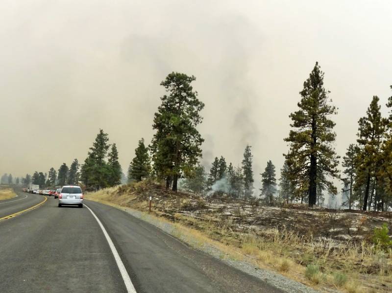 The ranger was trying to be helpful about proposing alternate routes while he was also monitoring the fire radio: he proposed back the way we came and then over small roads to get past the pile up to I90 (we didn’t want to go that far south if we could avoid it.) He said there “might” be a way down and up to Hwy 20. He had heard there was pilot car leading cars south on Hwy 97 from Okanogan. We decided to try it because it was the most direct way either to get back to Hwy 20 or else if we needed to continue down to I90.
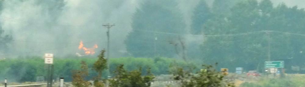
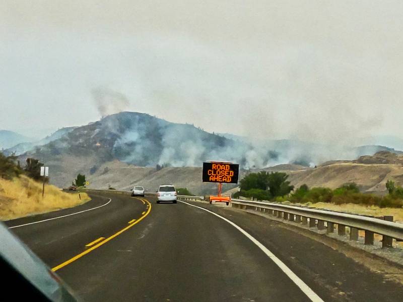
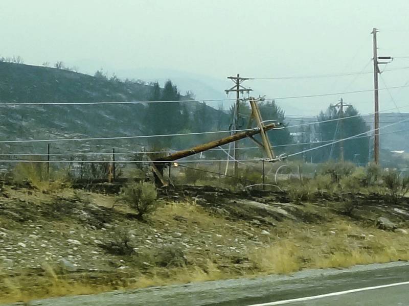
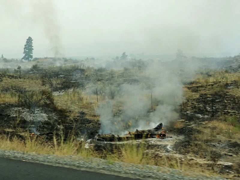 We headed south toward the smoke. There were fires on the hills to our west side. We stopped with the other traffic and Neil got out to take pictures while standing in ash on the road brim. There was fire equipment and firefighters still sitting on the side of the road near smouldering vegetation. The pilot car arrived and led us through the smoke which was very thick in parts. We could see power poles, highway signs, and orchards all burned. We continued to Pateros where Hwy 153 turns off back to the north toward Hwy 20.
 As I turned at the intersection to head west on 153 there were two sheriffs at the stop sign who had just come from that direction. I rolled down my window and asked if we could get through? He just stared at me (or through me) a moment and then said “be careful.” He looked like he was in shell shock and may not have realized what he was saying but that was all the permission I needed. Neil noticed about 100 fire fighting vehicles and mobs of firefighters congregating just south of the intersection, ready for deployment to the hotspots further south.
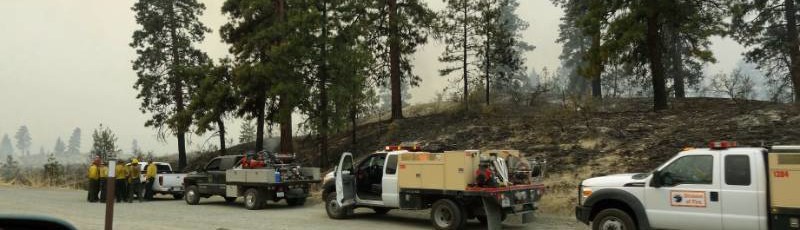
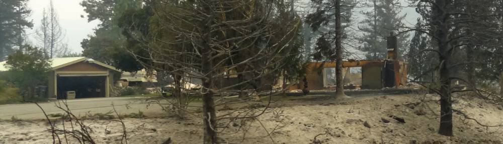
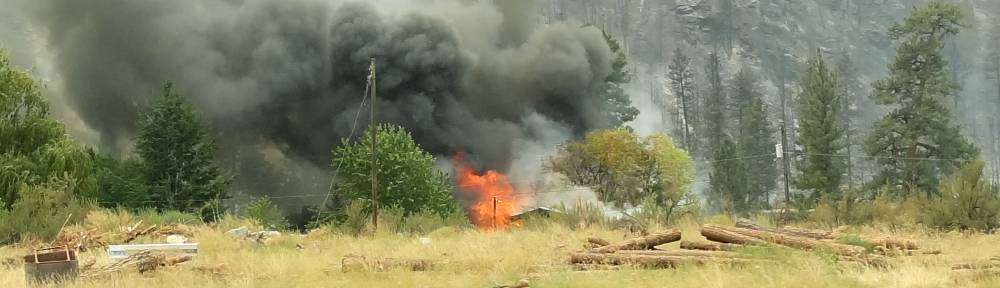
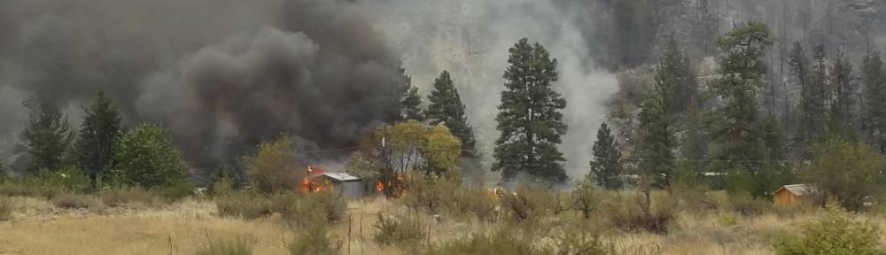
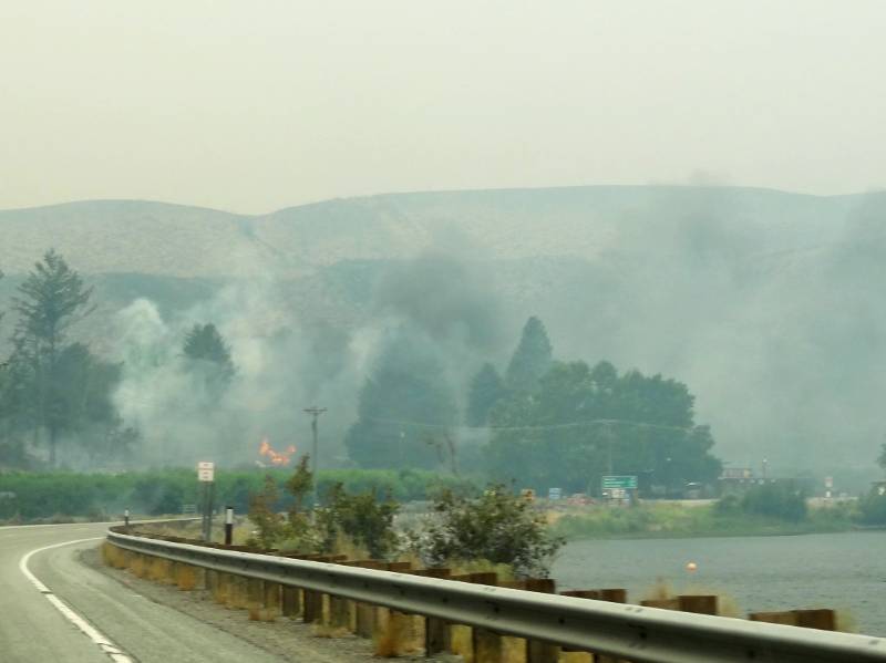
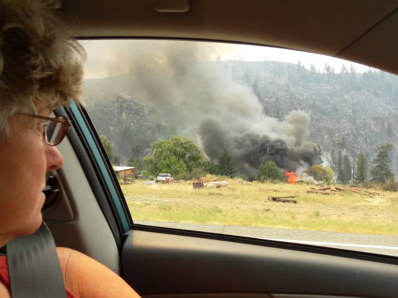
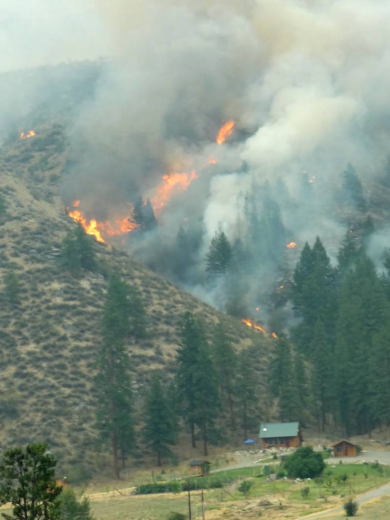
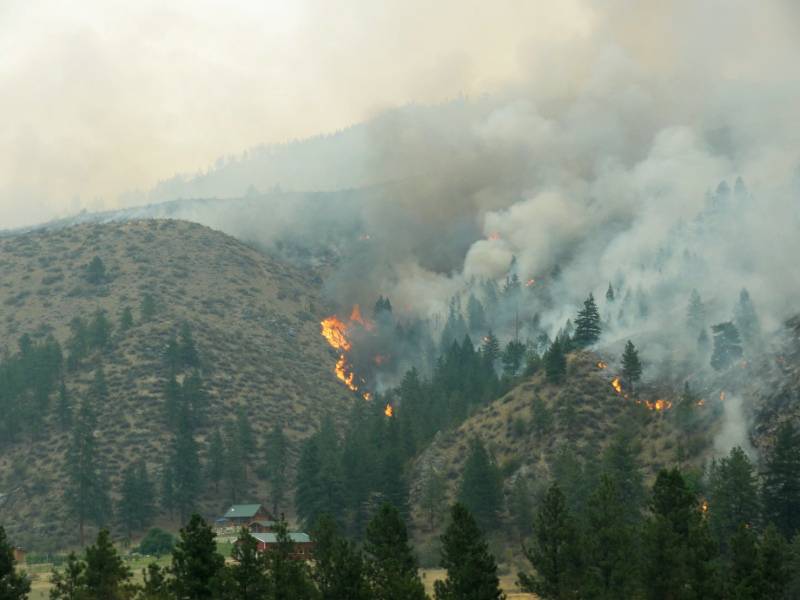 Starting a mile or two west from the intersection we drove by burned areas and saw fire on the hills; then we drove by where fire was right at the road and the firefighters were fighting it. We saw exhausted men and women and tens of fire trucks spread out along the road wherever pockets of fire remained. The sad thing was seeing homes completely gone except for the chimney and steps while houses nearby were untouched. Those untouched had green grass around them and the fire didn’t pass the open area. One house went up in flames off the road as we drove by.
 We connected with Hwy 20 at the town of Twisp. Power was out everywhere and we saw long lines of parked cars at all the gas stations, which were closed. Many people had been stranded for days. One Mom & Pop general store was the only place pumping gas. It was over a mile off the main highway and we were lucky to find it (good intuition). They must have had a generator. They also had a guard at the door allowing only one person in for each person who exited. I did see small amounts of food still on the shelves. There was no cell phone service throughout the whole region (hundreds of square miles) because the cell towers had burned or had no power.
 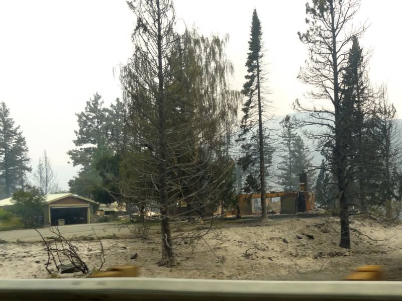 We had stopped to pick up info on the road ahead but soon found the info we had was extremely valuable. We were the first to bring news from the east. While I waited in the queue for much-needed gas (at almost double the normal price) people in front of the store crowded around Neil and pressed him for information. The store owners wrote down a summary on a big blackboard for later people to read.
 We drove on to Winthop and decided to stop at the Ranger Station to give our news. It was good we did because they were also dealing with lack of power and phones. They had little battery powered radios to talk to their trucks but couldn’t get any useful info from far away. Fire coordination was their main focus but they were trying to answer people’s questions. We saw people who had just lost their homes, people who had been evacuated and had nowhere to go, and stranded travelers in desperate circumstances, some camped on the lawn. They were all shocked when they heard we had made it through. They had all thought the highway was closed (maybe it was supposed to be?)
 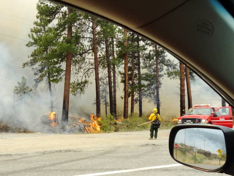 When they heard we had come through from Pateros the ranger came around from behind the desk and one came from the back room to grill us with more questions. Neil, with his previous experience in creating maps for emergency management, had them pull out their big map and was able to clearly point out on their maps the details we observed. They were all so starved for meaningful information, especially the rangers, that our decision to stop there turned out to be a huge blessing to many people.
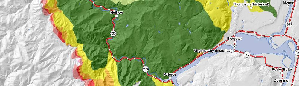
Carlton Complex Fire was the name given this wildfire. Neil researched and found links which provide
- an extensive description of the Carlton Complex Fire,
- a photo documentary of the Eastern Washington wildfires, and
- a color coded map of the fire area.
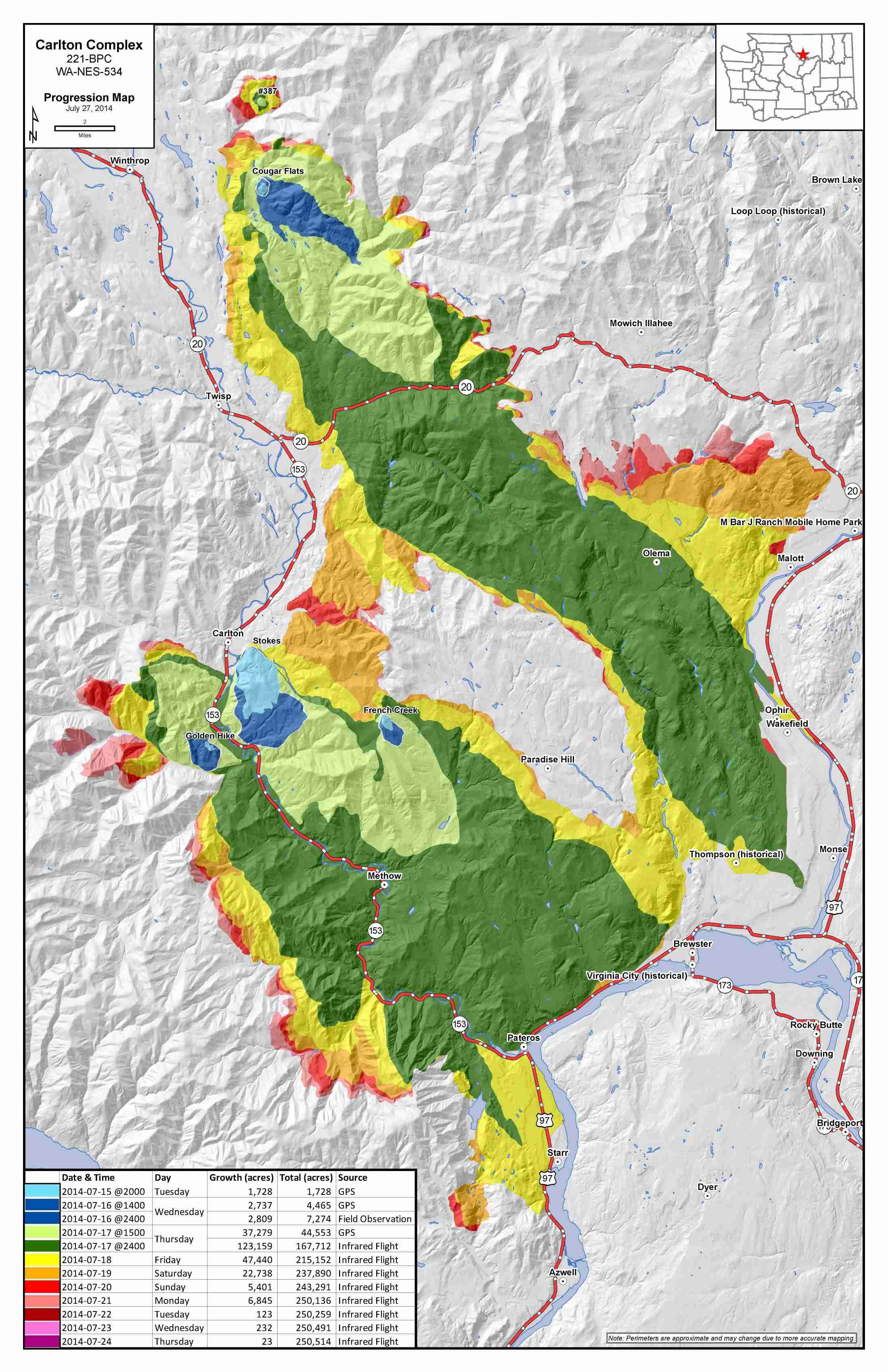 Four lighting strikes sparked fires on July 14, 2014, near Carlton, Twisp, and Winthrop which merged to become the largest recorded wildfire in Washington state history (the previous record was 1902.) The most intense burn days were July 17 (light and dark green) and 18 (yellow) fueled by high temperatures and strong northwest winds (we drove Hwy 153 on July 18!) The fire was not declared 100 percent contained until 41 days later.
“[The fire] burned 256,108 acres, destroyed 353 homes, and caused an estimated $98 million in damage. The fire caused no direct fatalities or serious injuries, although one homeowner died of a heart attack while protecting his home. … When July 19 arrived, a total of 760 firefighters were battling the Carlton Complex blaze, along with at least 15 helicopters and two planes. … In the end, the Carlton Complex fire was, in the words of The Wenatchee World, “a catastrophe beyond measure … too great for an ordinary detached person to grasp” (“The Long Struggle”).” HistoryLink.org
We left the fire and smoke behind driving west now seeing incredible views as we neared North Cascades National Park. We arrived just in time to get one of the very last available camp spots in the large campground. We had made it! What an experience!
Photo Credit: Neil Rhoads
Photo Slider: Neil has worked hard editing the pictures for you to enjoy in the posts. He has also had fun making header photos for the top rotating slider. This post has a unique slider with pictures from this adventure only. I hope you click into the webpage so you can see the slider in action.
Photo gallery below:
Clicking on any photo thumbnail brings up the full size photo with a description. To easily see them all, use the arrow buttons or keys to move through the full size gallery photos with descriptions. If you are receiving this in an email and don’t see a photo gallery below, please click into my webpage to view all the photos!


