


 We were driving the most northerly highway in Washington state and heading to a region that neither Neil nor I had ever been to see: the North Cascades. The Cascade Mountain Range extends from Canada all the way to northern California. The “North Cascades” designates the portion of the Mountain Range in north central Washington. Looking at the map from the Ice Age Floods Institute (first mentioned in the National Bison Range post), it appears that many North Cascade peaks extended above the ice sheet between the Puget Lobe and the Okanogan Lobe. Driving through these mountains, it is clear they are sculpted by glaciers. Archeological finds in the region suggest continuous human habitation since the end of that most recent glacial period when the native American ancestors of the Skagit tribes advanced to the interior of the mountainous region as the ice retreated.
 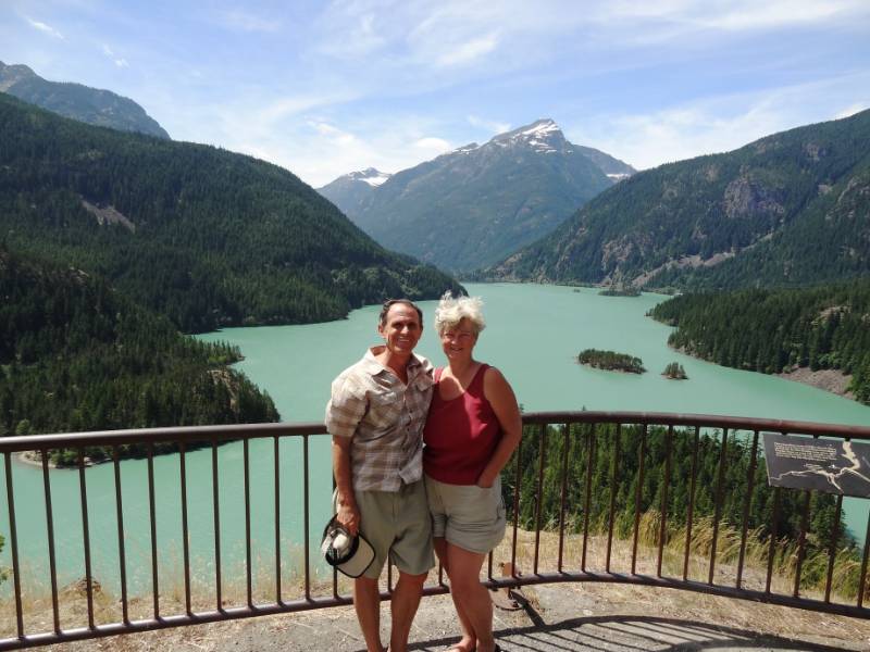 While the Puget Sound Skagits seemed to only venture into the North Cascades during the summer months, the tribes to the north and east of them, the Nlaka’pamux, Chelan, Okanogan and Wenatchi, lived partly or year-round in the eastern sections of the North Cascades. In 1811, a Scotsman named Alexander Ross explored the region for the fur trade and with the men of his company built Fort Okanagan. During the 1800s there were several expeditions to search for a transportation route through the North Cascades. They found no possible railroad route, only marginally suitable routes for roads, and it was determined that the mountains were virtually impenetrable! In fact, it wasn’t until 1972 that the road we drove, Highway 20, also called the North Cascades Highway, was finished to bisect the Cascades over Washington Pass at 5,477 feet. And the highway is closed in the winter due to the large snow accumulation in the mountains!
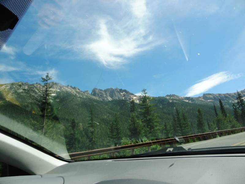
 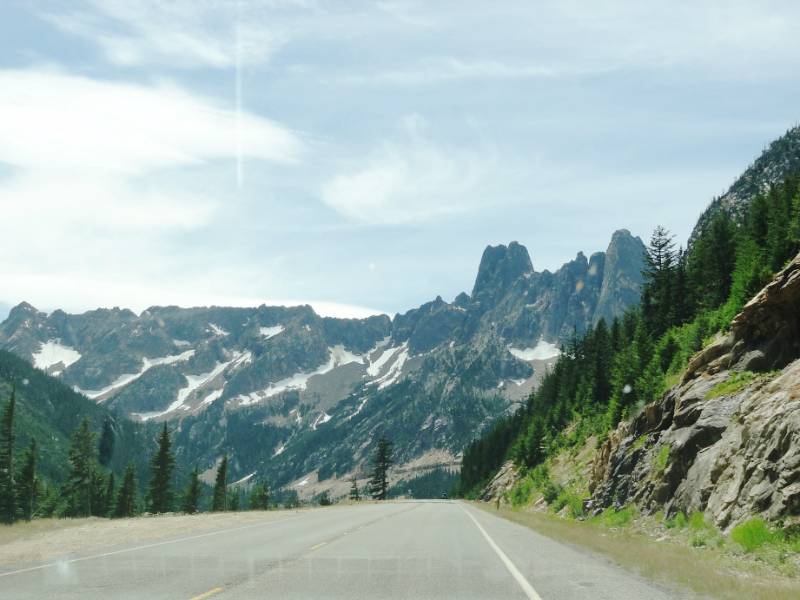 The mountain peaks were still snow covered in mid-July as we drove toward the North Cascades through the Methow Valley. It was brilliantly sunny and clear having left the smoke and fire behind us that Friday afternoon July 18. We were in awe of the breathtaking views of the spires and peaks as we viewed the scenery thorough the windshield. We didn’t take time to stop for photos because we were concerned about getting to the campground in time to get a good site.
American Alps
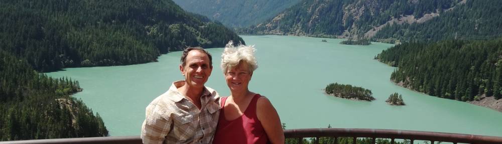
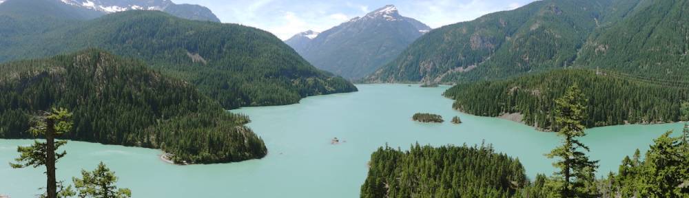
 It was a good thing we kept driving straight to North Cascades National Park and didn’t stop to take photos (well, one stop at the Diablo Lake Overlook) because we got one of the last available camp spots in the large Colonial Creek campground that Friday night. The campground is set in a beautiful old growth forest and we were pleased to get a fairly private little tent spot. After setting up camp, we still had more daylight and drove to the North Cascade visitor center to collect maps and information.
 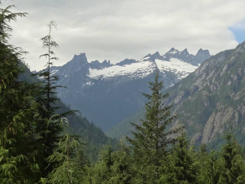 Viewing the setting sunlight on the North Cascade peaks from the visitor center viewpoint made me understand why Washington state citizens who petitioned for the region to be protected as a National Park in 1898 believed it to have scenery “greater than Switzerland’s”; the region has the nickname the “American Alps”. However, the North Cascades wasn’t designated as a National Park until 1968. I admire the generations of environmentalists who have worked to preserve the wilderness for future generations.
“Rival interests continued to argue over whether the lands should remain under the management of the U.S. Forest Service or the National Park Service but by the 1960s, the environmentalist argument advocating for a national park prevailed. Though the North Cascades National Park Act designated the region as a National Park on October 2, 1968, the National Park Service did not commence direct management until January 1, 1969. The North Cascades National Park Act also designated Ross Lake and Lake Chelan National Recreation Areas. Interestingly, Redwood National Park in California was also signed into existence on the same day as the North Cascades. By 1988, much of Bob Marshall’s original plan to set aside the future park as [unimproved] wilderness [as opposed to a national park] was achieved when 93 percent of North Cascades National Park was designated as the Stephen Mather Wilderness. Establishing the national park (Wikipedia)
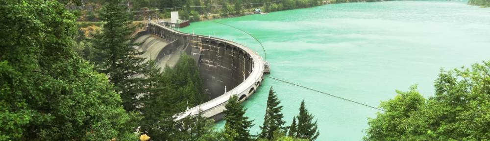
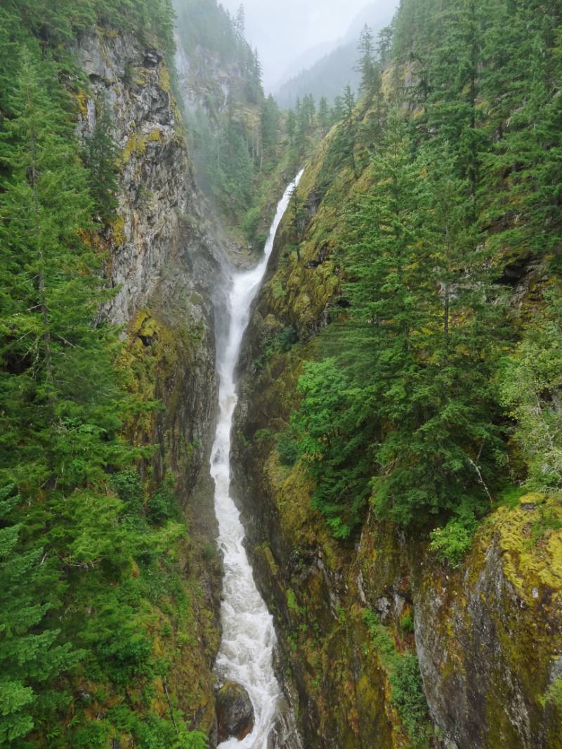 A wonderful top off to our day was viewing an impressive waterfall! Gorge Creek Falls is accessible from a large parking area right off the North Cascade Highway as we returned to our campground. Gorge Creek dramatically drops 242 feet into a steep-walled narrow gorge before flowing into the turquoise Gorge Lake. Following the walkways also took us to an overlook of Gorge Dam and the Skagit River flowing from it. As we prepared for sleep we were getting excited about hiking tomorrow in these glacier carved mountains full of lakes and waterfalls.
Water Water Everywhere
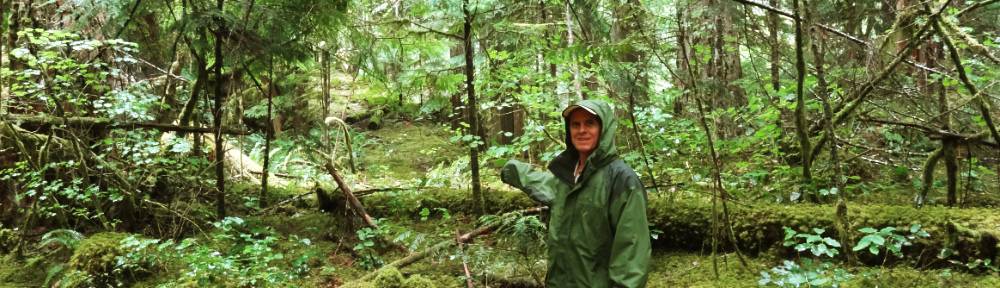
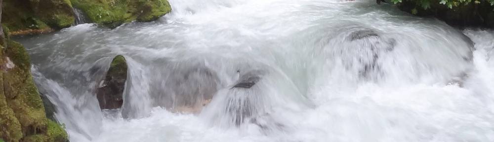
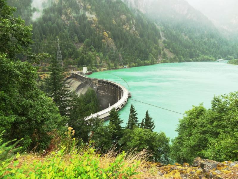 We woke to rain! We made our breakfast tea and off we went to hike in the rain. We were a little discouraged with the overcast because it had been so beautifully sunny on our drive the day before but we could only hope the rain would reach beyond us and help quench the wildfires to the east. Looking for a trailhead, we drove down the access road to the ferry landing and the North Cascades Environmental Learning Center. The road went right over the top of Diablo Dam and we stopped at the pullout! It was an impressive sight watching and feeling the rumble and roar of the water shooting out of the dam spillway with mist rising as the water plummeted down to the riverbed far below. We definitely felt the power of nature. Neil has edited a (53 seconds) video for you of Diablo Dam since still pictures simply fail to capture the moment.
Skagit River Hydroelectric Project
Now might be a good point to talk about the lakes and dams. The dams (Gorge, Diablo, and Ross) were built, and are owned and operated by Seattle City Light, the Seattle power company. These three dams with hydroelectric power-generating stations are designated as the Skagit River Hydroelectric Project. The project supplies approximately 25 percent of Seattle’s electric power. Construction on Gorge Dam was begun in 1921, then Diablo Dam construction began in 1927 upriver on the Skagit River, and lastly Ruby Dam, later named Ross Dam, began in 1937. The three lakes formed by the dams are encompassed by the Ross Lake National Recreation Area. Ross Lake stretches 20 miles upriver with its north tip extending into British Columbia.
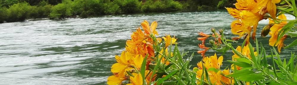
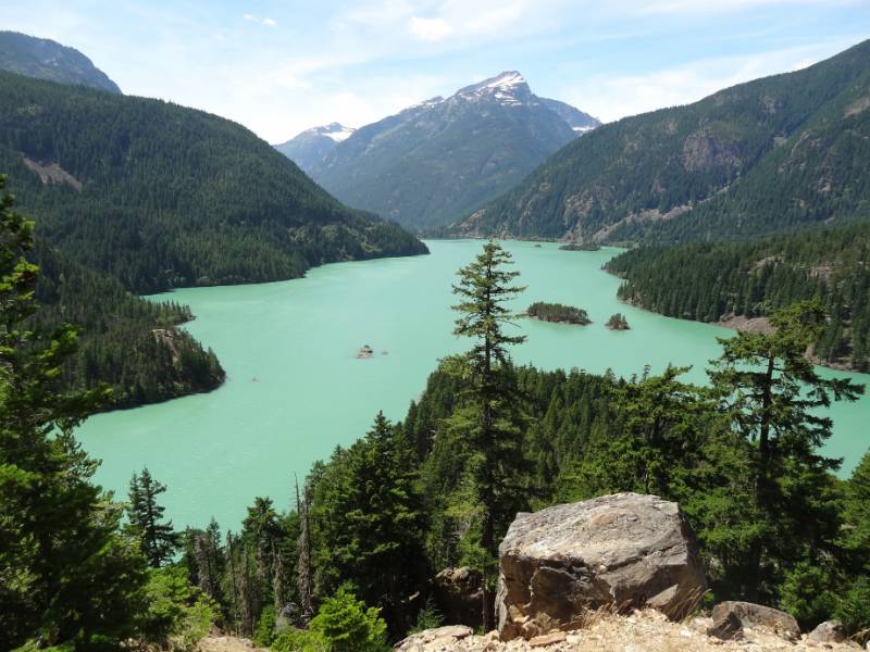 The Skagit River and, by extension the three lakes, are glacial fed. Approximately one third of the glaciers in the lower 48 states are within the North Cascades National Park (312 glaciers are on the mountains in the park.) The pressure of a glacier’s own weight and the force of gravity cause the glacier to move (or flow) outward and downward, grinding the the rocks below. Abrasion happens when the glacier’s ice and embedded rock fragments act as sandpaper, crushing the rock into finely pulverized rock flour and smoothing the rock below. The rock flour freezes into the ice and later flows downstream suspended in the glacier meltwater. This rock flour suspended in the water is what gives the lakes their beautiful turquoise color.
Thunder Creek Watershed: Glaciers and Diversity
“Thunder Creek is an ecologically important watershed with the largest concentration of glaciers in the lower 48 states. This valley deep within the mountain range carves through the “Crystalline Core” of the North Cascades. It mixes plant and animals typical of the dry east side of the mountains with those usually found on the wet west side. Natural disturbances such as fire, snow avalanches, landslide, and glaciation add complexity and help to create a mosaic of habitats.” Sign at the Diablo Lake Overlook
North Cascades National Park Complex
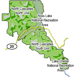 Here’s what I didn’t understand until I was looking at the park map to write this post: The Ross Lake National Recreation Area basically bisects the North Cascades National Park creating a northern and southern section of the Park. The Highway 20 corridor and all campgrounds are actually in the Recreation Area. The three portions (including the Lake Chelan National Recreation Area adjacent to the south edge of the Park) are all managed together as the North Cascades National Park Complex. Simple, right? Actually it was simple because we just thought of the whole area as the North Cascades and there were no National Park entrance fees—just the campground fees. Now I can understand how they can designate 93% of the North Cascades National Park as wilderness because there are no roads into the actual National Park—only foot trails.
Walking in the Rain
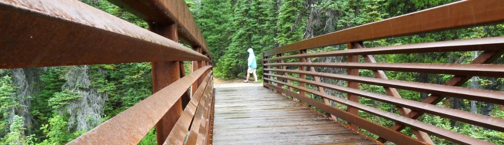
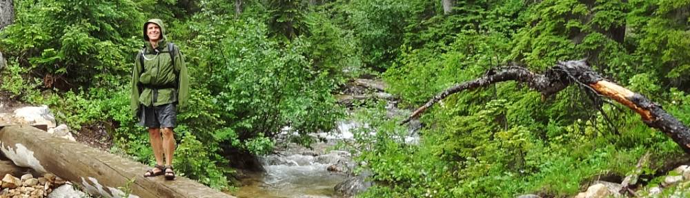
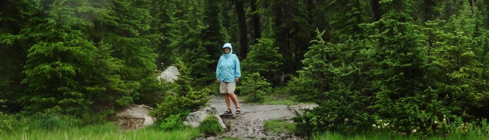
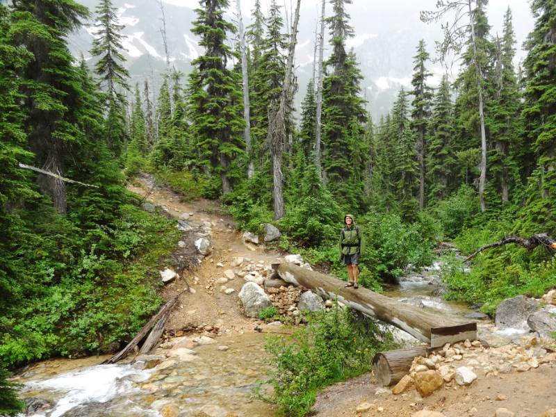 Speaking of trails, yesterday we had considered taking the ferry across Diablo Lake and walking back along the Diablo Lake Trail. The misty rain over the lake did not make the hike appealing since the higher elevations of the trial would be in cloud with no spectacular views. Instead we back tracked on the North Cascades Highway (Highway 20 back the route we had come yesterday up and over Washington Pass) and decided to hike a few shorter trails to see the variety of the area. We first hiked to Cutthroat Lake; named for the nearby Cutthroat Peak rocky spire, 8,050 feet, but I couldn’t find out how the peak got its name.
 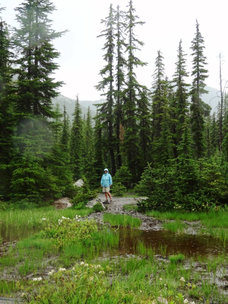 We were well prepared as we started out: bundled up for the cold air and covered with our rain jackets and hoods up. And then people started passing us on the trail in their tank tops and hoodies tied around their waist like they are out for a stroll. If you had seen us side by side could you tell which people were locals and which were visitors from the tropics? [In retrospect, this was Clue One.]
 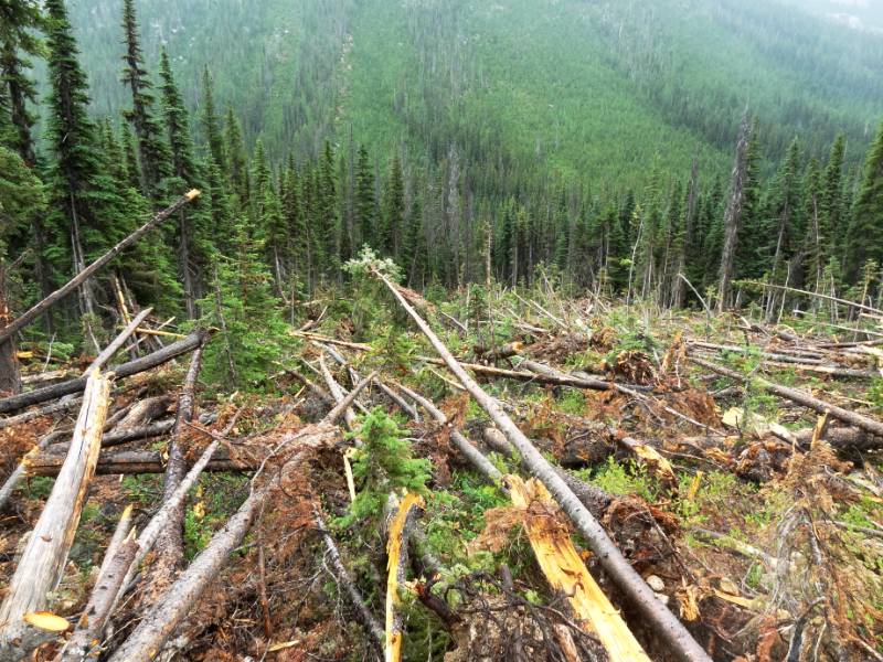 It was a moderately easy 4 mile round trip hike through thin forest and rocky areas. At one point we crossed a debris field of downed trees that had taken out the trail. The swath of downed trees extended far up the steep slope to our right and far down into the valley to our left. All the broken trees were snapped off in the downhill direction. Clearly, this was the site of a recent snow avalanche.
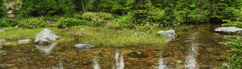
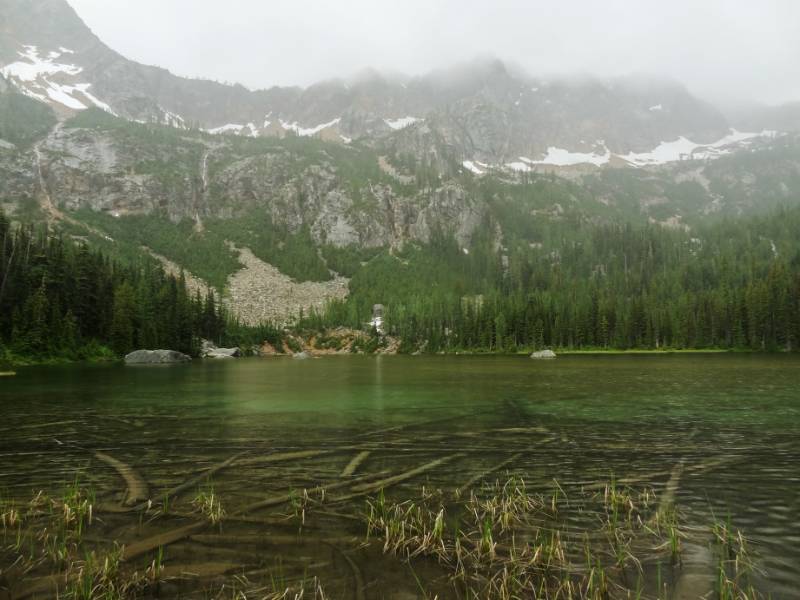 The lake itself wasn’t picturesque until you took in its impressive setting up against the huge expansive wall of rock forming a semicircle behind it. Geologists call this semicircular shape a cirque, and it often forms the beginning or head end of a glacier. Often, the bowl shape is so scooped out that when the glacier melts a lake is left behind. These lakes are tarns. This hike was a good choice in the rain even with the clouds hanging low over the surrounding peaks.
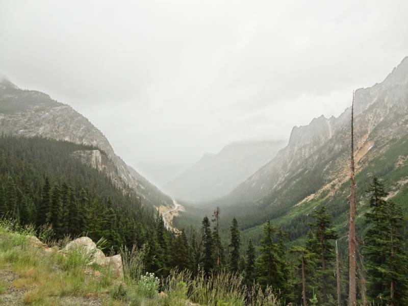 This time we had time to stop at the Washington Pass Overlook to take in the vista. Taking in this view of the towering rocky peaks and cliffs, I could see how these mountains could look impenetrable.
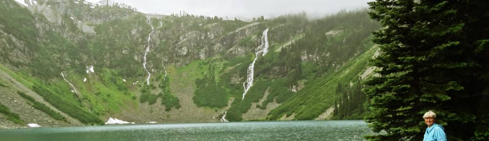
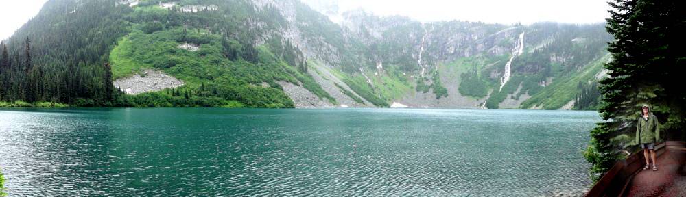
Our next hike was to another tarn called Rainy Lake, well it was more like a stroll, on a two mile round trip level trail (with the exception of a couple of large fallen trees to climb over across the path.) We walked in an old growth forest to emerge at a beautiful basin encircled almost all the way around by steep mountain slopes covered with cascading waterfalls from melting patches of snow. Here’s a short video of the beauty.
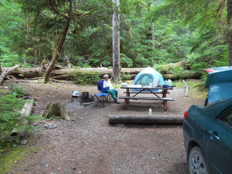
As we drove back through the campground, we noticed everyone had put up tarps over their tents and picnic tables to keep them dry from the rain. Some people even had tarps stretched high above their campfires so they could sit around them in shirtsleeves. [This was Clue Two] We arrived at our campsite and discovered our tent and sleeping bags were drenched from water running inside. Did you know that polyester fill sleeping bags can easily hold four to five times their own weight in water? [This was Clue Three]—We are not prepared for camping in the rainy Pacific northwest! We reorganized the car to put the dry items on the back seat and then carefully bundled the wet tent and sleeping bags plus mats in the trunk and headed to find a hotel.
Graceful Retreat
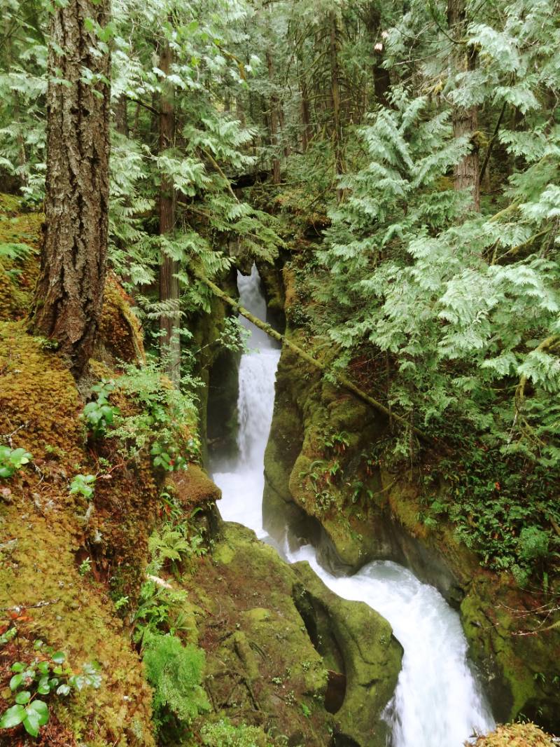
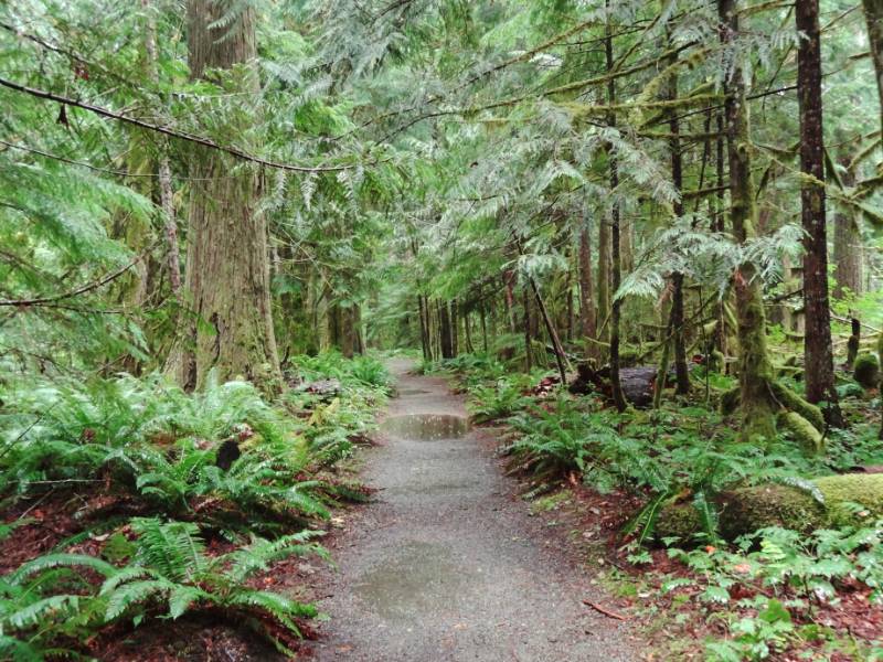 We had planned (and pre-paid) to camp two more nights depending on the weather and the trails we found. There were also a few trails in Newhalem by the visitor center we had planned to walk our last day when we exited the Park. Still bundled in our raincoats and hoods, we spent a few more hours walking the Trail of the Cedars, Rock Shelter Trail, and the Ladder Creek Falls and Rock Gardens behind the Gorge Power House. We were too late to take any of the Seattle City Light walking tours but crossed the Skagit River using the pedestrian suspension bridge and walked among the gardens on our own enjoying the view of the beautiful little waterfalls. The gardens were the creation of J.D. Ross, the second Seattle City Light superintendent, and an accomplished horticulturist, who envisioned the three dams and hydroelectric powerhouses.
“Ladder Creek Falls and Rock Gardens, located behind Gorge Powerhouse in Newhalem, is a refreshing woodland retreat with benches, exotic plantings, and close-up views of spectacular Ladder Creek Falls. Cross the Skagit River using the pedestrian suspension bridge next to the powerhouse, and follow signs to the trail. The historical light show has been restored and operates year-round from dusk until midnight.” Seattle City Light Skagit Project
Walking back over the suspension bridge we noticed cloudy wisps blowing over the valley walls. Their motion was so peaceful and beautiful we just stood and watched for a while.
We started looking for hotels before hitting I5, and then kept looking for vacancies at each major intersection. Neil started using the phone and calling. ALL FULL. Then it hit us, all the roads were closed going east and people might be stuck on the coast. After nine stops and eleven calls, we were nearing Seattle. 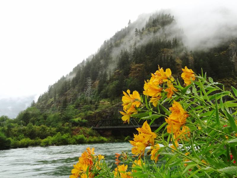 We called Helene and Timothy to ask if we could descend on them at 11 at night. They said COME and why did we even try for a hotel! We were exhausted and only managed to say our hellos before having them point us to the bed – luxuriantly soft and dry! Happiness 🙂
Photo and Video Credit: Neil Rhoads (Hope you enjoyed the addition of videos)
Photo Slider: Neil has worked hard editing the pictures for you to enjoy in the posts. He has also had fun making header photos for the top rotating slider. This post has a unique slider with pictures from this adventure only. I hope you click into the webpage so you can see the slider in action.
Photo gallery below:
Clicking on any photo thumbnail brings up the full size photo with a description. To easily see them all, use the arrow buttons or keys to move through the full size gallery photos with descriptions. If you are receiving this in an email and don’t see a photo gallery below, please click into my webpage to view all the photos!


