


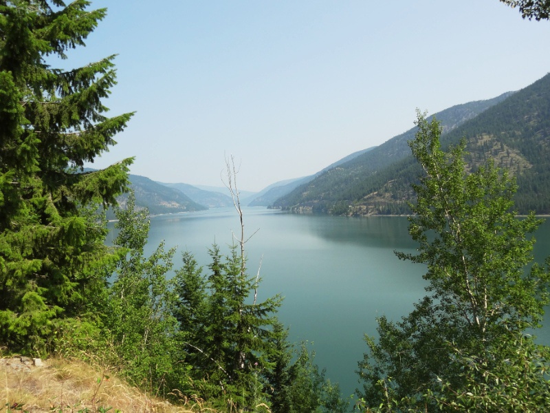
 After our hike to Little North Fork Falls and a refreshing dip in Big Creek, we set out on a brilliant Wednesday morning. We drove south along the west side of Lake Koocanusa looking down the steep sides of the lake before reaching the overlook of Libby Dam at midday.
Lake Koocanusa and Libby Dam
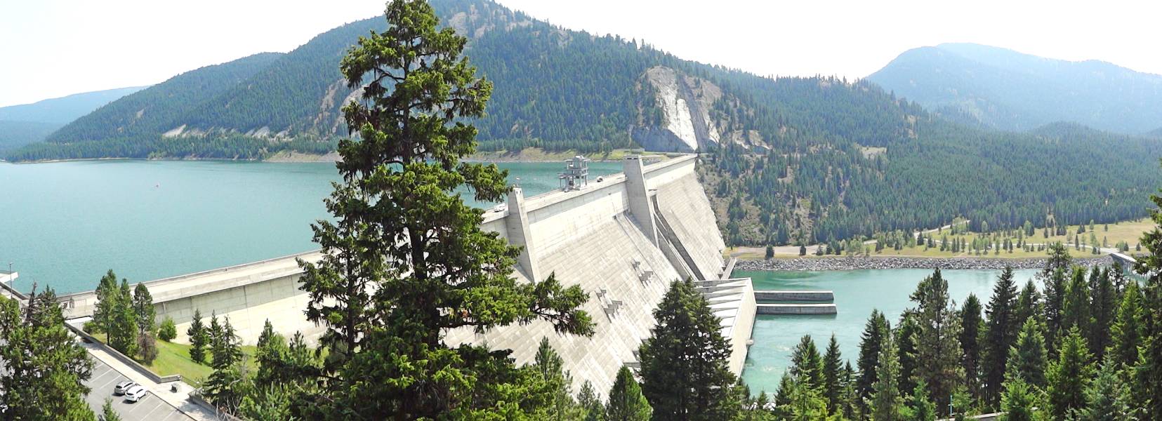 Libby Dam was completed in 1972 and stands 422 feet tall. It created a 90 mile long narrow lake stretching between the United States and Canada. It was a joint project between the two countries to provide flood protection from the Kootenai River spring fluctuation and to generate hydroelectric power. Lake Koocanusa received its name in a contest to name the Libby Dam reservoir. Alice Beers, from Rexford, Montana, combined the first three letters from KOOtenai River, and the first three letters of CANada and USA. They offer public tours of the dam but we just enjoyed the overlook view before continuing.
Our plan was to drive Highway 2, the very northern US route, to the Pacific. The highway traverses multiple National Forests and Parks including Kootenai National Forest. Kootenai encompasses the northwest corner of Montana where we spent two nights on our trip. We checked with the local experts at the Libby Ranger Stations for suggestions of sights to see and hike. The ranger said not to miss the Ross Creek Cedars, a hidden gem. We also asked about Kootenai Falls and she said “You can miss it. There are lots of cars and an ice cream stand.”
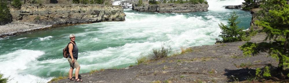
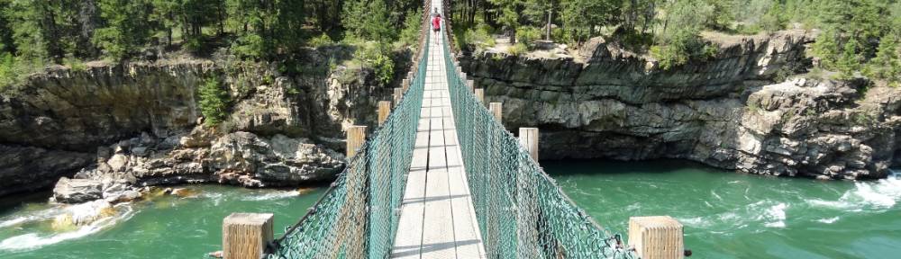
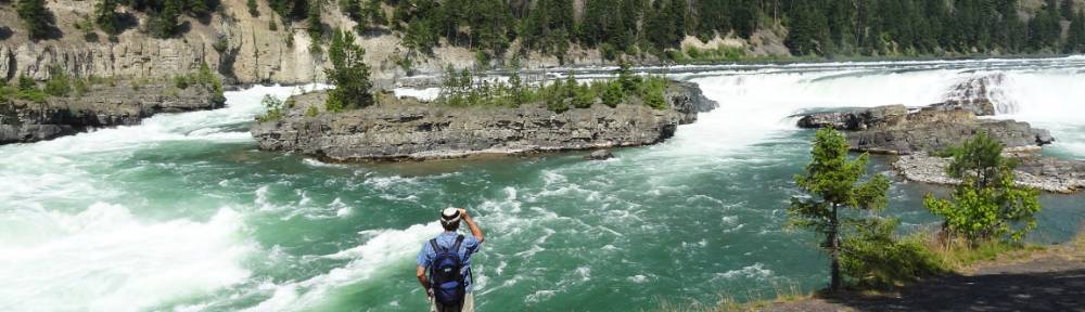
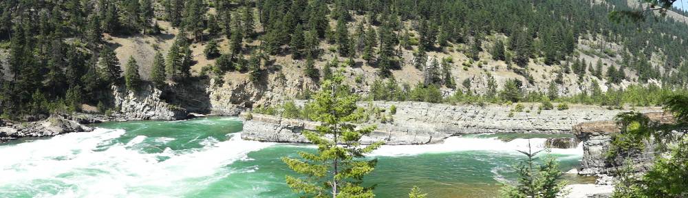
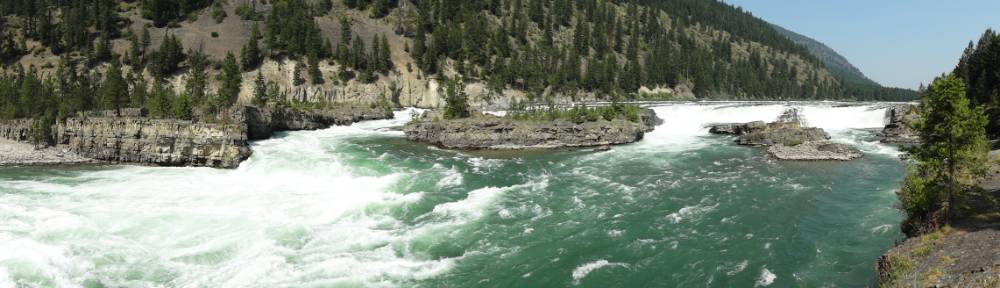
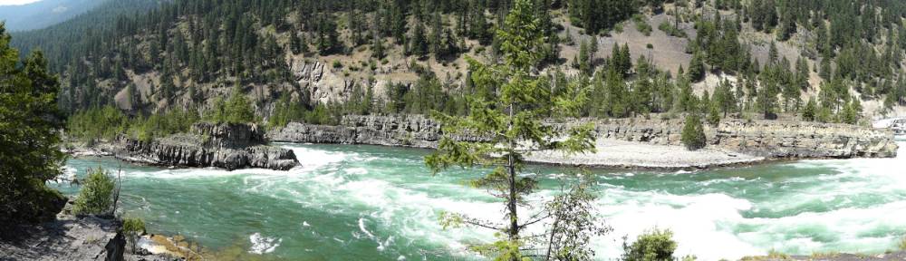
Kootenai Falls and Swinging Bridge
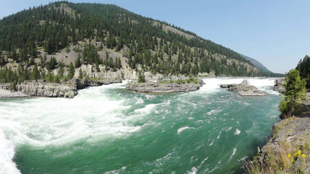 It was just as the ranger described it: lots of cars (and RVs) and a concession stand in a large parking lot with informational signs for Kootenai Falls. We walked a level foot path from the parking area next to the highway and then descend a dirt trail down the hill to double railroad tracks. A special enclosed pedestrian bridge has been built over the tracks with high stairs to climb and descend to the river side.
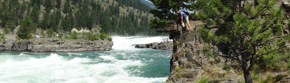
 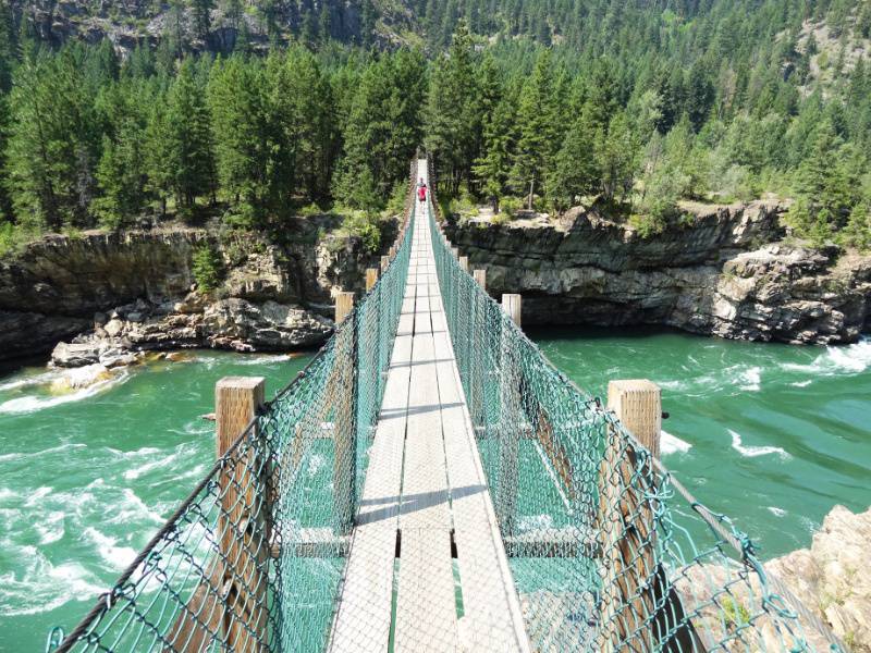 We took the left fork of the trail which winds along the river and down to the swinging bridge. After enjoying the view of the falls and the swaying feel of the bridge with the water racing below us, we retraced our steps and took the right fork along the river to rock cliffs immediately overlooking the falls. We could feel the power of the falls just standing on the rumbling rocks with the mist swirling around.
“The calm [Kootenai] river suddenly gathers momentum surging first through China Rapids and then over Kootenai Falls, dropping 90 feet in less than a mile. The main falls is 30 feet high and can be viewed from a “swinging bridge” that crosses the river. … The falls area is a sacred site to the Kootenai Indians who once called this area home. This was a place where tribal members communed with spiritual forces.” LibbyMT.com Kootenai Falls
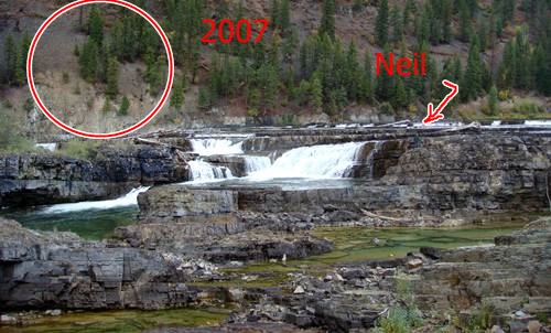
Kootenai Falls – Then and Now
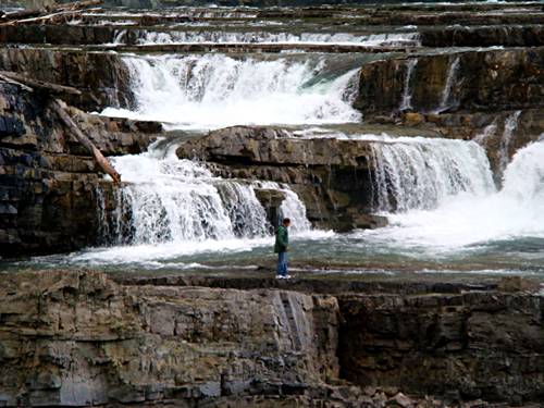 On our 2007 North American Adventure we found Kootenai Falls almost by accident. As we drove Highway 2, Neil was studying the terrain out the window and he suspected a dramatic elevation change was nearby when he spotted a sign for Kootenai Falls and large parking lot with just a few cars. It was a good place to stretch our legs so we stopped to investigate. What a find!
 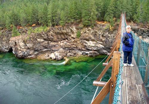 It was October 1, 2007 and the water flow was low enough in the channel that we were able to walk on the rocks down near the falls. We were able to see that at some time in the past the water flow must have been many times higher. You can read our description of our first experience with Kootenai Falls at Day 11 of our North American Adventure. We pulled a few photos from back then so you can see the comparison.
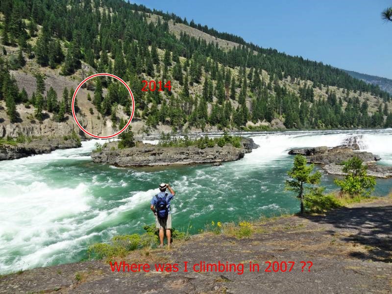
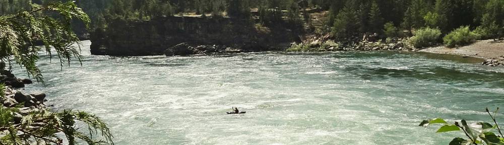
Our recent falls excursion was July 16, 2014 and the water was roaring down the falls filling the channel from bank to bank! On our first visit we scrambled down the bank and out onto rocks that were now completely submerged under raging currents. 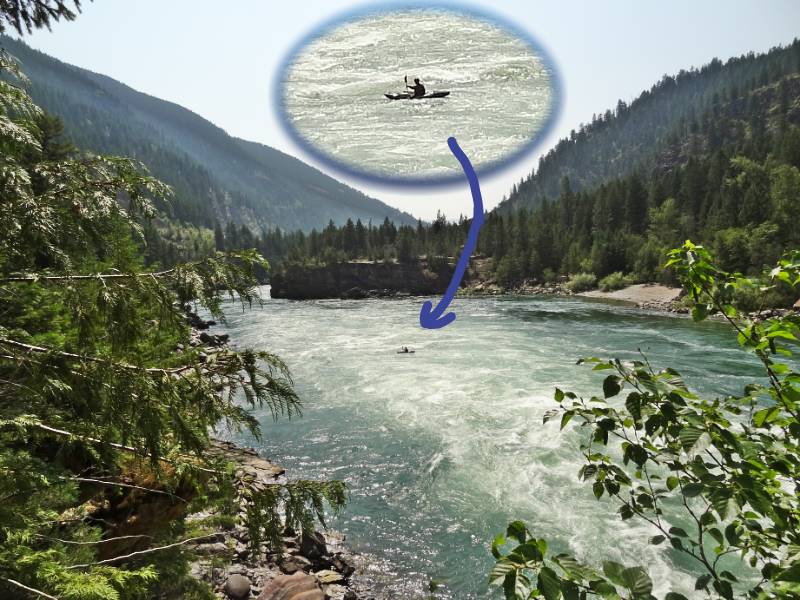 It’s hard to tell from photos but being out in the middle of a giant riverbed during low flow was somehow more profoundly impressive than just seeing it in full flow from above. Below where you see the kayaker in the water is some of the sandy river bottom we walked on years ago. Just imagine what it’s like for that kayaker!
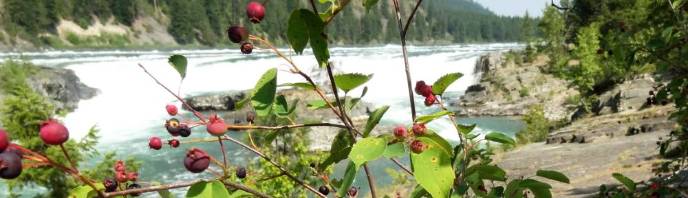
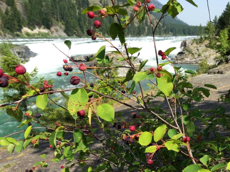 On the other hand one of the things that makes a summer visit better is the berries are in season. From out on the swinging bridge Neil saw a couple of people grazing some bushes. Some of you may know Neil loves to eat exotic things when he travels so naturally he went over to them and struck up a conversation. They were German tourists who recognized the berries as Juneberries and they offered to share some with him.
 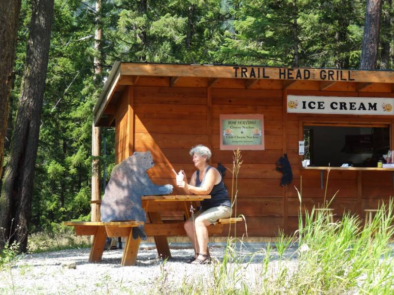 Yum! Neil ate quite a few.
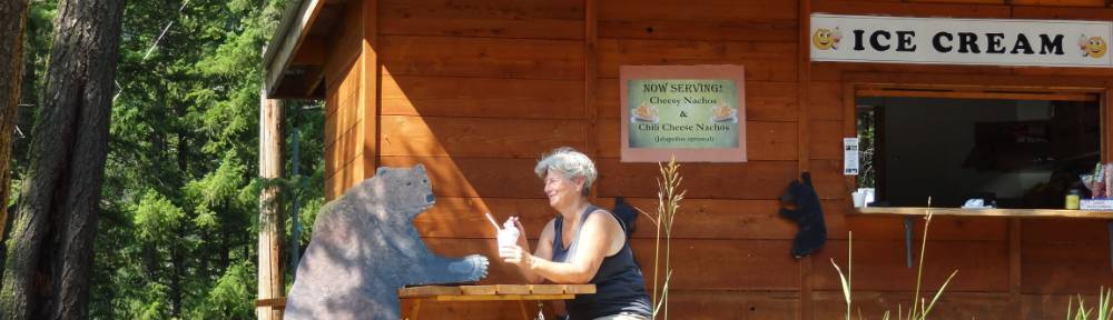
I couldn’t resist getting some ice cream as reward for accomplishing the hike and I shared some with a shaggy friend at the table with me. This is only fair since Neil ate his Juneberries.
Ross Creek Cedars
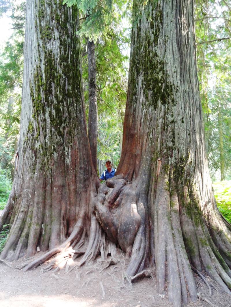 We are very grateful for the ranger’s recommendation! We would have completely missed this little magical place. Ross Creek Cedars is an amazing ecosystem of preserved old growth cedar trees. It is a mile long loop nature trail with informative signs of the history and ecology of the many plant and animal species native to the cedar grove.
“The Kootenai National Forest established the Ross Creek Cedars in 1960, as a scenic area protecting it for scientific and recreational value.
The 100 acre park is home to a grove of 500 year old ancient western red cedars. Some of these trees grow up to 12 feet in diameter and 175 feet in height. The grove is also home to various large specimens of other western trees and the many lush ferns and flowers that blanket the shady forest floor.” Exploring Montana: Ross Creek Cedars
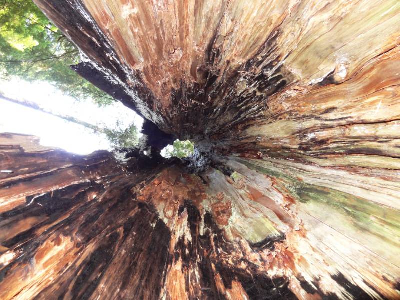
We only took a few photos because we were enjoying the magic of the location. The two website links above about the Ross Creek Cedars have a variety of photos if you want additional views of the trees.
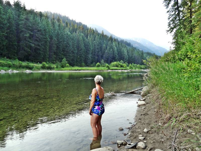 We camped nearby just off of Hwy 200 in a campground on the Bull River. The river had such a silty bottom that it wasn’t inviting to me for an evening swim. The campground was crowded but we had the convenience of a picnic table for cooking dinner and breakfast. There are tradeoffs in all things. 🙂
Photo Credit: Neil Rhoads
Photo Slider: Neil has worked hard editing the pictures for you to enjoy in the posts. He has also been having fun making header photos for the top rotating slider. This post has a unique slider with pictures from this adventure only. I hope you click into the webpage so you can see the slider in action.


