College Friends Reunion in Austin

In June, I took a trip to the mainland making four stops: California, Montana, Ohio, and Texas. The last stop was in Austin, Texas, where I meet seven other college friends for a three day reunion. My friend Carol Clouse did a wonderful job of writing up our adventure and organize all our photos and has given me permission to use her text here on the web post. Thanks Carol!

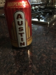
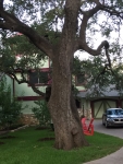
Austin BeerReal Austin
Our Fourth Biennial Reunion June 18-21, 2016
By Carol Clouse

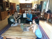
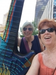
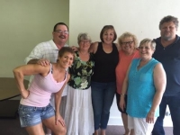
Our adventure stared out on June 18, 2016, eight friends traveling from Maui, Chicago, Breckenridge, Willow Glen, Santa Clara, and Watsonville gathering in Austin Texas, the live music capital of the world.

Our guest houseJay, our thorough and very organized travel agent, found our 705 Garner Ave. palatial six-bedroom house. On arrival, we were greeted with an amazing BBQ dinner from Terry Black’s Barbecue, a great find by Eric. The brisket and ribs were cooked to perfection, the cheesy sausage was an amazing blend of flavors, and the beans and the additional sides made for a perfect start to another fun adventure.

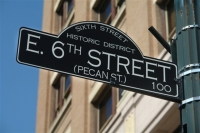
Hangin in The NookAfter catch up and cocktail hour, we walked the “Dirty Six” (6th St.) checking out bars and music venues. We popped in the Nook and played a ring game, which involved tossing a hanging ring onto a hook on the wall (quite a challenge). Not finding the right venue on 6th St., we traveled to One-2-One club where the band was playing Tom Petty music.

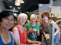
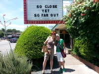
Our Barbecue leftovers made for a yummy breakfast, perfect with coffee roasted by Matt. Next, we settled on a list of things to see and do. The Lauries, Nan, Judy and Carol walked S. Congress from Heritage Boots to Allen’s Boots, enjoying shops along the way. The designer boots were tempting, but the over $1,000 price tag kept us at bay.

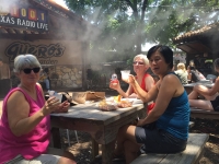
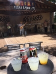
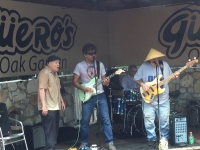
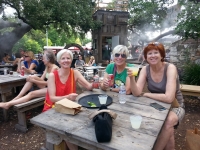
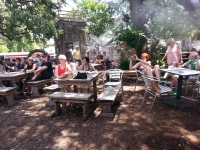
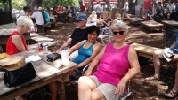
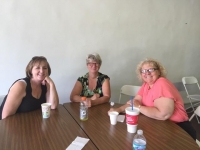
RefreshementsShopping is hard work, we eventually found ourselves with drinks in hand at Guero’s Garden listening to four musicians who just got together to form a band called Blue Sunday. Their bluegrass music was lively, entertaining and well done. With air misting to cool us down, we were very satisfied. After a bit, Eric, Jay, and Matt joined us.

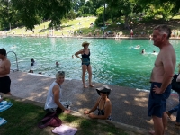
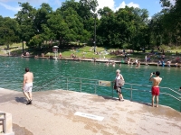
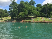
Our group getting ready for a swimNext on our check-off list of Austin finds was Barton Springs Pool. Nan, Jay, Laurie B., and Judy went swimming to cool off while Eric, Laurie and Matt stayed cool in the air-conditioned house enjoying margaritas, gin and tonics and the US Open. On our way back, we hit the food trucks near Barton Springs and brought home Monte Cristo Sandwiches from “Hey!…You Gonna Eat or What?”, chicken and avocado cones from “The Mighty Cone” and cupcakes from “Hey Cupcake”. We were very pleased with our selections.

Food Truck DinnerOur evening plan was to watch the NBA Finals and then seek out some live music. Our half-time entertainment was Eric on the piano and Judy singing. The current Californians cheered the Warriors while Eric and Laurie B. for some unexplained reason rooted for the Cavaliers/LeBron. Much to the disappointment of the Californians, the Cavaliers won the very close game. Eric and Laurie where kind not to rub our noses in it. The lure of spending a beautiful evening with a full moon, on the deck with college friends trumped a night of live music.

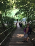
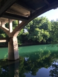
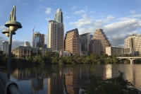
Amazing reflectionOur second full day was a day of many check offs. We got out early in the morning and walked down to Barton Springs Trail before it really go hot. We fallowed Barton River to the Colorado River (little Colorado) on a very well-traveled, tree covered path that followed the river. We even caught photos of an owl perched on a branch hanging over the river.

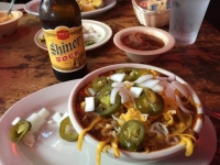
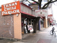
And what brought us to Austin??? Texas Chili ParlorJay heard about the Mad Dog Margaritas at the Texas Chili Parlor in the Townes Van Zandt version of Guy Clark’s “Dublin Blues” tune. Judy and Laurie B met us there after their fun shopping excursion. The margaritas and Bloody Mary’s were quite tasty and the chili did not disappoint, what flavor! Well-done Jay, we love Austin food and the music scene.

Laurie B. and Carol walked down to Barton Springs, this time not to the very large pool, but to a free section adjacent to the pool. A perfect spot to cool off in the refreshing water was found. A paddle boarder came along looking for someone to watch his paddle-board…perfect. Laurie was stoked with the opportunity to try paddle boarding again and Carol made a first attempt and got up on a first try. Very fun time.

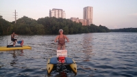
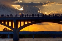
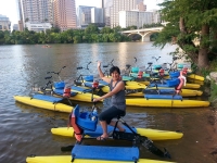
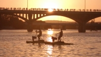
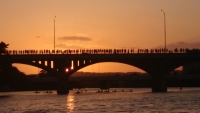
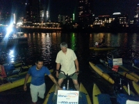
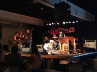
Nan and Carol on the water bikesWe were a group divided on the evening, half looking for great music and half looking for bats. Nan, Jay, Matt and Carol rented water bikes and tootled around the river waiting for the bats of Austin appear. Under a full moon, summer solstice sky at dusk, bats emerged from under the S. Congress Bridge. We definitely saw bats but not near as many as desired. (The one photo with bats shows what we were hoping to see.) Congress Avenue BatsMeanwhile, Judy, Eric, Laurie and Laurie went off to find some music and returned excited with their find at Antone’s. There was a $5 cover charge, lots of special guests and a birthday celebration for Derek with cake and pizza.

When we all returned, we shared stories of our adventure and enjoyed each others company. Carol and Matt received great news that night that Andrew and Julia were pregnant with their first child.

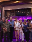
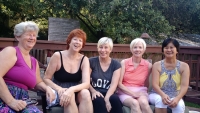
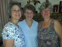
The GalsAlthough we were not able to check out more sites, music venues, restaurants and bars in Austin, we were pleased with the balance we were able to reach in the limited time we had together.

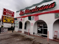
One last stop at La Mexicana Bakery and Taqueria for tacos; their tortillas and salsa were quite tasty and really added to the taco.

Another trip filled with new adventures and memories with good friends. We are left with the question, “Where to go in two years?” There are so many great destinations in the United States!

Photo gallery below:
Clicking on any photo thumbnail brings up the full size photo with a description. To easily see them all, use the arrow buttons or keys to move through the full size gallery photos with descriptions. If you are receiving this in an email and don’t see a photo gallery below, please click into my webpage to view all the photos!

New Grandson

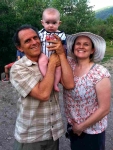
Patrick at 1 week oldPatrick Hayden Schultz was born January 9, 2016, at 4:58 am to Ariann (Neil’s youngest daughter) and Eric Schutz in Missoula, Montana. He was 8 lbs 0.9 ounces with a 14 inch head and 21 inches long. We enjoyed getting to watch him grow through lots of photos and finally got to meet the precious little guy in May and June of 2016 as he turned 5 months old. Neil flew in to Missoula the end of May and spent two weeks with Patrick, Ariann, and Eric in their new home. Granddad, Mom, and PatrickThey had just moved into their new house and Neil was able to help with a few handyman projects in addition to spending quality time getting to know Patrick and being Granddad Neil. I flew in for the last 4 days of his stay to get to be Grandma Nan and love the special little man.

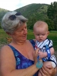
Pamela, Audrey, NanI started my trip in May landing in LA for 5 days visiting Pamela and Chris and then going up to Ridgecrest with Pamela to visit Mom and Bill. It was a relaxing low-key time. I flew to Missoula late Friday night and the following morning we spent at the downtown farmers market. The weather was beautiful and Patrick was happy in his stroller. We met up with our friends Sunni and Merrill for tea and walking about the downtown looking at some of Merrill’s incredible handmade wood projects installed in several business. Grandma Nan with PatrickOur days were spent working on yard projects and playing with Patrick. Evenings were spent with Eric using his smoker making wonderful meals and I enjoyed their deck hot tub! It ended much too soon and I headed off to Ohio.

I stayed with Dad and Jane in Ohio for 10 days. Dad and I spent time working on projects at the house and also many mornings cleaning the Lion’s Club sausage trailer after the Van Wert County Fair. Uncles and MomMy time there happened to overlap with Mom in Ohio visiting her family. We had some fun afternoon gatherings and I even showed Aunt Janet how I make my organic scones. Melanie drove up from Maryland in time for our Kreischer family gathering Sunday afternoon. It was great to see all my Uncles and Aunts, cousins and many of their children and grandchildren. Some of the Kreischer cousinsThanks Cindy and Clare for hosting us at your Special Occasions event center.

Time flew by and I was on a flight again to Austin for a reunion with Cal Poly college friends. There were 8 of us altogether. The next post will be about our adventures in Austin.

Four cities, five legs on five different airlines in three and a half weeks (I love google.com/flights for easy searching of one way fares including graphs and flexible date options). It was a great visit with family and friends and especially special to meet and spend time with our new grandson!

Quentin’s 15th Birthday

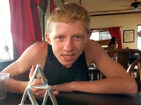
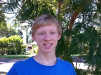
Quentin in SeptemberQuentin turned 15 on October 18. He is a sophomore in high school and becoming a mature young man. (How would I define mature? Maybe that he is willing to have conversations with adults, ha) He has grown tall enough to look me in the eye! He used to hate to have his hair cut but 6 months ago when great-grandma and I took him for a hair cut, he requested a new short style. He moved to Hana last month with his mom Vajra and her fiancé Tane (pronounced Taa-nay).

Beach DayLast Sunday, Neil and I drove over to Hana to celebrate Quentin’s birthday with him. He requested a beach day at Hamoa Beach but first we stopped to see their new home. They are living up a steep, steep driveway that needs a 4-wheel drive vehicle to get up to the house. We parked at the bottom and walked up! They also have to walk it themselves every day while Vajra is repairing her truck. They are all getting good exercise, especially on grocery day. They are cleaning up the house and doing repairs as part of their work/rent exchange. Quentin has his own room downstairs with his x-box and his keyboard. Only problem right now is no connectivity: no cell phone reception, no land line, no internet. They are working to get a wireless service which will provide a phone and internet but right now we leave messages on a cell phone that they can pick up when they go in to Hana town.

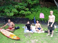
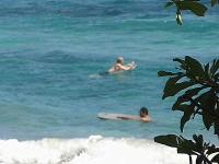
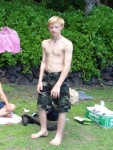
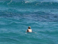
Quentin on Boogie BoardWe were fortunate to have a gorgeous sunny day after they had 3 prior days of rain. We moved down the beach to a grassy area past groups of visitors and locals enjoying the sun and the surf. Tane headed to the waves with his surf board while Quentin went out on his boogie board. I got a couple of telephoto shots of him on the water waiting for a wave. We put candles in the chocolate cupcakes I made him and we sang him happy birthday. Quentin shared his birthday cupcakes with nearby people on the beach rather than have the ant population swarm them! Very thoughtful of him.

Once everyone had enough sun, we dropped them back at their driveway for their walk up the hill. Neil and I drove back the winding road known as “the road to Hana.” From our convertible we enjoyed the green hills and valleys and ocean views and eventually the sunset colors in the clouds as we made the 2 hour drive back home.

Last Leg 2014

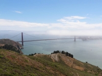
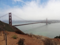
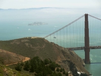
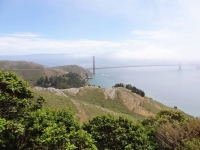
Golden Gate BridgeAfter our Sunday morning walk on the Mendocino Headlands, we started driving south for what became a very long drive day. We were heading to LA for our Tuesday departing flights, or as Neil says “we were heading back to the barn.” Our plan was to drive straight through San Francisco and on to San Luis Obispo for the night. That became easier said than done. Even on a Sunday, I couldn’t believe the traffic!

Marin Headlands

Close up of BridgeHeading south toward the Golden Gate Bridge we took the last exit north of the bridge which took us into the Golden Gate National Recreation Area. Neil wanted to get a view of the Golden Gate Bridge before we crossed it. When I would drive up to Sausalito or beyond I used to take the first exit coming north off the bridge to enjoy the vista of SF and the bridge from the overlook (you can’t get to that overlook parking area going south onto the bridge, and from that overlook you can’t go west onto the headlands). How could I have lived in the Bay area so long and not driven or hiked around in this large Recreation Area (it would have been the second exit going north)?

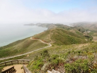
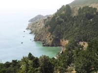
Marin HeadlandsThe exit took us onto Conzelman Rd. and into the midst of a swarm of other Sunday excursionists, all of us looking for a place to park. The area we were exploring I later read is called the Marin Headlands. We enjoyed beautiful views of the bridge and Pacific Ocean as we drove.

“Welcome to the Marin Headlands! One of the most unique areas in the Golden Gate National Recreation Area, the Marin Headlands covers various types of histories from the Miwok Indians to the Military,Marin Headlands Coast including historic Fort Barry and Fort Cronkhite, the NIKE Missile site and the 150 year-old Point Bonita lighthouse. Other attractions include varied hiking trails, dog friendly Rodeo Beach, and astonishing views of the coast and San Francisco. The explosion of wildflowers in the spring and raptor migration in the fall fill the headlands with year round excitement. The Marin Headlands is an example of open spaces still available in the Bay Area for visitors to enjoy.” NPS website Marin Headlands

It appears this is an area to explore when we next travel through the Bay Area!

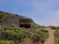
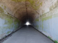
Battery 129 Tunnel entranceWe got out at a few viewpoints where I bundled up against the cold wind. People didn’t spend too much time in the chilly wind after taking in the views so parking spots frequently opened but were rapidly taken. The first viewpoint we stopped at turned out to be the highest point in the Recreational Area: Hawk Hill.  It is now known as a conservation site for the Mission Blue Butterfly (endangered) and for raptor migration viewing, but it has a military history from World War II and through the Cold War. There was a big tunnel at the viewpoint which Neil explored. It turns out have been built to house anti-aircraft guns but was never completed and was left with the simple name Battery 129. It wasn’t until I was researching this that I read that sitting on top of the hill above the tunnel had been a Nike missile site built in 1954. The radar buildings have been removed but you can see the concrete pads from Google Earth.

Battery 129 Tunnel“Hawk Hill, or Battery Construction 129, has been a silent witness to the ecological and cultural changes in and around the San Francisco Bay for eons. It is the story of soldiers waiting for an enemy that never came. Although most of the World War II fortifications built in the park were intended to keep the newest battleships from reaching striking range, the war was fought and ultimately won from the air. Built into the highest point at the Golden Gate, Battery Construction 129 had two large guns mounted under thick concrete shields covered with native vegetation for camouflage and virtually invisible from above. NPS Hawk Hill

Henry Cowell Redwoods

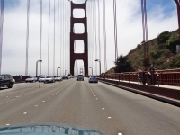
On the BridgeBack on the road, we crossed the always impressive Golden Gate Bridge. Neil took lots of photos through the windshield as I drove. I thought Sunday might be an easy day to get thorough the city that has no freeway crossing through it. I forgot there is always something going on in the City! We crawled through the Presidio, past Golden Gate Park, and along 19th street until we finally reached Interstate 280. Our next destination was Henry Cowell Redwoods.

On Maui, we sometimes use Google Maps on our phone to locate an address but we don’t need the navigation or traffic features. That Sunday I found their value and can understand what a great feature it is for urbanites! We would see lots of red areas along our route telling us the traffics was heavy. We hit a standstill when we turned onto Hwy 17 toward Santa Cruz and there was a long red line on Google Maps (two hour estimated delay). We were able to ease over and get off at the next exit, double back and get on Hwy 9 that was still slow but at least moving.

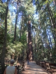
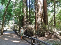
Redwood Grove LoopAs we turned into the Henry Cowell Redwoods State Park entrance, it felt very commercial. There is the visitors center, retail store, and Roaring Camp railroad train depot all surrounding the parking area. However, it had very easy access to the Redwood Grove Loop Trail which starts at the Visitors Center and loops .8 miles through the section of old growth redwoods.

“Henry Cowell’s redwood grove is the only remaining old-growth grove in the Santa Cruz area and is an intriguing glimpse into what the region’s extensive redwood forests might have once looked like.

Albino LeavesIn many ways the grove has a typical old-growth feel; it’s remarkably cool and lush, with a groundcover of ferns and redwood sorrel, and there’s a characteristic hush from all the sound-dampening foliage. However, typically for southern groves near the ocean, there aren’t a lot of big redwoods here, and an unusual number of the trees are oddly mishhapen. Also, mixed in with the redwoods is a thick understory of tanoak and bay trees that obscures the redwoods and makes the grove look like a dense deciduous forest. The broadleaf growth is densest within the redwood loop; the old growth just outside the loop is much more open, suggesting that the grove’s appearance may be partly the result of fire suppression or other land management practices. …

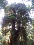
Tall Redwood TreesThe old growth was the first coast redwood grove to be saved from logging, having been purchased in 1867 by San Francisco entrepreneur Joseph Welch. A sawmill had existed near the grove since 1841, but the town of Felton and the railroad had not yet been built. Welch’s Big Trees Resort remained in operation until Santa Cruz County purchased the resort in 1930. In 1952, the Cowell family donated the adjacent land, which had been logged to support the nearby lime kilns, to the state.” The Redwood Grove Loop Trail

The Park brochure is very informative including a summary of the Geology, Native People, and additional History. I found the full brochure online if you are interested in reading further.

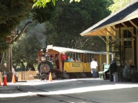
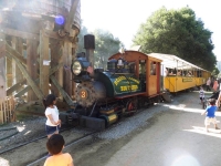
Roaring Camp Train“Adjoining the park is Roaring Camp Railroad, offering visitors a chance to journey back in time on an old steam locomotive.” (Friends of Santa Cruz State Parks) The train chugs up from Santa Cruz through the mountains with part of the route actually traveling through the Henry Cowell Redwoods State Park although the train depot is on private land connected by a walkway to the parking area of the State Park. After walking the redwood loop trail, we crossed the tracks to view the vintage steam engines in Roaring Camp. There seemed to be a lot of activities going on for children but nothing we saw that we could participate in.

“Ride into the Past on 19th Century Steam Trains: Travel over trestles, through towering redwood groves and up a winding narrow-gauge grade to the summit of Bear Mountain as conductors narrate the history of Roaring Camp, the railroad and the forest.

In the 1880s, narrow-gauge steam locomotives were used to haul giant redwood logs out of the mountains. Roaring Camp’s steam engines date from 1890 and are among the oldest and most authentically preserved narrow-gauge steam engines providing regularly scheduled passenger service in America.” Roaring Camp Railroad Redwood Train

San Luis Obispo

Back on the road again, we drove straight down Hwy 101 toward our hotel in San Luis Obispo, stopping only for gas and food in Paso Robles where the county fair was going on. We watched the colorful lights of midway carnival rides as we found our way back onto the highway. Yes, it was past dark by then and past 10 when we arrived at our comfortable, basic Motel 6 room for a shower and luscious sleep in a queen bed.

It felt like double luxury with no need to roll up sleeping bags nor pack the tent the next morning before we met our friend Ken near Madonna Inn at a local coffee shop for breakfast where we enjoyed catching up. My memory of the area from 20 to 30 years ago was all open ranch land along lower Madonna Road and Los Osos Valley Road; now it is all paved with shopping malls!

Departing LA

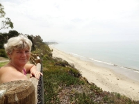
Santa Barbara BeachWe drove our final leg to LA, timing our arrival at Pamela and Chris’ in Lawndale for Monday midday to avoid the worst of rush hour traffic (worked out well.) We took a rest stop in Santa Barbara at a small little park overlooking the Pacific Ocean. I have to memorize the exit name for next time because it is not visible from the highway before taking the exit. Thank you again Google Maps.

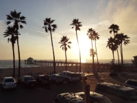
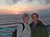
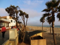
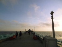
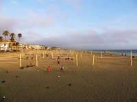
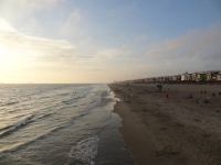
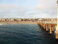
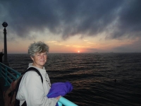
Sunset Manhattan BeachThe afternoon was spent unpacking and cleaning the car, sorting what would stay with mom or Pamela and what we would take back to Maui. We enjoyed a home cooked evening meal with Pamela and Chris before driving to Manhattan Beach pier to walk along the strand and on the pier. I saw all these people with ice cream cones and I just had to ask where. Just up a block on the avenue is the Manhattan Beach Creamery. It was hard to decide on a flavor but I am sure I had something with chocolate in it! Enjoying the sunset over the ocean as we stood on the end of the pier was a wonderful way to close our summer adventure together.

Pamela and NanOn our departure day, Tuesday July 29, we packed our bags for our flights and fit everything else in Mom and Bill’s car trunk to return to Ridgecrest. We had time to walk with Pamela along the Veterans Parkway (an old rail line converted into a parkway through Manhattan Beach) before enjoying a Mediterranean lunch at the Hummus House near their home before she went to work.

Chris kindly took a break in his work day to drop us at the LAX airport late afternoon. Neil and I had separate flights! He was returning home to Maui while I was flying to Ohio to visit with my dad and extended family. Nan and Neil SunsetHe took our one checked bag freeing me to just a carry-on for the rest of my trip. We had been able to work out our departures to within 45 minutes of each other and while Neil would arrive in Maui yet that night, I settled in for my red eye flight. It was one month ago we took the red eye from Maui to LA. What a great adventure!
Thank you for joining us as we relived our 2014 summer trip. We don’t know when our next adventure might be, but we hope to take you along with us.

Aloha, Nan and Neil

Redwoods 2014

Redwood CampsiteWe reached the California Redwoods on Friday night July 25, 2014. The first campground we tried, Jedediah Smith State Park, was not only completely full but it was $35 a night! Welcome to California! The ranger was very helpful providing us with a list of the Redwood campgrounds and marking the nearest ones. We found a great little spot in Florence Keller County Park, a second growth redwood forest, five miles north of Crescent City (and only $10 a night!) We decided to treat ourselves to a seafood dinner now that we were on the coast but so did all the other tourists on their summer vacations. The few places we tried had very long waits. Bear searching for dinnerWe settled on a Mexican restaurant that had some good spicy seafood entrees. 😉 This was the first time we had ventured into a Mexican restaurant since our bad experience in Eastern Washington. Being able to eat Mexican food again was one of the good things about being back in California!
Crescent City

Battery Point LighthouseWe cut over to the coast as soon as we could upon entering Crescent City and drove along Pebble Beach Drive. We came to a beautiful spot to park overlooking Crescent Bay at Brother Jonathan Park. The bay is full of small rock islands with the largest containing the picturesque Battery Point Lighthouse. We watched whales swimming beyond the rock island as we visited with a few locals and visitors also enjoying the view. We returned to the overlook after dinner to enjoy the sunset over the bay but by dark we were settled into our tent among the redwoods.Sunset through the trees

“The first American to explore the [Del Norte] country overland was Jedediah Strong Smith, for whom the Smith River is named. In 1828, Smith and his party of trappers traded with Native Americans, came upon Lake Earl, and camped at Crescent City.

In 1848, Major Pierson B. Reading discovered gold on the Trinity River, and by 1850, northwestern California was teeming with miners. The town of Crescent City was established in 1853 by J. F. Wendell … Crescent City became a bustling shipping and trade center, catering to and supplying the miners. … Crescent Bay Sunset[T]he area experienced a boom in settlement as a result of lumbering activity that followed the mining industry … To facilitate the use of Crescent Bay as a harbor, the Battery Point Lighthouse was erected in 1856. It survived the 1964 tsunami …

On, March 27, 1964 the Good Friday [Alaska] Earthquake (measuring 9.2 on the Richter scale) set in motion a tsunami down the west coast of the U.S. Crescent City was struck with four waves destroying hundreds of buildings (including most of the downtown area) and killing 12 people.” History of Crescent City

Redwood National Park

Flowers and Crescent BayA bright sunny Saturday morning greeted us as we drove out of our shaded forest campground. We arrived at the Redwood Park Information Center in Crescent City just as it opened. We had located it the previous evening but it was already closed. There were numerous brochures for us to collect while we waited our turn to speak with the ranger. We asked about the best driving routes, hiking areas, and any waterfalls.

Rays in the branchesThe National Park and three State Parks protect much of the state’s last remaining old growth redwood forests. A great number of people worked to protect these redwoods from falling to the ax. Logging felled many of the most ancient of trees, but I continue to be impressed with the dedication of early 1900s conservation visionaries who recognized the importance of protecting this heritage. Many individuals used their own funds to purchase land to protect it from logging and later donate it to the Parks.

Nan on Bridge“Paleontologists Henry Fairfield Osborn of the American Museum of Natural History, Madison Grant of the New York Zoological Society, and John C. Merriam of the University of California at Berkeley founded Save the Redwoods League in 1918. The League was formed as a nonprofit organization dedicated to buying redwood tracts for preservation. Through donations and matching state funds, the League bought over 100,000 acres of redwood forest between 1920 and 1960.” Redwood Area History

The park brochure notes that of the estimated original 2 million acres of coast redwood habitat, only 118,000 acres remain of older and old-growth redwoods (that’s only 5.9%).

The Indigenous People

Cathedral Trees“The native people of the North Coast region have made the redwood forests and associated ecosystems their home for thousands of years. … Prior to Euro-American contact, American Indians had adapted well to this environment. Their profound religious beliefs, extensive knowledge of the natural world, languages, customs, and perseverance continue to be a source of admiration for other cultures.

American Indians in the region belonged to many tribes, although no one tribe dominated. Indeed, the concept of “tribe” does not describe very well the traditional political complexity of the area. There were scores of villages that dotted the coast and lined the major rivers; each of these villages was more or less politically independent, yet linked to one another by intricate networks of economic, social, and religious ties.

Tall Trees… Efficient and reliable hunting, fishing, and gathering methods were always paired with a deep spiritual awareness of nature’s balance. Traditional homes of the region’s American Indians usually were constructed of planks split from fallen redwoods. … A house was understood to be a living being. The redwood that formed its planks was itself the body of one of the Spirit Beings.

Once gold was discovered along northwestern California’s Trinity River in 1850, outsiders moved into the area in overwhelming numbers. The initial contact with native peoples was gruesome.

Redwood RingsThe newcomers pushed the American Indians off their land, hunted them down, scorned, raped, and enslaved them. Resistance – and many of the American Indians did resist – was often met with massacres. Militia units composed of unemployed miners and homesteaders set forth to rid the countryside of “hostile” Indians, attacking villages and, in many documented cases, slaughtering men, women, and even infants. Upon their return, these killers were treated as heroes, and paid by the state government for their work.” Text based on Living in a Well-Ordered World NPS Redwoods History

Burn scarThe past treatment of indigenous peoples by “newcomers” has often been appalling, and I can’t say we are any better today trying to impose “The American Way” on other cultures. I want to end on a more positive note so I will add a quote from the next section of the NPS History: “Despite the dreadful history of the past 150 years, the American Indian community of northwestern California has persisted. It has, in fact, done more than persist. Whether in politics, art, religion, or any other area of life, the community exhibits great variety and astounding vigor.”

Hikes

Neil in Fork of TreeWe drove down Highway 101 along ocean vistas, through forested sections and the flats of Klamath River basin before reaching the turn off to the recommended Newton B. Drury Scenic Parkway. The Parkway took us through a dense section of old growth redwoods in the Prairie Creek Redwoods State Park. It was amazing to drive and walk among the tallest trees in the world.

Corkscrew TreeWe decided on several shorter hikes rather than one long one to see more variety. The first stop took us just a short way off the parkway when we saw the roadside sign for Corkscrew Tree. Many redwoods grow somewhat twisted but this was the crookedest I had ever seen! Next stop was at Big Tree! The sign in front says Height 304 ft., Diameter 21.6 ft., Circumference 68 ft., and Estimated Age 1500 years! We continued hiking beyond Big Tree on the Cathedral Trees Trail enjoying being in the in the majesty of the forest.

Trillium FallsOur next hike was to Trillium Falls, a 10-foot cascade flowing over rocks covered in deep-green moss. Quoting from the Trailhead sign, “The trail leads you through the misty hallways of an ancient redwood forest. Along the path, families of Douglas-fir, western hemlock, and Sitka spruce reside beneath the shade of the world’s tallest trees.” The trailhead overlooked Elk Meadow, where we paused for a snack watching a herd of Roosevelt Elk graze.

“Redwood Parks is home to a subspecies of elk known as Roosevelt elk (Cervis elaphus roosevelti). Herds of these magnificent Animals once ranged from San Francisco Bay toRoosevelt Elk Herd Vancouver Island, British Columbia and east to the Cascade Range in Oregon and Washington. … By 1925, the number of Roosevelt elk in California had dropped to as few as 15. One of the last elk herds was located in Prairie Creek State Park. Fortunately, protection of the habitat in the park and surrounding areas has allowed the California Roosevelt elk population so rebound to more than 1,000 animals.” NPS Elk in the Redwoods

The Avenue of the Giants

DSC03601-HeaderWe continued driving south on Hwy 101 and stopped at the village of Trinidad for lunch. Our hostesses and servers were all college age and I realized we were near Humboldt University where I did my six week science program during one of my high school summers. I have very fond memories of this area.

“Trinidad is a seaside town in Humboldt County, located on the Pacific Ocean 8 miles north of the Arcata-Eureka Airport and 15 miles north of the college town of Arcata. Situated directly above its own natural harbor, Trinidad is one of California’s smallest incorporated cities, (with a 2010 population of 367) and is noted for its spectacular coastline with ten public beaches and offshore rocks. Trinidad BayThese rocks are part of the California Coastal National Monument of which Trinidad is a Gateway City. This natural landmark is joined by three additional marine landmarks – the historic Trinidad Head Light, the Trinidad Memorial Lighthouse, and Humboldt State University’s Fred Telonicher Marine Laboratory. Fishing operations related to Trinidad Harbor are vital to both local tourism and commercial fishery interests in the region. In addition to its coastal assets, the city honors and works to protect its Native American cultural and historic heritage.” City of Trinidad

Avenue of the GiantsWe chose to travel down the coast route on our way to LA specifically to drive the Avenue of the Giants because we had missed it last time we drove Hwy 101. “This world-famous scenic drive is a 31-mile portion of old Highway 101, which parallels Freeway 101 with its 51,222 acres of redwood groves. … The Avenue of the Giants is surrounded by Humboldt Redwoods State Park which has the largest remaining stand of virgin redwoods in the world.” AvenueoftheGiants.net Rockefeller LoopMy suggestion is if you are driving up Hwy 101, it is worth taking the exit to travel State Route 254 (old 101) for the drive through patches of redwood groves along the route, but I wouldn’t go out of my way specifically to make it a destination, especially after we had just driven the densely forested beautiful Newton B. Drury Scenic Parkway!

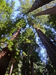
Nan looking upReading the drive guide, the best hike for our time sounded like the two-thirds of a mile Rockefeller Loop in Rockefeller Forest. In this short distance, 17 of the world’s tallest trees are found according to the brochure. I have to admit that standing at ground level and looking straight up, it is hard to tell that one of the redwood trees is that much taller than the next one! It was a well-trodden wide path through the grove and served a nice place to stretch our legs.

Mendocino

Mendocino County CoastWe continued south and decided to take Hwy 1 to Mendocino for our last night of camping. Mendocino was always a favorite getaway weekend destination for me when I lived in the Bay Area. The campground we found even had showers! We cooked our last dinner on our camp stove and settled into to our sleeping bags after the sunset pink tinge had left the high overhead clouds.

CampsiteThe usual morning fog greeted us as we enjoyed our green matcha tea and granola, packed the car, and headed into town to walk the Mendocino Headlands coastal bluffs. I highly recommend a previous Mendocino Coast webpage from a trip we took February 2007 because the lighting conditions resulted in prettier pictures on that visit.

“Mendocino Headlands State Park with its unique blend of gentle trails, rugged coastline, secluded beaches and timeless history surrounds the picturesque Village of Mendocino on three sides.  Miles of trails wind along the cliffs, giving the casual explorer spectacular views of sea arches and hidden grottos.” Mendocino Headlands SP

Mendocino Village“Mendocino, the only town on the California Coast that is designated as an Historical Landmark. Established in the 1850’s, the architecture is reminiscent of Maine with its grand Victorians and quaint Saltbox cottages.” Mendocino.com

I had no idea until I was reading some websites about Mendocino that Murder She Wrote was filmed in Mendocino County and that “Cabot Cove” is actually Mendocino Village!

Mendocino arch“Mendocino was discovered by mistake. Scouts were sent to salvage the remains of the Frolic shipwreck. By the time they arrived, the ship was demolished by the sea, but they noticed the huge redwood trees and [the logging began.] …Their mill set-up at Big River yielded 1 billion board-feet of timber during its 50-year run. Almost all of which was used to build San Francisco, and rebuild it again after the Great Earthquake and Fire in 1906.” Mendocino.com

Mendocino HeadlandsLooking to the hills around Mendocino today, there is no evidence of the once lush redwood forests that covered the coastal mountains. After walking the bluffs, we drove to Café Beaujolais brickery for a bakery treat, but the bakery is no longer there, just the restaurant. We found a busy bakery café on Langsing Street for a mid-morning snack before taking to the road again.

Photo Credit: Neil Rhoads, Roosevelt Elk by Mat Honan

Photo Slider: This post has a unique slider with pictures from this adventure only. I hope you click into the webpage so you can see the slider in action.

Photo gallery below:
Clicking on any photo thumbnail brings up the full size photo with a description. To easily see them all, use the arrow buttons or keys to move through the full size gallery photos with descriptions. If you are receiving this in an email and don’t see a photo gallery below, please click into my webpage to view all the photos!