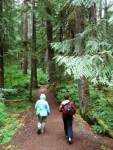
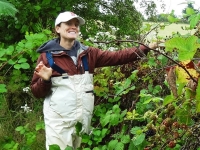
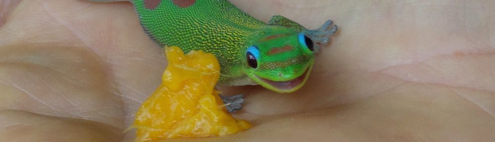
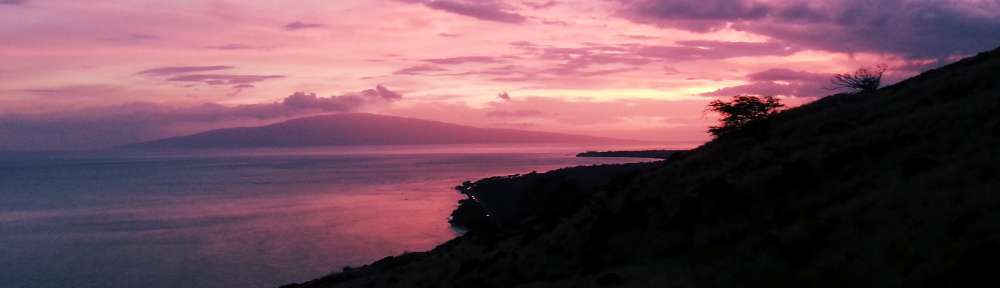
After our wonderful couple of days in Seattle, we began our trip down the West coast Tuesday morning, July 22, 2014. We didn’t have far to drive before reaching La Center, Washington, where we planned to stay with Mailea a few days. Mailea is living at the farm her mother and step-father recently bought for their retirement years. We want to thank Jamie and Michael for their hospitality allowing us to stay a few nights with Mailea. Most recently, the farm belonged to a horse trainer and has a great horse barn, training area, and pasture. Before that, it was a blackberry farm! The blackberry bushes still line the edge of the property and are working to take back some of the pasture. 😉 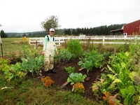 We took the walking tour of the farm’s 18 acres with Mailea. Near the house, we admired the huge garden where she had just been weeding and building brick borders. We picked cherry plums and blackberries to munch on as we walked around the property but couldn’t reach too far into the bushes because the bramble thorns were very sharp. The property backs up to a wooded creek of cedars and old growth Douglas fir; it was like entering a fairy land with the old trees, ferns and the moss covered ground. We could partially see the beaver dam on the creek but we didn’t get up close to it.
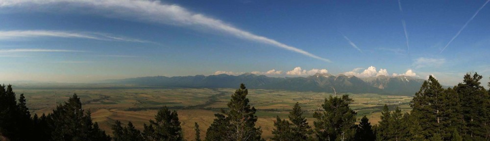
La Center
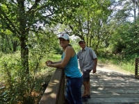
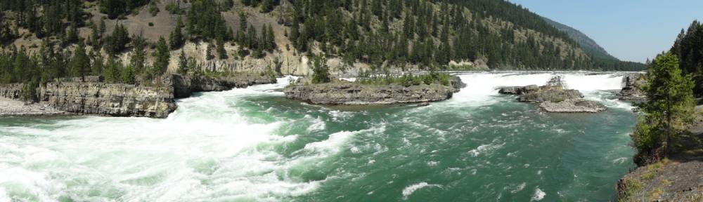
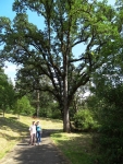 After lunch, Mailea drove us to the small town center and we walked through Stern-Wheeler Park and out to wetlands along the East Fork of the Lewis River. It is interesting that Ari and Eric live on the Clark Fork River and just north of one of the Lewis and Clark expedition winter camps and Mailea lives on the East Fork of the Lewis River and north of the Pacific winter camp of Lewis and Clark expedition!
The indigenous inhabitants of the La Center area are the Cowlitz Indians and they were peaceable with the white settlers moving into their territory in the mid 1800’s. They stayed out of the Indian Wars of 1855-1856 with the promise of a reservation by the U.S. Government. The Cowlitz Indians were largely displaced by white settlers and then were left landless by the unfilled promise of a reservation.
All the quotes in this section are taken from the La Center – Thumbnail History on HistoryLink.org (The Free Online Encyclopedia of Washington State History)
“The word “Cowlitz” is believed to mean “capturing the medicine spirit,” a reference to a rite of passage in which young men would remove themselves to sacred points along the Cowlitz River on fasting treks, communing with the spirit world. Some sources hold that Lewis and Clark “discovered” Cowlitz at Fort Clatsop in 1805, but others disagree, and it appears [geographically] unlikely. … Although they were inland, the Cowlitz did not escape the epidemic of “intermittent fever” that began ravaging coastal tribes in 1829, a pestilence that is believed to have been imported on an American ship, the Owyhee. By the time the disease burned itself out in the early 1840s, it had decimated the Native American population of southwestern Washington. The total Cowlitz population in 1800 was estimated at 80,000; by 1860, the estimates of the surviving Lower Cowlitz ranged from 150 to 350.”
“Chief Atwin Stockam sued the federal government in 1906, seeking to recover several pieces of land for his tribe, and this was the opening shot of a series of legal battles that ebbed and flowed for nearly the next 100 years. Throughout the twentieth century, the Cowlitz carried on a lonely battle for recognition, always opposed by bureaucrats and sometimes opposed by recognized tribes that feared a Cowlitz gain might be their loss. Finally, after decades of struggle, in January 2002 the Cowlitz, now 2,400 strong, were granted full recognition as a tribe, and they set about putting together a reservation.”
 The first white settlers arrived in 1850 when the U.S. Congress “gave away” the land to encourage settlement of the western United States. The area was heavily forested and the rivers became the highways since there were no roads. In the days prior to deforestation the rivers flowed deeper and straighter.
“For most of the 1800s, rivers were the primary means to travel into the interior of Western Washington, and it didn’t take long after settlement began for commercial vessels to penetrate the lower reaches of the East Fork of the Lewis. In the early days, river traffic consisted of bringing people and supplies into the area and shipping agricultural products out. The boats, all steam-powered sternwheelers, … started running up and down the river, stopping at each scattered homestead to trade. It was not long, however, until the potential of the area’s vast timber resource was realized, and logging became the area’s first real industry.”
A series of sternwheelers have run the East Fork of the Lewis River beginning in the 1850’s up until 1931. The town is proud of its steamboat heritage naming the downtown park Stern-Wheeler Park and putting a Sternwheeler Gallery on the town website. An informational sign in the park describes the sternwheelers. A side bar highlighted Captain Minnie Hill who was the first female west of the Mississippi to receive the master’s and pilot’s license. It was issued to her in 1886 at the age of 23 years old. “Captain Minnie Hill’s skill was so impressive that when she took the pilots exam she was awarded a lifetime license, a rare feat. This is despite the fact that her husband, also a steamboat captain, claimed the exam she was given was more difficult than usual due to a desire to fail her for cause.” Bellaonline.com
“For reasons that are no longer apparent, the site of present-day La Center was first known as “Podunk,” a name that may not then have had the negative connotations that it has today.” By the time it was incorporated in 1909, the name was changed to La Center to covey the town’s role as a center of commerce for Lewis River trade.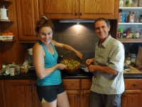
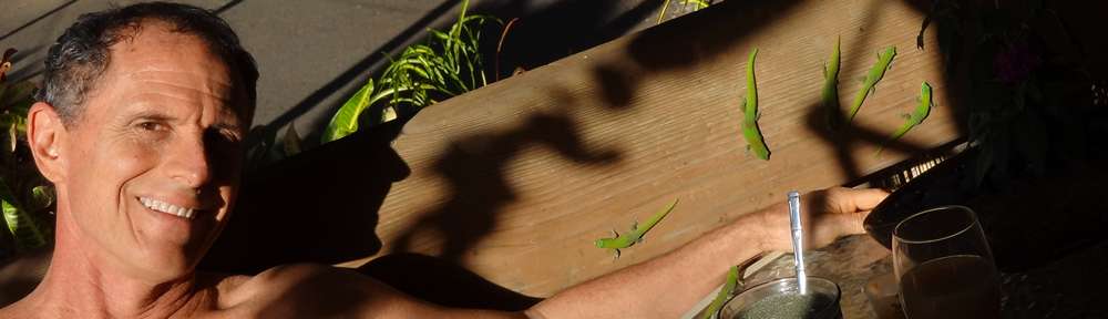
After our afternoon exploration, Mailea cooked us a great dinner utilizing fresh produce from the garden and then we enjoyed a relaxing evening around a fire in the fireplace. Neil misses fireplaces in Hawaii so he was happy it was a cool enough evening to light a fire!
Bagby Hot Springs
 We were back in in hot springs country! Neil read about Bagby Hot Springs last time we were in the area but we weren’t able to get there that time. What we read was the water is hot and the bath houses well maintained and best of all not chlorinated or treated water. Oh, did I mention we bought a Northwest US Hot Springs book before we left Maui and referred to it as we drove to see if there were any hot springs close to our route? We left that book with Mailea for her and Ari to explore more hot springs in their area.
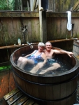
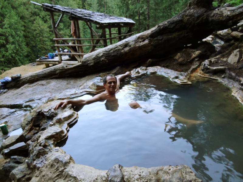
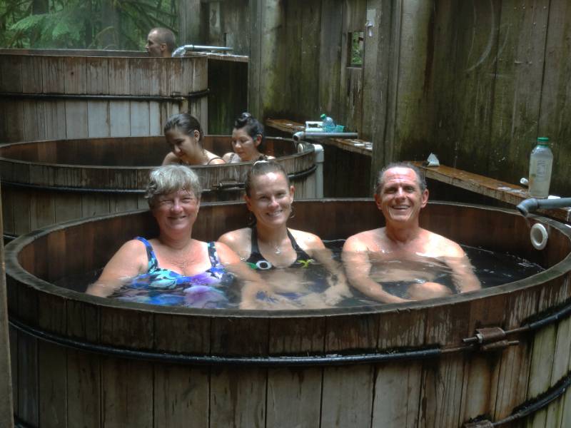
 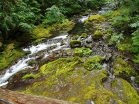 Bagby Hot Springs is in northern Oregon a couple hour drive from Mailea’ and is located on Forest Service land and maintained by the National Forest Service. The bath houses were built by volunteers over several years beginning in 1974. It is an easy mile and half hike through beautiful forest to the hot springs area and clearly popular even mid-week in rain because the parking area was completely full!
“Cedar logs have been hollowed to create 8-foot-long bathtubs at this rustic, free hot springs. Even if you don’t plan to soak, the trail here is a delight, leading through a towering old-growth forest along a fork of the Collawash River. Just don’t expect solitude. On weekends and all through summer the trail is heavily used and there’s a long waiting line at the bath house. Parking and hiking are free, but a private concessionaire charges $5 per person to use the hot springs.” OregonHiking
 “To my knowledge, this is the most well developed of the free hot springs in Oregon. At 2280 feet elevation, the hot springs is managed cooperatively by the Forest Service and a volunteer group, the Friends of Bagby. Many call Bagby their favorite hot spring. The spring water is channeled by wooden flumes into numerous bath houses and private tubs. … From the source, the water is 136 degrees Fahrenheit. Wooden buckets, which can be filled with cold spring, water are available for mixing to achieve the desired temperature.” OregonHotSprings
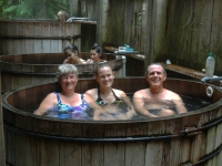 We hiked through the moist forest passing many returning bathers as we enjoyed the beauty around us. We didn’t have to wait too long to get our turn in a round tub big enough for the three of us on the open platform. Everyone was very friendly and considerate. Once water logged and thoroughly toasty, we passed the tub onto the next waiting group.
Portland
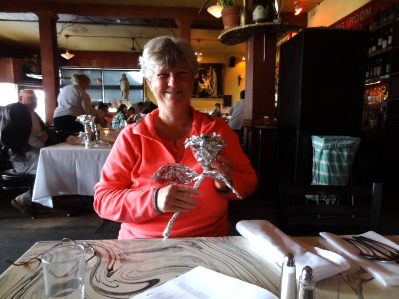
 We were ready for dinner after our hike and soak. For the last two weeks, we had been anticipating a scrumptious Cajun dinner ever since Ari and Eric had told us about the Cajun and Creole restaurant Mailea had taken them in Portland. They loved it. I didn’t know what a distinctive dining experience we were in for at Le Bistro Montage.
“Le Bistro Montage is located in what once was the home of the Royal Hotel, in the heart of the Central Eastside Industrial district. A completely unique dining experience awaits when you come in; linen-covered communal tables, custom art, a large selection of wine and eclectic décor is only the beginning. While you are here do not forget to try our famous macaroni, mouth-watering frog legs, gator bites and our homemade desserts. Make sure to ask your server to wrap your leftovers, and see what foil art masterpiece creature you get to take home!”
 For dessert, Mailea took us to a new Portland ice cream shop Salt and Straw. A sample list of some of their flavors includes Double Fold Vanilla, Coconut with Petunia’s Salted Caramel Bars, Pear & Blue Cheese, Strawberry Honey Balsamic with Black Pepper, Honey Lavender, Arbequina Olive Oil, Stumptown Coffee & Burnside Bourbon, Cinnamon Snickerdoodle, Chocolate Gooey Brownie, Almond Brittle with Salted Ganache, Sea Salt with Caramel Ribbons, Freckled Woodblock Chocolate. I can’t even remember what flavor I got but it was yummy! It deserves a stop next time we are in the area.
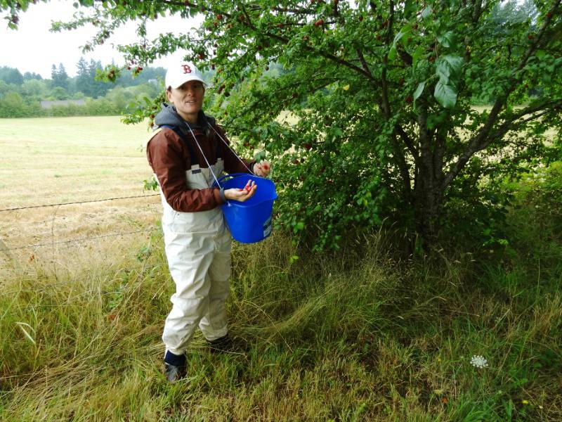
Bramble Pants
 We stopped at a Portland sporting goods store that has a basement full of used merchandise for sale. While Mailea found a pair of cleated shoes for soccer, Neil browsed through the racks and pulled out a pair of pants saying Mailea needs these. I am sure I was giving him a strange look because I couldn’t figure out why she needed stiff waxy canvas pants? He said she needed them for protection from the thorns while picking blackberries. How brilliant! He showed Mailea and she tried them on; they fit her perfectly. The pants were labeled ski powder pants but now they were Bramble Pants!
 A sunny Wednesday morning was an excellent time to try out the bramble pants. Mailea and Neil got suiting up for berry picking, including “wellies” (rubber boots), and I showed them my dad’s trick of hanging the bucket on a string around his neck so he can use both hands for picking the berries. They brought in a major haul and Mailea planned to dehydrate some for long term enjoyment.
As much as we wanted to stay longer with Mailea, we knew it was time to hit the road again to continue our drive down the west coast. It was sad to leave but least we left with full bags of fresh fruit to sustain us!
Photo Credit: Neil Rhoads
Photo Slider: This post has a unique slider with pictures from this adventure only. I hope you click into the webpage so you can see the slider in action.
Photo gallery below:
Clicking on any photo thumbnail brings up the full size photo with a description. To easily see them all, use the arrow buttons or keys to move through the full size gallery photos with descriptions. If you are receiving this in an email and don’t see a photo gallery below, please click into my webpage to view all the photos!


 Oregon in search of another hot springs on our way to Crater Lake and eventually the Redwoods.
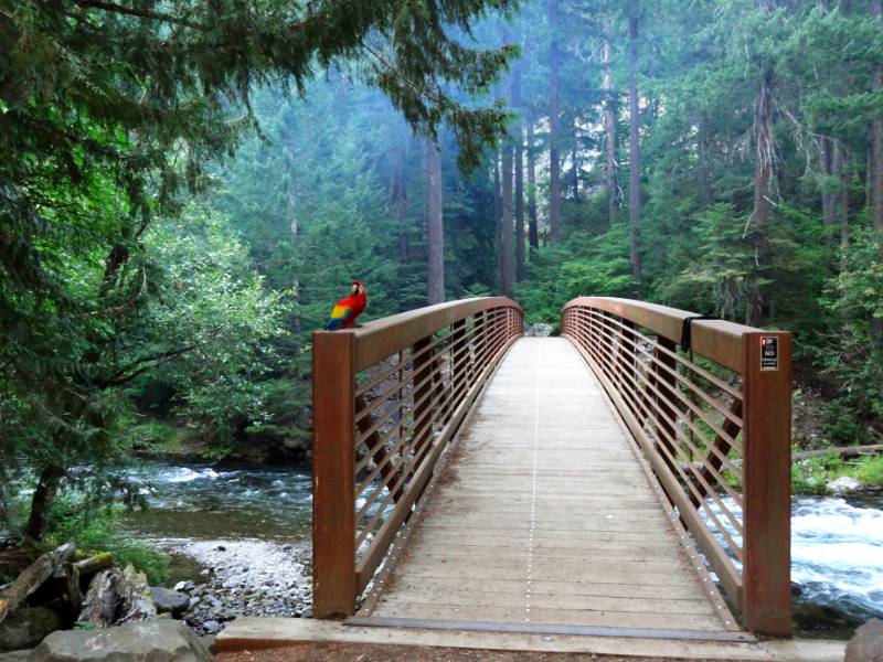 That describes it exactly! After crossing the solidly constructed bridge over the North Umpqua River (with a colorful parrot belonging to one of the campers gracing the bridge entrance), we started climbing up a STEEP slippery trail and I was very grateful for the hand rail that had been installed. We topped out and walked a level dry pine needle covered path before we descended slightly to the springs.
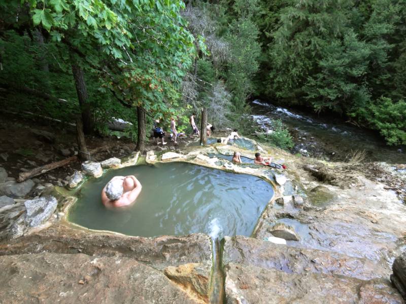 We had read that the hot springs consisted of a series of travertine lined natural pools but in person it was impressive to see these naturally formed little hot tubs created from the minerals in the water cascading down the hillside. The only man-made structure was a deck and roof built over the largest pool. It was a handy spot to put our towels and bags as we moved among the different temperature pools and soaked away the miles.
There are two to three oval pools for soaking above and behind the main, covered pool. The larger pool is tub-like due to the minerals from the spring creating a travertine mound over the centuries that caps the cliffside. The main pool exists sunken into this travertine stone with the view opening like an ampitheater to soakers. The upper, smaller pool is 4 by 5 feet and 112 degrees F; the lower, larger pool is 5 by 8 feet and 110 degrees F. Both pools are 2-3 feet deep and floored with coarse sand.” OregonHotSprings
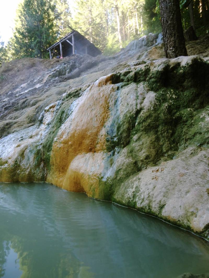
“Volcanic activity that formed this area within the High Cascades less than two million years ago is still cooling. Here, molten rock just a few thousand feet below the surface transmits heat upward through solid rock, heating the ground water that has penetrated to that depth. Hot water then forces its way up through fissures and fractures to escape to the surface, forming hot springs. Extremely hot water dissolves large amounts of silica, a common component of volcanic rock. These dissolved silica minerals are deposited as water flows over the surface and cools. Over thousand of years the deposits have accumulated, building the hot springs mound that overlooks the North Umpqua River.” From the information sign at the Trail entrance.
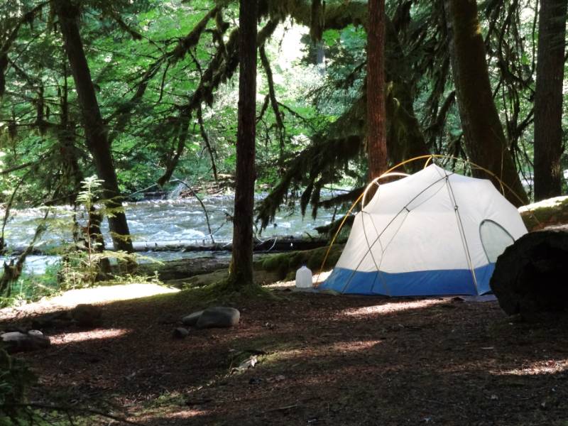 About ½ mile away was a great spot by the river but two tents were already there. Neil asked if they minded if we camped nearby and they were fine with it. We finished setting up the tent in the dark with our headlamps. Good thing we were getting to be old hands at setting up camp. We were asleep soon after and have no idea how late our neighbors stayed up enjoying their fire.
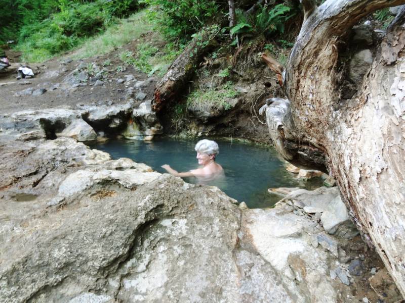
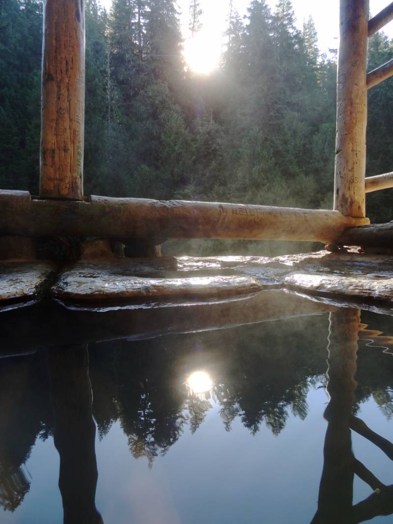 We woke with the sun and hopped in the car back to the hot springs. Only one couple was there that early (the campground partiers were probably still asleep, yeah). We soon had the pools all to ourselves and watched the sunlight light up the forest trees as it topped the mountain. Thoroughly toasty and buoyant of spirit, we went back to pack up the tent and were on the road before most campers were up.


