Crater Lake 2014

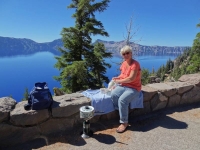
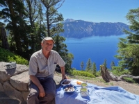
Nan at breakfastAll warm from soaking in Umpqua Hot Springs at dawn on the morning of Friday, July 25, we drove a short distance to Crater Lake National Park to have our breakfast.

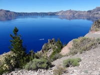
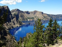
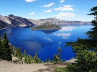
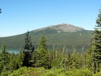
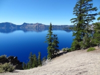
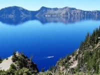
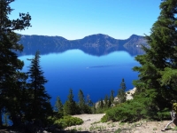
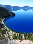
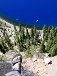
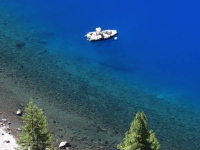
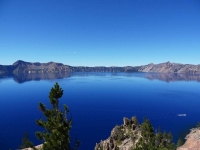
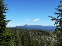
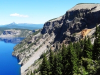
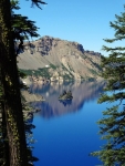
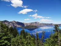
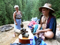
We still have the receipt showing we entered Crater Lake north entrance at 10:01 on 7/25/14; it is taped to the Crater Lake National Park map. šŸ˜‰ We opted to take East Rim Drive around the lake which is slightly longer but I donā€™t think I have ever been on this side of the lake before. Neil at breakfastAll along the crater rim road there are incredible views of the nationā€™s deepest lakeā€”1,943 feet at its deepest point. We stopped in a pullout overlooking Steel Bay to make our breakfast tea. There at 7000 feet, we fired up our propane burner to boil the tea water and sat on the rock wall looking out over the sparkling blue lake.

Crater Lakeā€™s caldera was formed 7,700 years ago as Mt. Mazama collapsed forming a deep crater after the volcano violently erupted. More information about the geology can be found at nps.gov Crater Lake Geology brochure and Crater Lake geology feature facts.

Park History

Crater overlookā€œLocal Native Americans witnessed the collapse of Mount Mazama and kept the event alive in their legends. One ancient legend of the Klamath people closely parallels the geologic story which emerges from today’s scientific research. The legend tells of two Chiefs, Llao of the Below World and Skell of the Above World, pitted in a battle which ended up in the destruction of Llao’s home, Mt. Mazama. The battle was witnessed in the eruption of Mt. Mazama and the creation of Crater Lake.

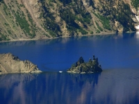
Phantom Ship LookoutThe Klamaths revered the lake and the surrounding area, keeping it undiscovered by white explorers until 1853. That year, on June 12, three gold prospectors, John Wesley Hillman, Henry Klippel, and Isaac Skeeters, came upon a long, sloping mountain. Upon reaching its highest point, a huge, awe-inspiring lake was visible. “This is the bluest lake we’ve ever seen,” they reported, and named it Deep Blue Lake. But gold was more on the minds of settlers at the time and the discovery was soon forgotten.

Captain Clarence Dutton was the next [white] man to make a discovery at Crater Lake. Dutton commanded a U.S. Geological Survey party which carried the Cleetwood, a half-ton survey boat, up the steep slopes of the mountain then lowered it to the lake. From the stern of the Cleetwood, a piece of pipe on the end of a spool of piano wire sounded the depth of the lake at 168 different points. Wizard Island  and Crater LakeDutton’s soundings of 1,996 feet were amazingly close to the sonar readings made in 1959 that established the lake’s deepest point at 1,932 feet.

William Gladstone Steel devoted his life and fortune to the establishment and management of Crater Lake National Park. His preoccupation with the lake began in 1870. In his efforts to bring recognition to the park, he participated in lake surveys that provided scientific support. He named many of the lake’s landmarks, including Wizard Island, Llao Rock, and Skell Head. Steel’s dream was realized on May 22, 1902 when President Theodore Roosevelt signed the bill giving Crater Lake national park status.ā€
— Provided by the National Park Service on Oregon.com

Hike to the Pinnacles

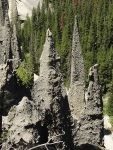
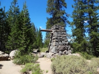
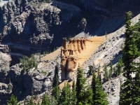
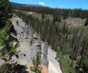
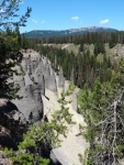
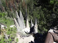
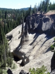
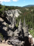
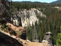
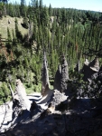
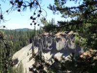
Pinnacles closeupWe stopped at many of the overlooks to view the lake and various named geological features such as Pumice Castle, Sentinel Rock and Phantom Ship. Fun fact from the NPS website: “Seven different trees live on Phantom Ship, an island in Crater Lake. There are also colonies of violet green swallows, and several varieties of wildflowers and lichens living there.” There was a variety of park hikes listed in the guide and we settled on an easy one mile walk to the Pinnacles because of the unique description: ā€œThe Pinnacles are ‘fossil fumaroles’ where volcanic gases rose up through a layer of volcanic ash, cementing the ash into solid rock.ā€ Old ParK EntranceThe softer loose ash has eroded away over the years leaving the chimneys and spires lining the side of the canyon. The trail goes right to the park boundary. A sign in front of a 10 foot constructed stone pillar said this trail was the original east side entrance to the Park where Teddy Roosevelt would enter on horseback. The wood pole still projected out pillar near the top where it would have held the National Park sign.

The Depths of Crater Lake

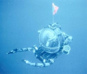
“Beneath Crater Lake National Park lies a reservoir of restless magma. … In the summers of 1988 and 1989, a one-person submarine made 47 separate dives to the bottom … [the] purpose was to collect data on the lakes’ hydrology, biology, and geology, and to resolve a controversy over geothermal energy development that was brewing on the borders of the national park. … Underwater Rover[The Deep Rover submarine was flown in by helicopter onto the lake. Three men alternated dives into the darkness.]Ā  What they found was surprisingā€”and spectacular. Colonies of yellow-gold bacteria grew in vast, puffy mats, often around pools of aqua-blue water. Probes inserted into the bacteria mats registered temperatures as high as 66Ā°F, much warmer than the surrounding 38Ā°F lake water. … “Bacteria were not the only life forms found to be thriving at great depths in Crater Lake. A variety of worms, insects, and tiny crustaceans were spotted as well. Although not dependent on the hydrothermal vents, they were remarkable for their ability to tolerated the extreme water pressures found in the lake’s deepest basin 1,943 feet below the surface. Some were also notable for their life history. Adult flies of the genus Heterotrissocladius, for example, drop their eggs into the lake. The eggs sink slowly to the bottom, hatch into larvae, feed on lake floor sediments for perhaps two to three years, swim back up to the surface (pupating along the way), then emerge as winged adults. Two to three days later, the adults lay eggs and die, and the cycle starts again. …
[T]he sub visited only 2% of the lake floor. Many secrets surely remain in the dark, water, depths of the collapsed volcano.” Crater Lake Visitors Guide newspaper Summer/Fall 2014

Neil and I have always loved diving and were very intrigued by the exploration of the Crater Lake floor. The National Park Service Crater Lake website has some cool pictures of the Deep Rover and the crater bottom:

The Crater Lake National Park aquatic ecologist (since 1985), Mark Buketnica, was one of the three men making the scientific dives in the Deep Rover. Bukentnica published an interesting first hand (human readable) article on the Crater Lake Institute Nature Notes “Why Enter a Sleeping Volcano in a Submarine?”

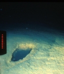
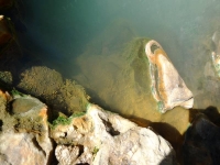
Llao Bath“Another interesting discovery was the presence of discrete pools of saline water on the lake floor that had a distinct blue color. The first “blue pool” discovered was named Llao’s Bath by Jack Dymond, after the legendary spirit of the lake. The pool resembled an oblong bath, 10 to 13 feet long and 3 to 5 feet across. It appeared to be elevated on one side by precipitates, and was surrounded by golden-colored bacteria. This pool and others like it are composed of hydrothermal water with salt content as much as ten times higher than the surrounding lake water. The presence of the salts makes the liquid in the pool heavier than lake water, and the pools appear blue because of the optical properties of the chemically enriched fluids.Ā  …

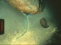
Underwater Stream Like ChannelWe were surprised to find another area of hydrothermal activity below the Palisades along the northeast caldera wall during one of the dives. Small stream-like features originated from underneath boulders or rock outcrops along the base of the caldera wall. The stream-like channels were two to three inches in width and equally as deep. Although no flow was observed at the time, the channels formed networks which exhibited classic erosional flow patterns. The channels were lined with brilliant gold bacteria and often terminated down slope in a series of blue pools. Twenty or more pools with associated islands, embayments, and delta-like features were observed in an area approximately 160 feet wide and 320 feet long.” “Why Enter a Sleeping Volcano in a Submarine?”

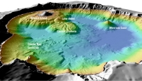
Crater Lake Bathymetry ImageThe US Geological Survey has interesting shaded-relief bathymertry images of the lake floor and more detail about the lake and caldera formation. USGS Crater Lake, Oregon Overview and USGS Shaded-relief bathymertry image of Crater Lake

California Ho

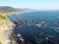
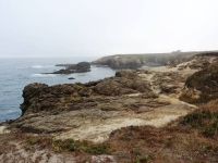
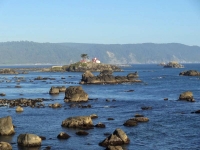
We left the park on the south road and then drove west crossing over I5 at Grants Pass as we headed to the California coastal redwoods. We were angling our way south planning to take the coast route the rest of the way to LA.

Photo Credit: Neil Rhoads, NPS, USGS

Photo Slider: This post has a unique slider with pictures from this adventure only. I hope you click into the webpage so you can see the slider in action.

Photo gallery below:
Clicking on any photo thumbnail brings up the full size photo with a description. To easily see them all, use the arrow buttons or keys to move through the full size gallery photos with descriptions. If you are receiving this in an email and donā€™t see a photo gallery below, please click into my webpage to view all the photos!

Umpqua Hot Springs 2014

We set out on the road again for our last week of the summer trip. We left Maileaā€™s on Thursday afternoon, July 24, and drove south throughNeil with the shelter beyond Oregon in search of another hot springs on our way to Crater Lake and eventually the Redwoods.

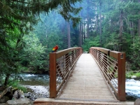
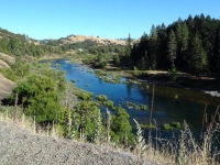
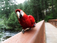
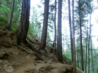
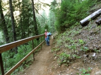
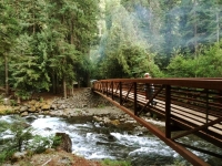
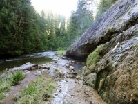
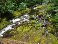
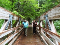
Umpqua Hot Springs is located inland in southern Oregon near the northwest approach to Crater Lake. We found the turn off and drove a few miles on a National Forest dirt road before reaching the gravel parking area for the trailhead and undeveloped campground. The trail to the hot springs is a .3 mile side trail off the North Umpqua River trail and the description is ā€œshort but steep.” Bridge and BirdThat describes it exactly! After crossing the solidly constructed bridge over the North Umpqua River (with a colorful parrot belonging to one of the campers gracing the bridge entrance), we started climbing up a STEEP slippery trail and I was very grateful for the hand rail that had been installed. We topped out and walked a level dry pine needle covered path before we descended slightly to the springs.

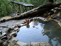
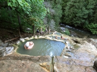
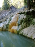
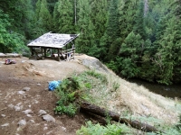
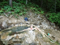
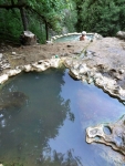
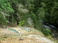
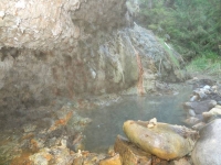
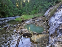
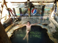
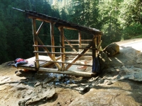
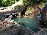
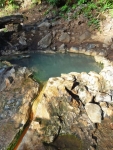
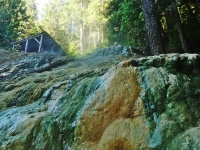
Series of poolsWe had read that the hot springs consisted of a series of travertine lined natural pools but in person it was impressive to see these naturally formed little hot tubs created from the minerals in the water cascading down the hillside. The only man-made structure was a deck and roof built over the largest pool. It was a handy spot to put our towels and bags as we moved among the different temperature pools and soaked away the miles.

ā€œSituated on a clifftop perch, Umpqua Hot Springs’ view of the North Umpqua River below is one of Oregon hot springs’ most memorable. It certainly adds to the soothing pleasure of soaking in this spring. Pool and ShelterThere are two to three oval pools for soaking above and behind the main, covered pool. The larger pool is tub-like due to the minerals from the spring creating a travertine mound over the centuries that caps the cliffside. The main pool exists sunken into this travertine stone with the view opening like an ampitheater to soakers. The upper, smaller pool is 4 by 5 feet and 112 degrees F; the lower, larger pool is 5 by 8 feet and 110 degrees F. Both pools are 2-3 feet deep and floored with coarse sand.ā€ OregonHotSprings

Hot Springs Geology

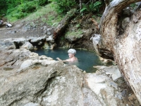
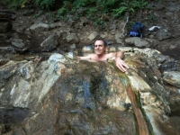
Nan in the hot pool“Volcanic activity that formed this area within the High Cascades less than two million years ago is still cooling. Here, molten rock just a few thousand feet below the surface transmits heat upward through solid rock, heating the ground water that has penetrated to that depth. Hot water then forces its way up through fissures and fractures to escape to the surface, forming hot springs. Extremely hot water dissolves large amounts of silica, a common component of volcanic rock. These dissolved silica minerals are deposited as water flows over the surface and cools. Over thousand of years the deposits have accumulated, building the hot springs mound that overlooks the North Umpqua River.” From the information sign at the Trail entrance.

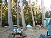
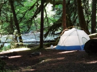
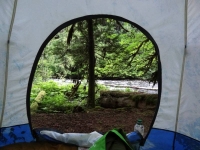
There were a few other groups enjoying the pools with plenty of space for all of us to have a private pool. We stayed until the daylight was waning and hiked back before darkness overtook the trail. We wanted to camp nearby but the undeveloped campground was full of loudly partying groups so we decided to drive on. Tent in the sunlightAbout Ā½ mile away was a great spot by the river but two tents were already there. Neil asked if they minded if we camped nearby and they were fine with it. We finished setting up the tent in the dark with our headlamps. Good thing we were getting to be old hands at setting up camp. We were asleep soon after and have no idea how late our neighbors stayed up enjoying their fire.

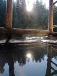
Sunrise ReflectionWe woke with the sun and hopped in the car back to the hot springs. Only one couple was there that early (the campground partiers were probably still asleep, yeah). We soon had the pools all to ourselves and watched the sunlight light up the forest trees as it topped the mountain. Thoroughly toasty and buoyant of spirit, we went back to pack up the tent and were on the road before most campers were up.

Photo Credit: Neil Rhoads

Photo Slider: This post has a unique slider with pictures from this adventure only. I hope you click into the webpage so you can see the slider in action.

Photo gallery below:
Clicking on any photo thumbnail brings up the full size photo with a description. To easily see them all, use the arrow buttons or keys to move through the full size gallery photos with descriptions. If you are receiving this in an email and donā€™t see a photo gallery below, please click into my webpage to view all the photos!

Brambles and Springs 2014

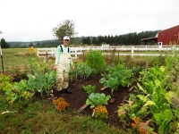
After our wonderful couple of days in Seattle, we began our trip down the West coast Tuesday morning, July 22, 2014. We didnā€™t have far to drive before reaching La Center, Washington, where we planned to stay with Mailea a few days. Mailea is living at the farm her mother and step-father recently bought for their retirement years. We want to thank Jamie and Michael for their hospitality allowing us to stay a few nights with Mailea. Most recently, the farm belonged to a horse trainer and has a great horse barn, training area, and pasture. Before that, it was a blackberry farm! The blackberry bushes still line the edge of the property and are working to take back some of the pasture. šŸ˜‰ Mailea in the gardenWe took the walking tour of the farmā€™s 18 acres with Mailea. Near the house, we admired the huge garden where she had just been weeding and building brick borders. We picked cherry plums and blackberries to munch on as we walked around the property but couldnā€™t reach too far into the bushes because the bramble thorns were very sharp. The property backs up to a wooded creek of cedars and old growth Douglas fir; it was like entering a fairy land with the old trees, ferns and the moss covered ground. We could partially see the beaver dam on the creek but we didnā€™t get up close to it.

La Center

Mailea and NeilAfter lunch, Mailea drove us to the small town center and we walked through Stern-Wheeler Park and out to wetlands along the East Fork of the Lewis River. It is interesting that Ari and Eric live on the Clark Fork River and just north of one of the Lewis and Clark expedition winter camps and Mailea lives on the East Fork of the Lewis River and north of the Pacific winter camp of Lewis and Clark expedition!

The indigenous inhabitants of the La Center area are the Cowlitz Indians and they were peaceable with the white settlers moving into their territory in the mid 1800ā€™s. They stayed out of the Indian Wars of 1855-1856 with the promise of a reservation by the U.S. Government. The Cowlitz Indians were largely displaced by white settlers and then were left landless by the unfilled promise of a reservation.

All the quotes in this section are taken from the La Center ā€“ Thumbnail History on HistoryLink.org (The Free Online Encyclopedia of Washington State History)

ā€œThe word “Cowlitz” is believed to mean “capturing the medicine spirit,” a reference to a rite of passage in which young men would remove themselves to sacred points along the Cowlitz River on fasting treks, communing with the spirit world. Some sources hold that Lewis and Clark “discovered” Cowlitz at Fort Clatsop in 1805, but others disagree, and it appears [geographically] unlikely. ā€¦ Although they were inland, the Cowlitz did not escape the epidemic of “intermittent fever” that began ravaging coastal tribes in 1829, a pestilence that is believed to have been imported on an American ship, the Owyhee. By the time the disease burned itself out in the early 1840s, it had decimated the Native American population of southwestern Washington. The total Cowlitz population in 1800 was estimated at 80,000; by 1860, the estimates of the surviving Lower Cowlitz ranged from 150 to 350.ā€

ā€œChief Atwin Stockam sued the federal government in 1906, seeking to recover several pieces of land for his tribe, and this was the opening shot of a series of legal battles that ebbed and flowed for nearly the next 100 years. Throughout the twentieth century, the Cowlitz carried on a lonely battle for recognition, always opposed by bureaucrats and sometimes opposed by recognized tribes that feared a Cowlitz gain might be their loss. Finally, after decades of struggle, in January 2002 the Cowlitz, now 2,400 strong, were granted full recognition as a tribe, and they set about putting together a reservation.ā€

Mailea and Neil on bridgeThe first white settlers arrived in 1850 when the U.S. Congress ā€œgave awayā€ the land to encourage settlement of the western United States. The area was heavily forested and the rivers became the highways since there were no roads. In the days prior to deforestation the rivers flowed deeper and straighter.

ā€œFor most of the 1800s, rivers were the primary means to travel into the interior of Western Washington, and it didn’t take long after settlement began for commercial vessels to penetrate the lower reaches of the East Fork of the Lewis. In the early days, river traffic consisted of bringing people and supplies into the area and shipping agricultural products out. The boats, all steam-powered sternwheelers, ā€¦ started running up and down the river, stopping at each scattered homestead to trade. It was not long, however, until the potential of the area’s vast timber resource was realized, and loggingĀ became the area’s first real industry.ā€

A series of sternwheelers have run the East Fork of the Lewis River beginning in the 1850ā€™s up until 1931. The town is proud of its steamboat heritage naming the downtown park Stern-Wheeler Park and putting a Sternwheeler Gallery on the town website. An informational sign in the park describes the sternwheelers. A side bar highlighted Captain Minnie Hill who was the first female west of the Mississippi to receive the masterā€™s and pilotā€™s license. It was issued to her in 1886 at the age of 23 years old. ā€œCaptain Minnie Hill’s skill was so impressive that when she took the pilots exam she was awarded a lifetime license, a rare feat. This is despite the fact that her husband, also a steamboat captain, claimed the exam she was given was more difficult than usual due to a desire to fail her for cause.ā€ Bellaonline.com

ā€œFor reasons that are no longer apparent, the site of present-day La Center was first known as “Podunk,” a name that may not then have had the negative connotations that it has today.ā€ By the time it was incorporated in 1909, the name was changed to La Center to covey the townā€™s role as a center of commerce for Lewis River trade.Mailea and Neil cooking

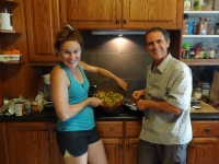
After our afternoon exploration, Mailea cooked us a great dinner utilizing fresh produce from the garden and then we enjoyed a relaxing evening around a fire in the fireplace. Neil misses fireplaces in Hawaii so he was happy it was a cool enough evening to light a fire!

Bagby Hot Springs

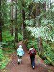
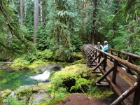
The trailWe were back in in hot springs country! Neil read about Bagby Hot Springs last time we were in the area but we werenā€™t able to get there that time. What we read was the water is hot and the bath houses well maintained and best of all not chlorinated or treated water. Oh, did I mention we bought a Northwest US Hot Springs book before we left Maui and referred to it as we drove to see if there were any hot springs close to our route? We left that book with Mailea for her and Ari to explore more hot springs in their area.Ā Picturesque streamBagby Hot Springs is in northern Oregon a couple hour drive from Maileaā€™ and is located on Forest Service land and maintained by the National Forest Service. The bath houses were built by volunteers over several years beginning in 1974. It is an easy mile and half hike through beautiful forest to the hot springs area and clearly popular even mid-week in rain because the parking area was completely full!

ā€œCedar logs have been hollowed to create 8-foot-long bathtubs at this rustic, free hot springs. Even if you donā€™t plan to soak, the trail here is a delight, leading through a towering old-growth forest along a fork of the Collawash River. Just donā€™t expect solitude. On weekends and all through summer the trail is heavily used and thereā€™s a long waiting line at the bath house. Parking and hiking are free, but a private concessionaire charges $5 per personĀ to use the hot springs.ā€ OregonHiking

Soaking in the hot tubā€œTo my knowledge, this is the most well developed of the free hot springs in Oregon. At 2280 feet elevation, the hot springs is managed cooperatively by the Forest Service and a volunteer group, the Friends of Bagby. Many call Bagby their favorite hot spring. The spring water is channeled by wooden flumes into numerous bath houses and private tubs. ā€¦Ā  From the source, the water is 136 degrees Fahrenheit.Ā  Wooden buckets, which can be filled with cold spring, water are available for mixing to achieve the desired temperature.ā€ OregonHotSprings

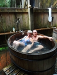
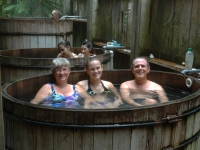
SoakingWe hiked through the moist forest passing many returning bathers as we enjoyed the beauty around us. We didnā€™t have to wait too long to get our turn in a round tub big enough for the three of us on the open platform. Everyone was very friendly and considerate. Once water logged and thoroughly toasty, we passed the tub onto the next waiting group.

Portland

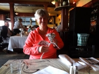
Nan at RestaurantWe were ready for dinner after our hike and soak. For the last two weeks, we had been anticipating a scrumptious Cajun dinner ever since Ari and Eric had told us about the Cajun and Creole restaurant Mailea had taken them in Portland. They loved it. I didnā€™t know what a distinctive dining experience we were in for at Le Bistro Montage.

ā€œLe Bistro Montage is located in what once was the home of the Royal Hotel, in the heart of the Central Eastside Industrial district.Ā  A completely unique dining experience awaits when you come in; linen-covered communal tables, custom art, a large selection of wine and eclectic dĆ©cor is only the beginning. While you are here do not forget to try our famous macaroni, mouth-watering frog legs, gator bites and our homemade desserts. Ā Make sure to ask your server to wrap your leftovers, and see what foil art masterpiece creature you get to take home!ā€

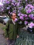
Neil with BlossomsFor dessert, Mailea took us to a new Portland ice cream shop Salt and Straw. A sample list of some of their flavors includes Double Fold Vanilla, Coconut with Petuniaā€™s Salted Caramel Bars, Pear & Blue Cheese, Strawberry Honey Balsamic with Black Pepper, Honey Lavender, Arbequina Olive Oil, Stumptown Coffee & Burnside Bourbon, Cinnamon Snickerdoodle, Chocolate Gooey Brownie, Almond Brittle with Salted Ganache, Sea Salt with Caramel Ribbons, Freckled Woodblock Chocolate. I canā€™t even remember what flavor I got but it was yummy! It deserves a stop next time we are in the area.

Bramble Pants

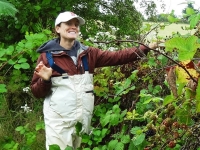
Mailea in her BramblepantsWe stopped at a Portland sporting goods store that has a basement full of used merchandise for sale. While Mailea found a pair of cleated shoes for soccer, Neil browsed through the racks and pulled out a pair of pants saying Mailea needs these. I am sure I was giving him a strange look because I couldnā€™t figure out why she needed stiff waxy canvas pants? He said she needed them for protection from the thorns while picking blackberries. How brilliant! He showed Mailea and she tried them on; they fit her perfectly. The pants were labeled ski powder pants but now they were Bramble Pants!

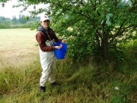
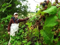
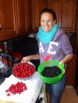
Bucket and BramblepantsA sunny Wednesday morning was an excellent time to try out the bramble pants. Mailea and Neil got suiting up for berry picking, including ā€œwelliesā€ (rubber boots), and I showed them my dadā€™s trick of hanging the bucket on a string around his neck so he can use both hands for picking the berries. They brought in a major haul and Mailea planned to dehydrate some for long term enjoyment.

As much as we wanted to stay longer with Mailea, we knew it was time to hit the road again to continue our drive down the west coast. It was sad to leave but least we left with full bags of fresh fruit to sustain us!

Photo Credit: Neil Rhoads

Photo Slider: This post has a unique slider with pictures from this adventure only. I hope you click into the webpage so you can see the slider in action.

Photo gallery below:
Clicking on any photo thumbnail brings up the full size photo with a description. To easily see them all, use the arrow buttons or keys to move through the full size gallery photos with descriptions. If you are receiving this in an email and donā€™t see a photo gallery below, please click into my webpage to view all the photos!

A vacation from our vacation

We are taking a brief break in writing our trip report. We have written twelve posts so far about our summer trip and anticipate about 4-5 more in the coming weeks. Neil is working on co-authoring a paper with his daughter Mailea and hasnā€™t had time for photo processing. Me? I just needed a few days away from my computer šŸ˜‰

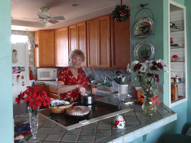
Audrey at ChristmasI have been enjoying time with my mom Audrey before she returns to California a few months. We walk the beach 3 mornings a week. She is busy with various activities the other mornings! We enjoyed a delicious four course lunch last Wednesday at the Maui Culinary Arts School ā€œLeis Family Class Act Restaurant.ā€ The restaurant is run by the culinary students doing an intern programā€”open twice a week during the semester. Momā€™s condo neighbor is completing the culinary program and she was one of the chefs. She came by our table to say hello. The students are the wait staff, baristas, maĆ®tre d’, as well as the food preparation personnel through the semester in order to experience all the roles in restaurant environment. They do a great job!
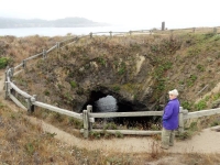
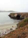
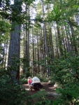
Neil with whaleWe went on a whale watch boat a few weeks ago. It was the first time Neil and I as well as my mom had been on the water this season. From our lanai, we do get to watch whales breaching and tail slaps through binoculars a few miles off shore but we always enjoy getting a little closer view on the boat. It was whale soup as we call it–seeing whale spouts in all direction around the boat. We followed a few mom and calf pairs watching the little one come up often to get a breath. A couple of males swam up to challenge the primary (male) escort accompanying one mom and calf and we were ā€œmuggedā€ — the whales get so close to the boat, it canā€™t move till the whales choose to move farther away. Ā We saw fluke up dives, pecks slaps, and the finale of four breaches on our way back to the harbor.

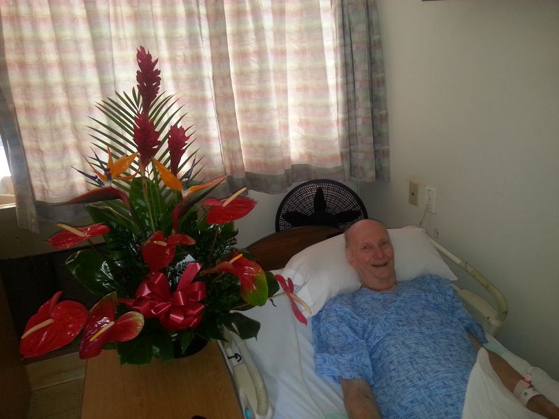
Morley with flowersIn sad news, Neilā€™s step-father Morley has been declining since November. He had been getting so weak and he fell a few times when his legs just gave out. Once on the floor (unhurt) he just doesn’t have the strength to get back up. He went to the hospital for pneumonia and fluid on the lungs in Nov. He never regained much strength and went to the hospital a second time in January with high fever in addition to not being able to get up. That time, they operated to scrape the accumulated jelly-like fluid from around the lungs. After nearly a month in the hospital, he was moved to a skilled nursing facility for rehab. He has just finished the month of rehab with minimal progress. He got pneumonia again and is continually exhausted and sleepy. Neil and I have been spending a good deal of time supporting Jean and traveling to visit Morley. We also write frequent updates to his daughters in Minnesota. Jean misses Morley but knows she is unable to be a caregiver with her own health issues. She is doing well living alone (with us next door for support.) She has come to grips with the fact that life will not return to the way it was, and she seems to be coping well with the stress of continuing uncertainties and the many decisions that need to be made.

Perry RhoadsOn top of that it is the one year anniversary since the passing of Neilā€™s older brother Perry Wayne Rhoads in Massachusetts. Neil misses him, especially each time he reads a good joke. Perry loved to laugh and always had a joke ready. His passing was very sudden. He was surrounded by his beloved Paula, his children, family and friends when he died just over a week after he was admitted to the hospital. Neil was in touch with Paula during the week and wrote email updates to Perryā€™s friends who were unable to get to the hospital. Jean and Neil were in the process of booking flights when the news arrived of his passing. He is loved and missed by many.

Quentin new hair cutOn a happier note, I will be a great aunt again twice over this summer. My nieces Madison and Hailey are both expecting and we just found out both babies are boys! Quentin has been the only great-grandson for 14 years. My parents have three great-granddaughters, Quentinā€™s little sisters. We are thrilled for the new-to-be parents and grandparents!
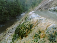
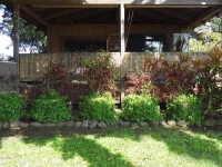
We still enjoy breakfast tea on the lanai with our green gecko friends. They have to make do with frozen mango juice but they donā€™t complain.Planter Bushes and greenery It will be several months before they get fresh mango. We do have a lot of blossoms on the mango trees so we’re hoping for a good crop. At the one year mark, our planter pot hedge just reached the top of the lanai rail. They still need to fill in thicker but we’re happy with the growth progress. The hearts and flowers ground cover greenery has draped down the edges of the planters making a beautiful display.

Nature in the City 2014

Timothy, Helene, and NanWe had a wonderful few day visit with Helene and Timothy in their beautiful home in Seattleā€™s Magnolia neighborhood. Our only regret was not having time with their daughters, Shane and Talia, because the girls left very early Sunday morning for a multi-day rock climbing excursion. We were able to give them a hug on Saturday night when we arrived in our exhausted state from our day at North Cascades hiking, hotel searching, and driving. Iā€™m sorry I wasnā€™t coherent enough to sit up visiting a little while. (Helene later told me the girls had a great trip and werenā€™t impacted by the Leavenworth wildfire that was still burning nearby.)

Trail through ravineWe woke up to a beautiful Sunday morning–well cloudy and drizzly but that is a beautiful day in Seattle isnā€™t it? After hanging out our wet tent and sleeping bags to dry in their spacious downstairs workroom/game room, we walked with Helene and Timothy from their house down through the lower edge of the Kiwanis Ravine on a foot path and across the Ballard Locks for brunch at the Portage Bay CafĆ©. During our wait for a table, we browsed the Ballard Sunday Farmers Market. Ballard Sunday MarketItā€™s a weekly street fair and market stretching several blocks with local vendors and music. We sampled local artisan cheese and salami, as well as organically grown fruit and vegetables. We took home fresh blueberries and cheese for later. Yum! On the way back, there was a free Jazz concert starting on the open lawn area in the Ballard Lock Gardens.Band Concert in Gardens People were seated around in lawn chairs and the rangers offered folding chairs for those of us who hadnā€™t brought our own. Neil and I sat a while to enjoy the upbeat music until a water main broke in the ground below the musicians and they had to scramble to save their equipment as water covered their feet and started flowing in a river down the sidewalk. Eventually the stage was moved slightly uphill and they restarted the concert but by that time we had already started strolling through the surrounding botanical gardens.

Great Blue Herons

HeronHelene and Timothyā€™s home backs onto the Kiwanis Ravine blue heron wildlife sanctuary and we were able to watch parent herons bringing food to the young ones in a few nests visible from their expansive dining room windows.

ā€œThis park was named the city’s first Wildlife Sanctuary in 2010. It is home to Seattleā€˜s largest nesting colony of Great Blue Herons. The herons make their nests there from February through July or August each year; volunteers counted approximately 90 nests in 2011.ā€ Kiwanis Memorial Preserve Park

Heron 2During nesting season, houses adjacent to the ravine canā€™t do any outside construction nor any work that might disturb the nesting herons. Timothy told us these past few years the eagles have been voraciously raiding the nests for the new hatchlings and it was estimated that very few young survived the nesting season. Fewer numbers of Great Blue Herons returned to nest this year in the ravine; it seems they are moving their nesting area. We saw many herons and nests in the trees of Commodore Park, the canal-side promenade downhill from Kiwanis Ravine. Neil was able to get some good photos of them.

Hiram M Chittenden Locks

Ballard Lock and train bridgeMonday, July 21, we woke to sunshine. While Helene and Timothy went to work, we did laundry, repacked the car, and did some route planning. For lunch, we retraced the same walking route to Ballard so we could feast at the Indian restaurant our friends pointed out the day before; Indian food is one our favorite cuisines. Walking back, we noticed the Ballard Locks visitor center was open and decided to look through the museum. The official name of the Ballard Locks is actually Hiram M. Chittenden Locks. They were built by the U.S. Army Corps of Engineers beginning in 1906 and are still operated by the Corps. Various Seattle locations were proposed and considered over the years for building the canal and locks (one proposal was to dig out a hill in middle of downtown Seattle.) U.S. Army Major Hiram M. Chittenden determined the current site of the locks was the best engineering choice and is credited with its innovative design. While we were browsing through the interesting exhibits, the load speaker announced a free tour of Gardens and Locks downstairs and we thought why not?

ā€œConstruction of the Lake Washington Ship Canal and Hiram M. Chittenden Locks was completed in 1917 by the U.S. Army Corps of Engineers. Connecting the waters of Lake Washington, Lake Union, and Ballard LocksSalmon Bay to the tidal waters of Puget Sound, the canal and locks allow recreational and commercial vessels to travel to the docks and warehouses of Seattle’s busy fresh water harbor.

The complex ofĀ locks sit in the middle ofĀ Salmon BayĀ and are part of Seattle’s Lake Washington Ship Canal. They are known locally as the Ballard Locks after the neighborhood to their north. (Magnolia lies to the south.)

The locks and associated facilities serve three purposes:

  • To maintain the water level of the fresh water Lake Washington and Lake Union at 20 to 22 feet above sea level.
  • To prevent the mixing of sea water from Puget Sound with the fresh water of the lakes (saltwater intrusion).
  • To move boats from the water level of the lakes to the water level of Puget Sound, and vice versa.

A fish ladder is integrated into the locks for migration of anadromous fish, notably salmon. The grounds feature a visitor center, as well as the Carl S. English, Jr. Botanical Gardens.ā€ Hiram M. Chittenden Locks, US Army Corps of Engineers
Aerial view of the Locks

Chittendenā€™s ingenious design of the locks is what helped fulfill the above listed three purposes without complex engineering equipment. He also advocated the addition of the second smaller lock adjacent to the originally planned large capacity lock because he recognized the locks would be used for smaller pleasure craft along with higher tonnage commercial vessels. Using the small lock when boat traffic is low conserves fresh lake water during summer, when the lakes receive less inflow. The two lock design also allows one of the locks to be drained for maintenance without blocking all boat traffic. Our park ranger guide explained how the locks worked and how the design prevented the salt water from entering the fresh water lakes. Rather than quoting it all here, I recommend you read the Hiram M. Chittenden Locks Atlas Obscura link for a historical description about the need for as well the creation of the Locks.

Smolt FlumesBeside the two locks stretches the spillway dam which maintains the freshwater levels within a range of 2 feet for Lake Washington, Lake Union, and the Shipping Canal. The pedestrian walkway we crossed on our way to Ballard goes over the top of the dam and the lock gates themselves creating a walking corridor between Ballard and Magnolia and connecting the parks on either side of the canal. The Lake Washington Shipping Canal was built at the same time as the Ballard Locks. Admin Building at LocksCommercial transportation is what drove the need for locks. In the 19th century, goods and raw materials transported from inland Washington arrived at Lake Washington on the way to Puget Sound. They need to be moved across the lake and then unloaded and moved across a section of land before reaching the docks on the Sound. I mentioned there were several locations considered to build a lock and canal. The current location of the locks requires shipping traffic to transition Lake Union before reaching the Lake Washington. The problem in the early 1900s was that Lake Washington was almost 9 feet higher than Lake Union. The opponents to the Salmon Bay location argued you would need a second set of locks between the lakes! Chittenden solved this by simply lowering Lake Washington 8.8 feet to the same level of Lake Union and building a level canal between the two lakes. It was an elegant engineering and commercial solution but had a drastic impact on the watershed:

“In 1916, Lake Washington is lowered 8.8 feet and the Black River disappears due to construction of the Lake Washington Ship Canal. …Ā  The lowering of Lake Washington and raising of Salmon Bay causes a number of changes to the watershed, the most dramatic of which is the drying up of the Black River when the level of Lake Washington drops below the river channel entrance [the natural outlet for Lake Washington]. As a result, the way water moves through the watershed changes drastically, with environmental and human consequences” HistoryLink.org

You can read the full article about the reshaping of the watershed and its impact at Washington State History HistoryLink.org. The article concludes “Like many large civil engineering projects in Seattle, the Lake Washington Ship Canal wrought enormous change to the landscape and to the lives of people who lived on the waterways affected by the project. It brought many benefits to the city, but exacted a large environmental and social price.”

Fish Ladder

Fish in before entering the ladderThe tour then moved onto the Fish Ladder. Major Chittenden proposed the building of a fish ladder as a part of the locks design (he was environmentally aware that the salmon’s natural migration route up the Black River to their spawning grounds was about to dry up) and the first ladder was completed with the construction of the locks.

ā€œAll fish, including endangered salmon, must pass through the locks, spillway or the fish ladder to move between Lake Washington and Puget Sound. In 1976, Corps of Engineers officials renovated and improved the ladder to reflect changes in fish conservation. Today’sĀ ladder has 21 steps, or weirs, which allow the fish to swim upstream on a gradual incline. For many years the locks has been the focus of studies detailing migrating juvenile and adult salmon behavior.ā€ Fish Ladder, US Army Corps of Engineers

More Fish in LadderAn underground low light viewing room offers five large glass windows to watch the fish swimming upstream in an upper weir as they approach the fresh water end of the ladder. The room has excellent interpretive signage offering information about the ladder and diagrams of five salmon species you will most likely see through the viewing windows. Although we have visited the fish ladder viewing area in the past, our guide shared some great information.One thing we learned is the fish often mill around lingering in each weir. Fish ChartThis allows their body to literally change its physiology adapting to the progressively lower salinity of the water above the spillway dam. In more natural settings, salmon migrating up unobstructed streams spend days moving from their adult salt water environment to the brackish estuary to the fresh water of their birth place allowing for a slow change in their physiology. The salmon migrating through the Locks fish ladder have a mere few hundred yards for their bodies to make the adaptation, thus they need to take it slowly. (Video 23 sec.)

A detailed discussion of the unusual and unique design of this fish ladder is at the link below:

ā€œThe fish ladder at the Chittenden locks is unusualā€”materials published by the federal government say “unique”ā€”in being located where salt and fresh water meet. Normally, fish ladders are located entirely within fresh water. ā€¦ The [first] ladder was designed to use attraction water: fresh water flowing swiftly out the bottom of the fish ladder, in the direction opposite which anadromous fish migrate at the end of their lives. ā€¦ The Corps rebuilt the fish ladder in 1976 by increasing the flow of attraction water and adding more weirs. ā€¦ A diffuser well mixes salt water gradually into the last 10 weirs. ā€¦ The fish approaching the ladder smell the attraction water, recognizing the scent of Lake Washington and its tributaries. They enter the ladder, and either jump over each of the 21 weirs or swim though tunnel-like openings. They exit the ladder into the fresh water of Salmon Bay. ā€¦ The offspring remain in the fresh water until they are ready to migrate to the ocean as smolts [juvenile fish].ā€ Fish Ladder, Wikipeida

We had been wondering about large white tubes we saw extending from the spillway pouring out water from above the spillway dam. Our guide explained these “smolt flumes” were inserted into the spillway during spawning season to provide a safe route downstream for the smolt as they made their journey to the sea where they will live their adult life. They actually face upstream and swim against the current as they are carried backwards through the flumes. For scientific purposes the flumes have counters built into them so can keep track of how many smolt pass through. You can view additional photos at My Ballard and KelliTravels.com.

Carl S. English Jr. Botanical Gardens

FlowersThe tour had begun inside the auditorium with a short video and introduction by the Park Ranger guide. As we exited the visitor center and walked toward the locks, we paused only briefly on the main path in the Carl S. English Jr. Botanical Garden for our guide to give us some history about the gardens and a few antidotal stories. ā€œCarl S. English was hired in 1931 by the U.S. Army Corps of Engineers to transform the gravel lot remaining from the construction of the newly completed Hiram M. Chittenden Locks into a grassy field which could be used for marching, training drills and public events. Ā Instead, he took it upon himself to bring to life an elaborate, English-style landscape garden which today boasts over 1500 varieties of plants from around the world.ā€ [You can read more at Atlas Obscura] The fun antidotal story I remember: No other US Army Corps of Engineers site has a ā€œgardenā€ and years into Englishā€™s work, a visiting superior found not a flat marching drill grounds but the sculptured landscaped garden. The superior ordered English to remove the garden and put in a large flat grassy field. English said he would be happy to comply but would the superior please communicate to the University that the garden was to be removed; the University had by this time established a curriculum for all its botany classes to do their field work at the gardens. And would the superior also please communicate to the numerous volunteers who had spent 1000s of hours helping create and maintain the garden. The superior backed down and the Ballard Locks is still to this day the only Corps facility that has a Botanical Gardens!

ā€œThis botanical garden is a tribute to the devotion of our first horticulturist, Carl S. English, Jr. During the 43 years working for the U.S. Army Corps of Engineers, Carl transformed the barren lawn, left after the construction of the locks, into a garden worthy of serious study.

Through his travels and correspondence with prominent botanists and with the assistance of ship captains returning through the locks, Carl collected specimens of trees and flowers from around the world. He brought about an amazing homecoming, the dawn redwood Previously known only as a fossil, it was discovered growing in China. Carl arranged to receive some of the first seeds ever shipped to the United States. Eight specimens grow in the garden today.

These lovely grounds are a masterpiece of horticultural splendor, combining the elegant lines and vistas of the romantic English landscape style with the original character of more than 570 species and 1,500 varieties from around the world.ā€ Botanical Gardens, US Army Corps of Engineers

We had enjoyed walked through the lovely and colorful gardens the day before so didnā€™t miss moving straight on to the canal and locks. The free guided tour was fascinating and I would recommend it if you are in the Seattle Ballard area.

Statue in front of houseWe topped off the day enjoying wine and pupus with our hosts in their garden, taking advantage of the sunny, warm evening and then shared a wonderful dinner together on our last evening in Seattle. Tuesday morning, once the Seattle rush hour traffic subsided, it would be time to head south and on to the next phase of our adventure.

Photo and Video Credit: Neil Rhoads

Photo Slider: This post has a unique slider with pictures from this adventure only. I hope you click into the webpage so you can see the slider in action.

Photo gallery below:
Clicking on any photo thumbnail brings up the full size photo with a description. To easily see them all, use the arrow buttons or keys to move through the full size gallery photos with descriptions. If you are receiving this in an email and donā€™t see a photo gallery below, please click into my webpage to view all the photos!