Nature in the City 2014

Timothy, Helene, and Nan
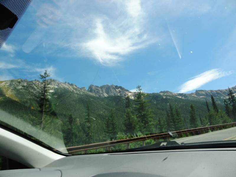
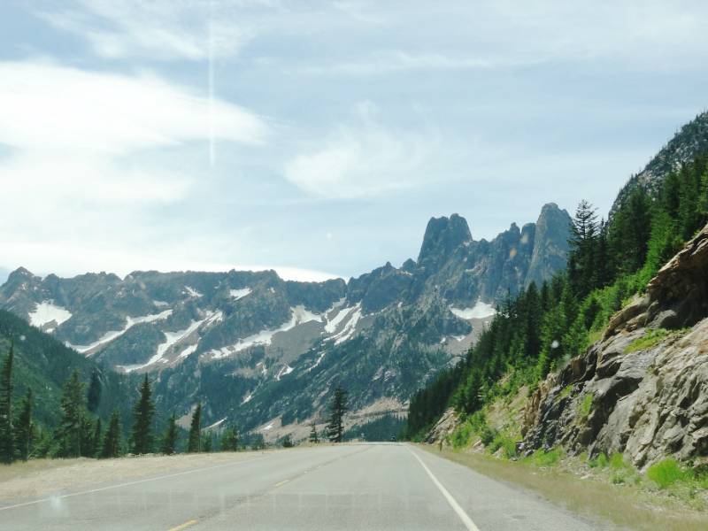
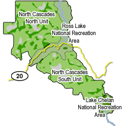
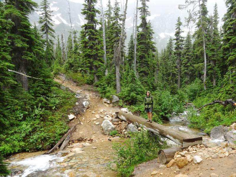
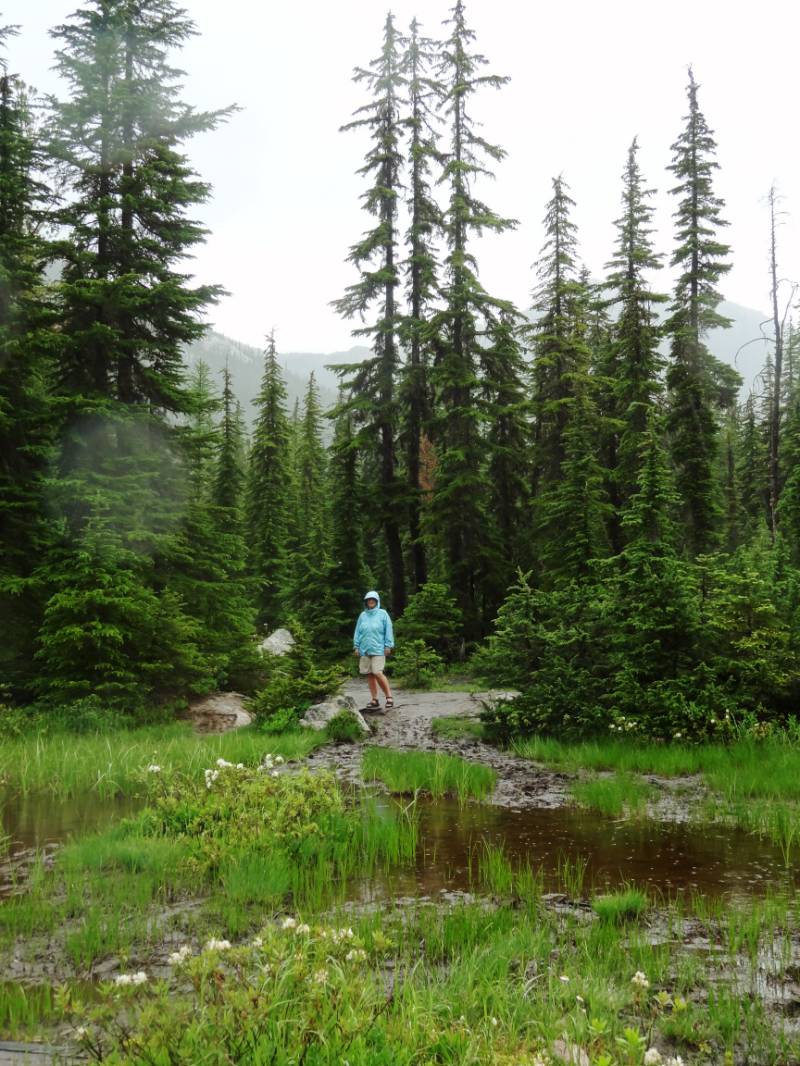
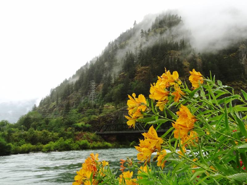
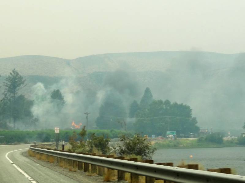
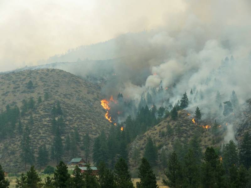
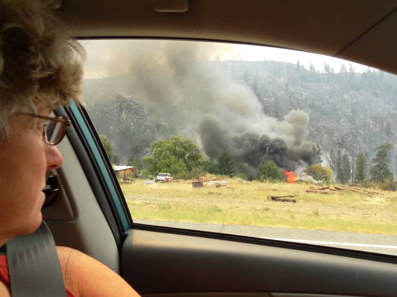
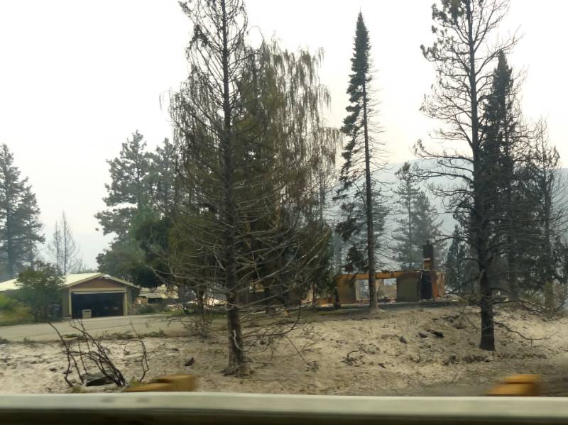
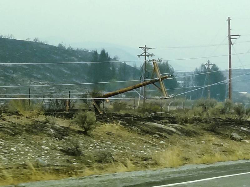
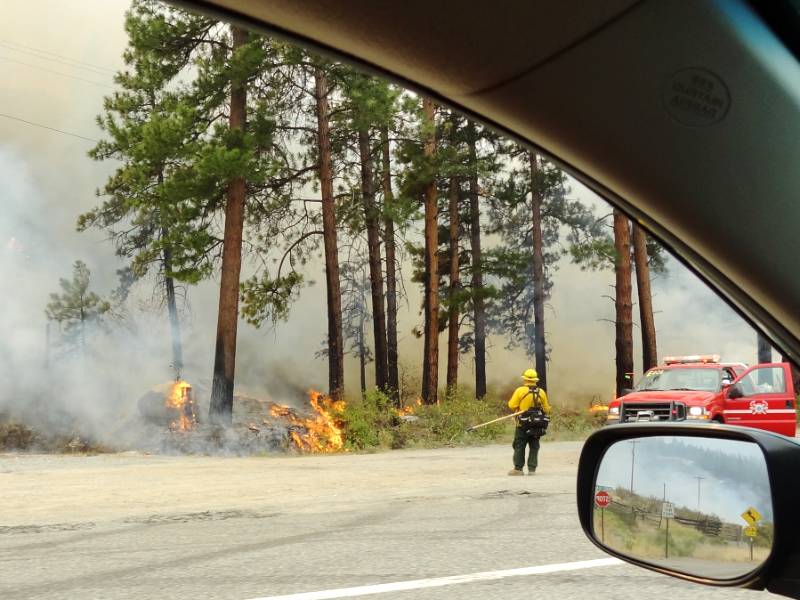
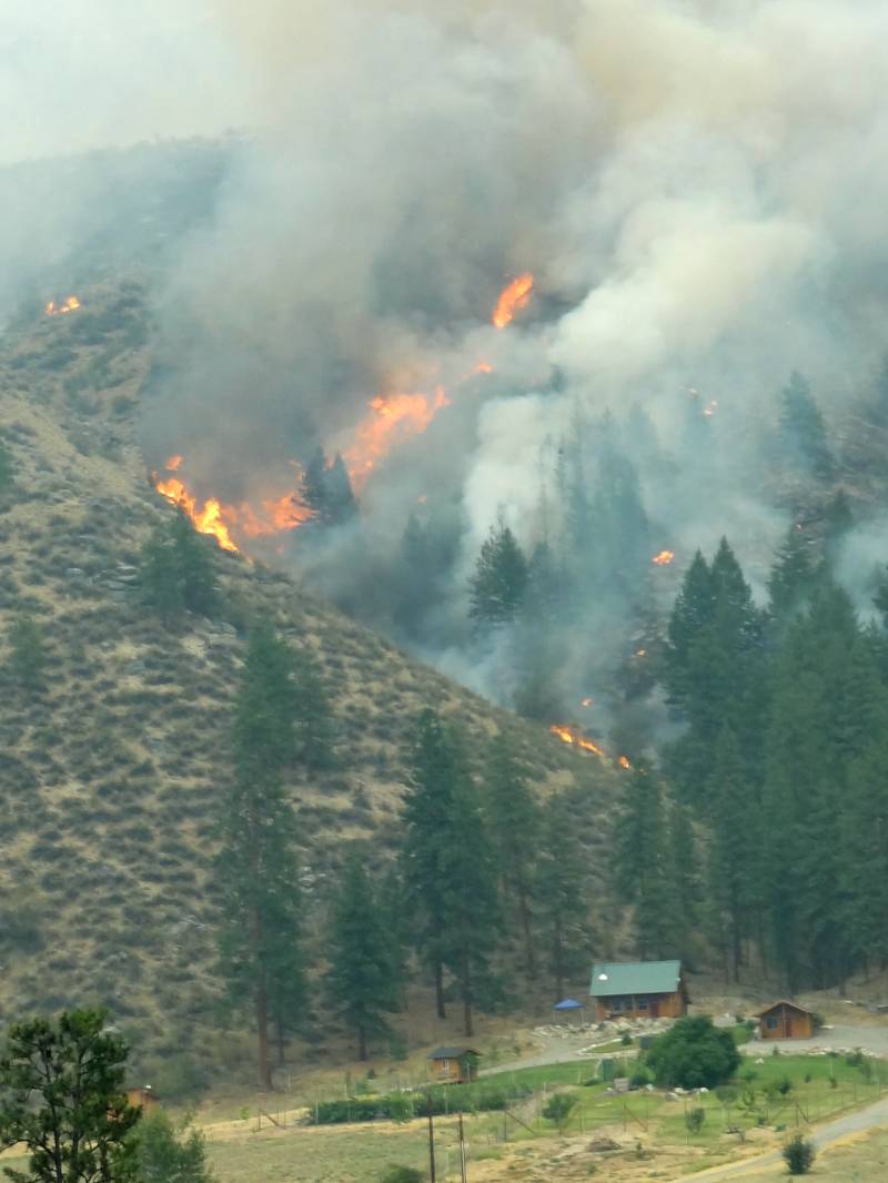
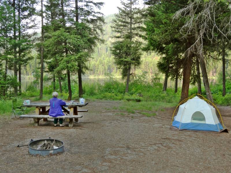
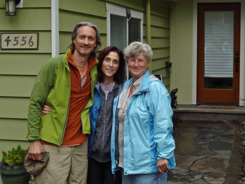
We had a wonderful few day visit with Helene and Timothy in their beautiful home in Seattle’s Magnolia neighborhood. Our only regret was not having time with their daughters, Shane and Talia, because the girls left very early Sunday morning for a multi-day rock climbing excursion. We were able to give them a hug on Saturday night when we arrived in our exhausted state from our day at North Cascades hiking, hotel searching, and driving. I’m sorry I wasn’t coherent enough to sit up visiting a little while. (Helene later told me the girls had a great trip and weren’t impacted by the Leavenworth wildfire that was still burning nearby.)

Trail through ravine
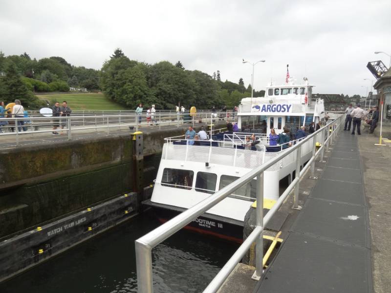
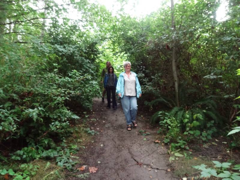
We woke up to a beautiful Sunday morning–well cloudy and drizzly but that is a beautiful day in Seattle isn’t it? After hanging out our wet tent and sleeping bags to dry in their spacious downstairs workroom/game room, we walked with Helene and Timothy from their house down through the lower edge of the Kiwanis Ravine on a foot path and across the Ballard Locks for brunch at the Portage Bay Café. During our wait for a table, we browsed the Ballard Sunday Farmers Market. Ballard Sunday Market
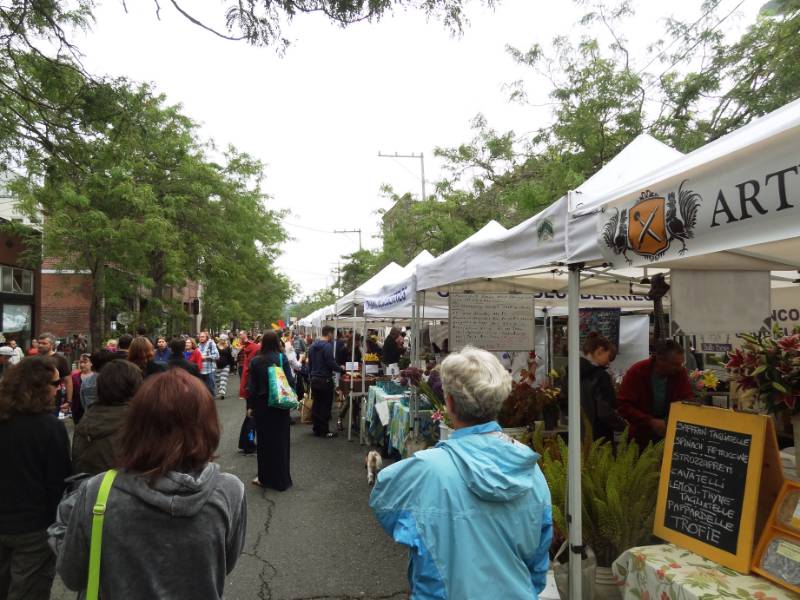
It’s a weekly street fair and market stretching several blocks with local vendors and music. We sampled local artisan cheese and salami, as well as organically grown fruit and vegetables. We took home fresh blueberries and cheese for later. Yum! On the way back, there was a free Jazz concert starting on the open lawn area in the Ballard Lock Gardens.Band Concert in Gardens 
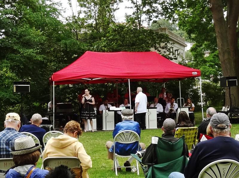
People were seated around in lawn chairs and the rangers offered folding chairs for those of us who hadn’t brought our own. Neil and I sat a while to enjoy the upbeat music until a water main broke in the ground below the musicians and they had to scramble to save their equipment as water covered their feet and started flowing in a river down the sidewalk. Eventually the stage was moved slightly uphill and they restarted the concert but by that time we had already started strolling through the surrounding botanical gardens.

Great Blue Herons

Heron
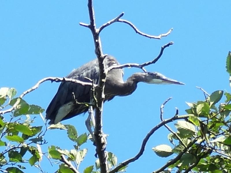
Helene and Timothy’s home backs onto the Kiwanis Ravine blue heron wildlife sanctuary and we were able to watch parent herons bringing food to the young ones in a few nests visible from their expansive dining room windows.

“This park was named the city’s first Wildlife Sanctuary in 2010. It is home to Seattle‘s largest nesting colony of Great Blue Herons. The herons make their nests there from February through July or August each year; volunteers counted approximately 90 nests in 2011.” Kiwanis Memorial Preserve Park

Heron 2
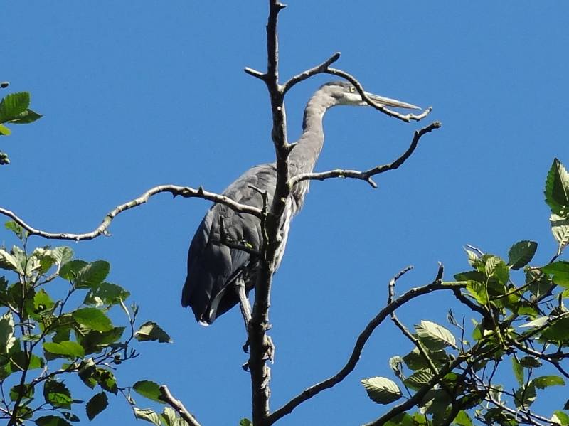
During nesting season, houses adjacent to the ravine can’t do any outside construction nor any work that might disturb the nesting herons. Timothy told us these past few years the eagles have been voraciously raiding the nests for the new hatchlings and it was estimated that very few young survived the nesting season. Fewer numbers of Great Blue Herons returned to nest this year in the ravine; it seems they are moving their nesting area. We saw many herons and nests in the trees of Commodore Park, the canal-side promenade downhill from Kiwanis Ravine. Neil was able to get some good photos of them.

Hiram M Chittenden Locks

Ballard Lock and train bridge
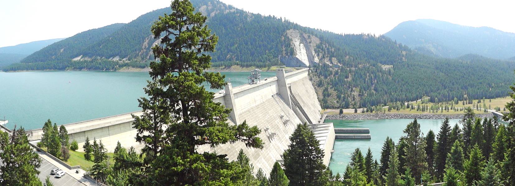
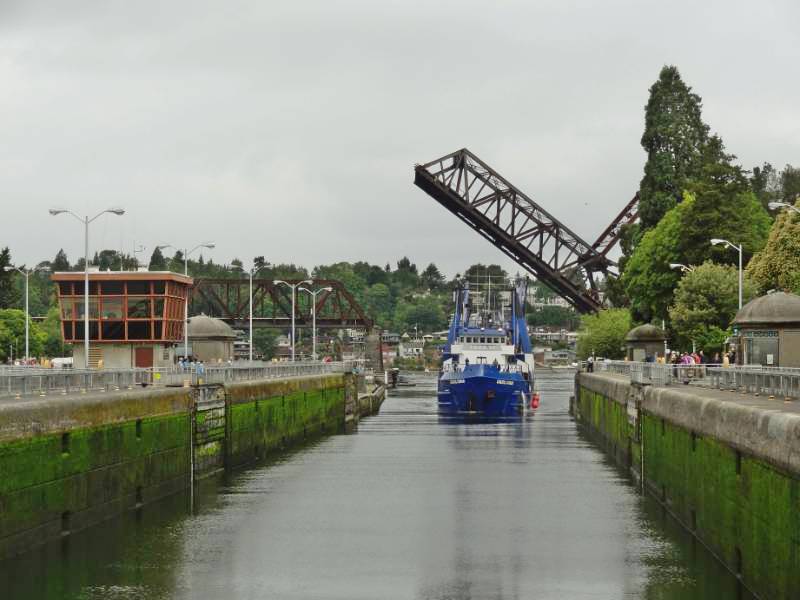
Monday, July 21, we woke to sunshine. While Helene and Timothy went to work, we did laundry, repacked the car, and did some route planning. For lunch, we retraced the same walking route to Ballard so we could feast at the Indian restaurant our friends pointed out the day before; Indian food is one our favorite cuisines. Walking back, we noticed the Ballard Locks visitor center was open and decided to look through the museum. The official name of the Ballard Locks is actually Hiram M. Chittenden Locks. They were built by the U.S. Army Corps of Engineers beginning in 1906 and are still operated by the Corps. Various Seattle locations were proposed and considered over the years for building the canal and locks (one proposal was to dig out a hill in middle of downtown Seattle.) U.S. Army Major Hiram M. Chittenden determined the current site of the locks was the best engineering choice and is credited with its innovative design. While we were browsing through the interesting exhibits, the load speaker announced a free tour of Gardens and Locks downstairs and we thought why not?

“Construction of the Lake Washington Ship Canal and Hiram M. Chittenden Locks was completed in 1917 by the U.S. Army Corps of Engineers. Connecting the waters of Lake Washington, Lake Union, and Ballard LocksSalmon Bay to the tidal waters of Puget Sound, the canal and locks allow recreational and commercial vessels to travel to the docks and warehouses of Seattle’s busy fresh water harbor.

The complex of locks sit in the middle of Salmon Bay and are part of Seattle’s Lake Washington Ship Canal. They are known locally as the Ballard Locks after the neighborhood to their north. (Magnolia lies to the south.)

The locks and associated facilities serve three purposes:

  • To maintain the water level of the fresh water Lake Washington and Lake Union at 20 to 22 feet above sea level.
  • To prevent the mixing of sea water from Puget Sound with the fresh water of the lakes (saltwater intrusion).
  • To move boats from the water level of the lakes to the water level of Puget Sound, and vice versa.

A fish ladder is integrated into the locks for migration of anadromous fish, notably salmon. The grounds feature a visitor center, as well as the Carl S. English, Jr. Botanical Gardens.” Hiram M. Chittenden Locks, US Army Corps of Engineers
Aerial view of the Locks

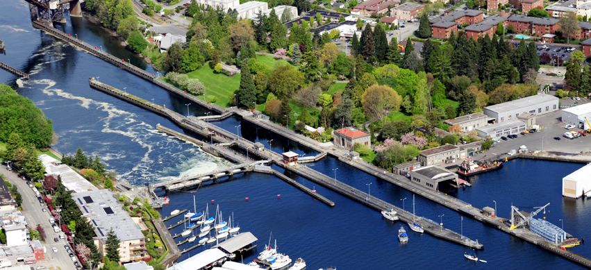
Chittenden’s ingenious design of the locks is what helped fulfill the above listed three purposes without complex engineering equipment. He also advocated the addition of the second smaller lock adjacent to the originally planned large capacity lock because he recognized the locks would be used for smaller pleasure craft along with higher tonnage commercial vessels. Using the small lock when boat traffic is low conserves fresh lake water during summer, when the lakes receive less inflow. The two lock design also allows one of the locks to be drained for maintenance without blocking all boat traffic. Our park ranger guide explained how the locks worked and how the design prevented the salt water from entering the fresh water lakes. Rather than quoting it all here, I recommend you read the Hiram M. Chittenden Locks Atlas Obscura link for a historical description about the need for as well the creation of the Locks.

Smolt Flumes
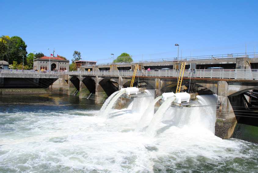
Beside the two locks stretches the spillway dam which maintains the freshwater levels within a range of 2 feet for Lake Washington, Lake Union, and the Shipping Canal. The pedestrian walkway we crossed on our way to Ballard goes over the top of the dam and the lock gates themselves creating a walking corridor between Ballard and Magnolia and connecting the parks on either side of the canal. The Lake Washington Shipping Canal was built at the same time as the Ballard Locks. Admin Building at Locks
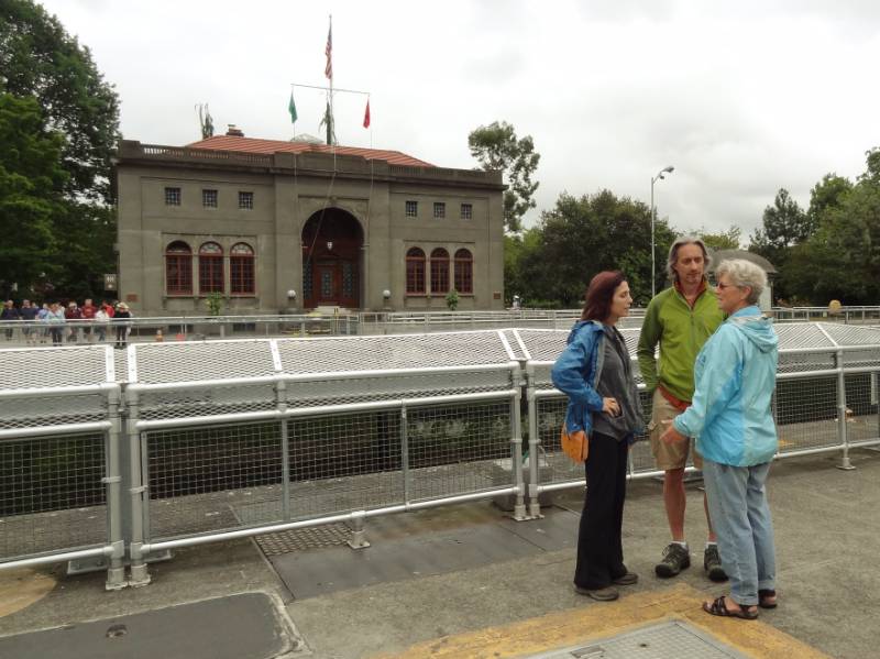
Commercial transportation is what drove the need for locks. In the 19th century, goods and raw materials transported from inland Washington arrived at Lake Washington on the way to Puget Sound. They need to be moved across the lake and then unloaded and moved across a section of land before reaching the docks on the Sound. I mentioned there were several locations considered to build a lock and canal. The current location of the locks requires shipping traffic to transition Lake Union before reaching the Lake Washington. The problem in the early 1900s was that Lake Washington was almost 9 feet higher than Lake Union. The opponents to the Salmon Bay location argued you would need a second set of locks between the lakes! Chittenden solved this by simply lowering Lake Washington 8.8 feet to the same level of Lake Union and building a level canal between the two lakes. It was an elegant engineering and commercial solution but had a drastic impact on the watershed:

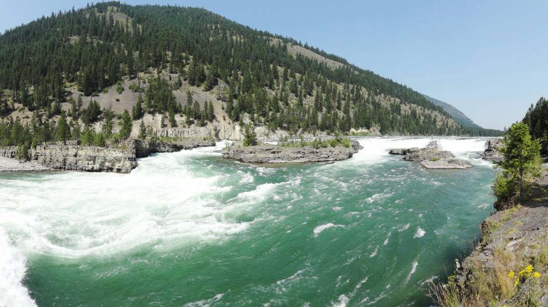
“In 1916, Lake Washington is lowered 8.8 feet and the Black River disappears due to construction of the Lake Washington Ship Canal. …  The lowering of Lake Washington and raising of Salmon Bay causes a number of changes to the watershed, the most dramatic of which is the drying up of the Black River when the level of Lake Washington drops below the river channel entrance [the natural outlet for Lake Washington]. As a result, the way water moves through the watershed changes drastically, with environmental and human consequences” HistoryLink.org

You can read the full article about the reshaping of the watershed and its impact at Washington State History HistoryLink.org. The article concludes “Like many large civil engineering projects in Seattle, the Lake Washington Ship Canal wrought enormous change to the landscape and to the lives of people who lived on the waterways affected by the project. It brought many benefits to the city, but exacted a large environmental and social price.”

Fish Ladder

Fish in before entering the ladder
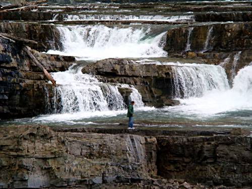
The tour then moved onto the Fish Ladder. Major Chittenden proposed the building of a fish ladder as a part of the locks design (he was environmentally aware that the salmon’s natural migration route up the Black River to their spawning grounds was about to dry up) and the first ladder was completed with the construction of the locks.

“All fish, including endangered salmon, must pass through the locks, spillway or the fish ladder to move between Lake Washington and Puget Sound. In 1976, Corps of Engineers officials renovated and improved the ladder to reflect changes in fish conservation. Today’s ladder has 21 steps, or weirs, which allow the fish to swim upstream on a gradual incline. For many years the locks has been the focus of studies detailing migrating juvenile and adult salmon behavior.” Fish Ladder, US Army Corps of Engineers

More Fish in Ladder
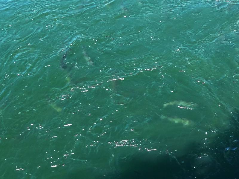
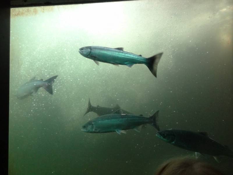
An underground low light viewing room offers five large glass windows to watch the fish swimming upstream in an upper weir as they approach the fresh water end of the ladder. The room has excellent interpretive signage offering information about the ladder and diagrams of five salmon species you will most likely see through the viewing windows. Although we have visited the fish ladder viewing area in the past, our guide shared some great information.One thing we learned is the fish often mill around lingering in each weir. Fish Chart
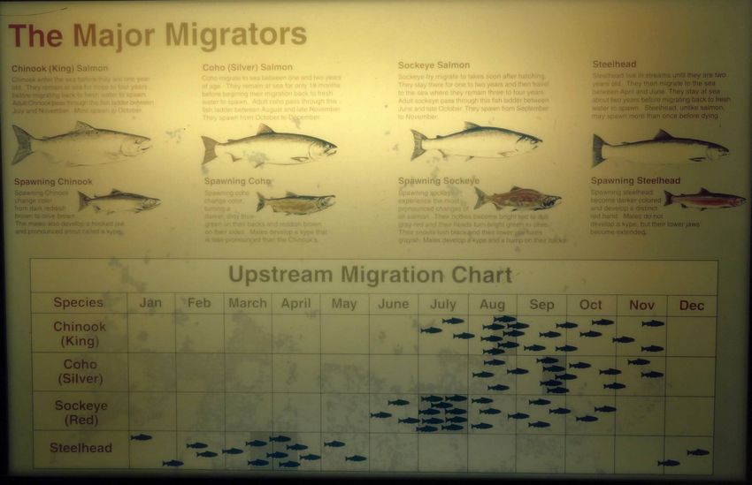
This allows their body to literally change its physiology adapting to the progressively lower salinity of the water above the spillway dam. In more natural settings, salmon migrating up unobstructed streams spend days moving from their adult salt water environment to the brackish estuary to the fresh water of their birth place allowing for a slow change in their physiology. The salmon migrating through the Locks fish ladder have a mere few hundred yards for their bodies to make the adaptation, thus they need to take it slowly. (Video 23 sec.)

A detailed discussion of the unusual and unique design of this fish ladder is at the link below:

“The fish ladder at the Chittenden locks is unusual—materials published by the federal government say “unique”—in being located where salt and fresh water meet. Normally, fish ladders are located entirely within fresh water. … The [first] ladder was designed to use attraction water: fresh water flowing swiftly out the bottom of the fish ladder, in the direction opposite which anadromous fish migrate at the end of their lives. … The Corps rebuilt the fish ladder in 1976 by increasing the flow of attraction water and adding more weirs. … A diffuser well mixes salt water gradually into the last 10 weirs. … The fish approaching the ladder smell the attraction water, recognizing the scent of Lake Washington and its tributaries. They enter the ladder, and either jump over each of the 21 weirs or swim though tunnel-like openings. They exit the ladder into the fresh water of Salmon Bay. … The offspring remain in the fresh water until they are ready to migrate to the ocean as smolts [juvenile fish].” Fish Ladder, Wikipeida

We had been wondering about large white tubes we saw extending from the spillway pouring out water from above the spillway dam. Our guide explained these “smolt flumes” were inserted into the spillway during spawning season to provide a safe route downstream for the smolt as they made their journey to the sea where they will live their adult life. They actually face upstream and swim against the current as they are carried backwards through the flumes. For scientific purposes the flumes have counters built into them so can keep track of how many smolt pass through. You can view additional photos at My Ballard and KelliTravels.com.

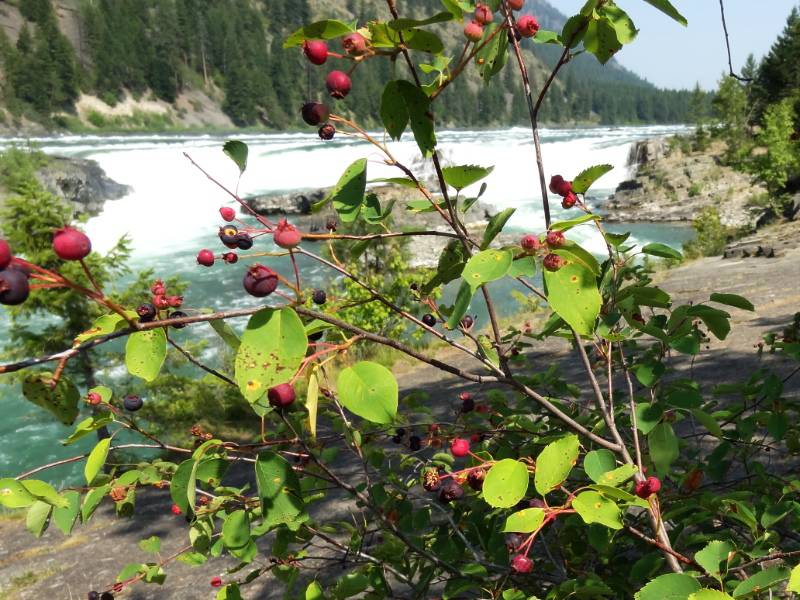
Carl S. English Jr. Botanical Gardens

FlowersThe tour had begun inside the auditorium with a short video and introduction by the Park Ranger guide. As we exited the visitor center and walked toward the locks, we paused only briefly on the main path in the Carl S. English Jr. Botanical Garden for our guide to give us some history about the gardens and a few antidotal stories. “Carl S. English was hired in 1931 by the U.S. Army Corps of Engineers to transform the gravel lot remaining from the construction of the newly completed Hiram M. Chittenden Locks into a grassy field which could be used for marching, training drills and public events.  Instead, he took it upon himself to bring to life an elaborate, English-style landscape garden which today boasts over 1500 varieties of plants from around the world.” [You can read more at Atlas Obscura] The fun antidotal story I remember: No other US Army Corps of Engineers site has a “garden” and years into English’s work, a visiting superior found not a flat marching drill grounds but the sculptured landscaped garden. The superior ordered English to remove the garden and put in a large flat grassy field. English said he would be happy to comply but would the superior please communicate to the University that the garden was to be removed; the University had by this time established a curriculum for all its botany classes to do their field work at the gardens. And would the superior also please communicate to the numerous volunteers who had spent 1000s of hours helping create and maintain the garden. The superior backed down and the Ballard Locks is still to this day the only Corps facility that has a Botanical Gardens!

“This botanical garden is a tribute to the devotion of our first horticulturist, Carl S. English, Jr. During the 43 years working for the U.S. Army Corps of Engineers, Carl transformed the barren lawn, left after the construction of the locks, into a garden worthy of serious study.

Through his travels and correspondence with prominent botanists and with the assistance of ship captains returning through the locks, Carl collected specimens of trees and flowers from around the world. He brought about an amazing homecoming, the dawn redwood Previously known only as a fossil, it was discovered growing in China. Carl arranged to receive some of the first seeds ever shipped to the United States. Eight specimens grow in the garden today.

These lovely grounds are a masterpiece of horticultural splendor, combining the elegant lines and vistas of the romantic English landscape style with the original character of more than 570 species and 1,500 varieties from around the world.” Botanical Gardens, US Army Corps of Engineers

We had enjoyed walked through the lovely and colorful gardens the day before so didn’t miss moving straight on to the canal and locks. The free guided tour was fascinating and I would recommend it if you are in the Seattle Ballard area.

Statue in front of houseWe topped off the day enjoying wine and pupus with our hosts in their garden, taking advantage of the sunny, warm evening and then shared a wonderful dinner together on our last evening in Seattle. Tuesday morning, once the Seattle rush hour traffic subsided, it would be time to head south and on to the next phase of our adventure.

Photo and Video Credit: Neil Rhoads

Photo Slider: This post has a unique slider with pictures from this adventure only. I hope you click into the webpage so you can see the slider in action.

Photo gallery below:
Clicking on any photo thumbnail brings up the full size photo with a description. To easily see them all, use the arrow buttons or keys to move through the full size gallery photos with descriptions. If you are receiving this in an email and don’t see a photo gallery below, please click into my webpage to view all the photos!

North Cascades 2014

Peaks through the windshieldWe were driving the most northerly highway in Washington state and heading to a region that neither Neil nor I had ever been to see: the North Cascades. The Cascade Mountain Range extends from Canada all the way to northern California. The “North Cascades” designates the portion of the Mountain Range in north central Washington. Looking at the map from the Ice Age Floods Institute (first mentioned in the National Bison Range post), it appears that many North Cascade peaks extended above the ice sheet between the Puget Lobe and the Okanogan Lobe. Driving through these mountains, it is clear they are sculpted by glaciers. Archeological finds in the region suggest continuous human habitation since the end of that most recent glacial period when the native American ancestors of the Skagit tribes advanced to the interior of the mountainous region as the ice retreated. Neil and Nan at Diable Lake OverlookWhile the Puget Sound Skagits seemed to only venture into the North Cascades during the summer months, the tribes to the north and east of them, the Nlaka’pamux, Chelan, Okanogan and Wenatchi, lived partly or year-round in the eastern sections of the North Cascades. In 1811, a Scotsman named Alexander Ross explored the region for the fur trade and with the men of his company built Fort Okanagan. During the 1800s there were several expeditions to search for a transportation route through the North Cascades. They found no possible railroad route, only marginally suitable routes for roads, and it was determined that the mountains were virtually impenetrable! In fact, it wasn’t until 1972 that the road we drove, Highway 20, also called the North Cascades Highway, was finished to bisect the Cascades over Washington Pass at 5,477 feet. And the highway is closed in the winter due to the large snow accumulation in the mountains! Viewing the North Cascades from the eastThe mountain peaks were still snow covered in mid-July as we drove toward the North Cascades through the Methow Valley. It was brilliantly sunny and clear having left the smoke and fire behind us that Friday afternoon July 18. We were in awe of the breathtaking views of the spires and peaks as we viewed the scenery thorough the windshield. We didn’t take time to stop for photos because we were concerned about getting to the campground in time to get a good site.

American Alps

Colonial Creek CampsiteIt was a good thing we kept driving straight to North Cascades National Park and didn’t stop to take photos (well, one stop at the Diablo Lake Overlook) because we got one of the last available camp spots in the large Colonial Creek campground that Friday night. The campground is set in a beautiful old growth forest and we were pleased to get a fairly private little tent spot. After setting up camp, we still had more daylight and drove to the North Cascade visitor center to collect maps and information. Visitor Center ViewpointViewing the setting sunlight on the North Cascade peaks from the visitor center viewpoint made me understand why Washington state citizens who petitioned for the region to be protected as a National Park in 1898 believed it to have scenery “greater than Switzerland’s”; the region has the nickname the “American Alps”. However, the North Cascades wasn’t designated as a National Park until 1968. I admire the generations of environmentalists who have worked to preserve the wilderness for future generations.

“Rival interests continued to argue over whether the lands should remain under the management of the U.S. Forest Service or the National Park Service but by the 1960s, the environmentalist argument advocating for a national park prevailed. Though the North Cascades National Park Act designated the region as a National Park on October 2, 1968, the National Park Service did not commence direct management until January 1, 1969. The North Cascades National Park Act also designated Ross Lake and Lake Chelan National Recreation Areas. Interestingly, Redwood National Park in California was also signed into existence on the same day as the North Cascades. By 1988, much of Bob Marshall’s original plan to set aside the future park as [unimproved] wilderness [as opposed to a national park] was achieved when 93 percent of North Cascades National Park was designated as the Stephen Mather Wilderness. Establishing the national park (Wikipedia)

Gorge Creek Falls with RainfallA wonderful top off to our day was viewing an impressive waterfall! Gorge Creek Falls is accessible from a large parking area right off the North Cascade Highway as we returned to our campground. Gorge Creek dramatically drops 242 feet into a steep-walled narrow gorge before flowing into the turquoise Gorge Lake. Following the walkways also took us to an overlook of Gorge Dam and the Skagit River flowing from it. As we prepared for sleep we were getting excited about hiking tomorrow in these glacier carved mountains full of lakes and waterfalls.

Water Water Everywhere

Diablo Dam from the HighwayWe woke to rain! We made our breakfast tea and off we went to hike in the rain. We were a little discouraged with the overcast because it had been so beautifully sunny on our drive the day before but we could only hope the rain would reach beyond us and help quench the wildfires to the east. Looking for a trailhead, we drove down the access road to the ferry landing and the North Cascades Environmental Learning Center. The road went right over the top of Diablo Dam and we stopped at the pullout! It was an impressive sight watching and feeling the rumble and roar of the water shooting out of the dam spillway with mist rising as the water plummeted down to the riverbed far below. We definitely felt the power of nature. Neil has edited a (53 seconds) video for you of Diablo Dam since still pictures simply fail to capture the moment.

Skagit River Hydroelectric Project

Now might be a good point to talk about the lakes and dams. The dams (Gorge, Diablo, and Ross) were built, and are owned and operated by Seattle City Light, the Seattle power company. These three dams with hydroelectric power-generating stations are designated as the Skagit River Hydroelectric Project. The project supplies approximately 25 percent of Seattle’s electric power. Construction on Gorge Dam was begun in 1921, then Diablo Dam construction began in 1927 upriver on the Skagit River, and lastly Ruby Dam, later named Ross Dam, began in 1937. The three lakes formed by the dams are encompassed by the Ross Lake National Recreation Area. Ross Lake stretches 20 miles upriver with its north tip extending into British Columbia.

Diablo LakeThe Skagit River and, by extension the three lakes, are glacial fed. Approximately one third of the glaciers in the lower 48 states are within the North Cascades National Park (312 glaciers are on the mountains in the park.) The pressure of a glacier’s own weight and the force of gravity cause the glacier to move (or flow) outward and downward, grinding the the rocks below. Abrasion happens when the glacier’s ice and embedded rock fragments act as sandpaper, crushing the rock into finely pulverized rock flour and smoothing the rock below. The rock flour freezes into the ice and later flows downstream suspended in the glacier meltwater. This rock flour suspended in the water is what gives the lakes their beautiful turquoise color.

Thunder Creek Watershed: Glaciers and Diversity
“Thunder Creek is an ecologically important watershed with the largest concentration of glaciers in the lower 48 states. This valley deep within the mountain range carves through the “Crystalline Core” of the North Cascades. It mixes plant and animals typical of the dry east side of the mountains with those usually found on the wet west side. Natural disturbances such as fire, snow avalanches, landslide, and glaciation add complexity and help to create a mosaic of habitats.” Sign at the Diablo Lake Overlook

North Cascades National Park Complex

North-Cascades-map-smallHere’s what I didn’t understand until I was looking at the park map to write this post: The Ross Lake National Recreation Area basically bisects the North Cascades National Park creating a northern and southern section of the Park. The Highway 20 corridor and all campgrounds are actually in the Recreation Area. The three portions (including the Lake Chelan National Recreation Area adjacent to the south edge of the Park) are all managed together as the North Cascades National Park Complex. Simple, right? Actually it was simple because we just thought of the whole area as the North Cascades and there were no National Park entrance fees—just the campground fees. Now I can understand how they can designate 93% of the North Cascades National Park as wilderness because there are no roads into the actual National Park—only foot trails.

Walking in the Rain

Neil crossing Cutthroat CreekSpeaking of trails, yesterday we had considered taking the ferry across Diablo Lake and walking back along the Diablo Lake Trail. The misty rain over the lake did not make the hike appealing since the higher elevations of the trial would be in cloud with no spectacular views. Instead we back tracked on the North Cascades Highway (Highway 20 back the route we had come yesterday up and over Washington Pass) and decided to hike a few shorter trails to see the variety of the area. We first hiked to Cutthroat Lake; named for the nearby Cutthroat Peak rocky spire, 8,050 feet, but I couldn’t find out how the peak got its name. Nan at Cutthroat LakeWe were well prepared as we started out: bundled up for the cold air and covered with our rain jackets and hoods up. And then people started passing us on the trail in their tank tops and hoodies tied around their waist like they are out for a stroll. If you had seen us side by side could you tell which people were locals and which were visitors from the tropics? [In retrospect, this was Clue One.] Avalanche looking downhillIt was a moderately easy 4 mile round trip hike through thin forest and rocky areas. At one point we crossed a debris field of downed trees that had taken out the trail. The swath of downed trees extended far up the steep slope to our right and far down into the valley to our left. All the broken trees were snapped off in the downhill direction. Clearly, this was the site of a recent snow avalanche.

Cutthroat LakeThe lake itself wasn’t picturesque until you took in its impressive setting up against the huge expansive wall of rock forming a semicircle behind it. Geologists call this semicircular shape a cirque, and it often forms the beginning or head end of a glacier. Often, the bowl shape is so scooped out that when the glacier melts a lake is left behind. These lakes are tarns. This hike was a good choice in the rain even with the clouds hanging low over the surrounding peaks.

Washington PassThis time we had time to stop at the Washington Pass Overlook to take in the vista. Taking in this view of the towering rocky peaks and cliffs, I could see how these mountains could look impenetrable.

Our next hike was to another tarn called Rainy Lake, well it was more like a stroll, on a two mile round trip level trail (with the exception of a couple of large fallen trees to climb over across the path.) We walked in an old growth forest to emerge at a beautiful basin encircled almost all the way around by steep mountain slopes covered with cascading waterfalls from melting patches of snow. Here’s a short video of the beauty.

As we drove back through the campground, we noticed everyone had put up tarps over their tents and picnic tables to keep them dry from the rain. Some people even had tarps stretched high above their campfires so they could sit around them in shirtsleeves. [This was Clue Two] We arrived at our campsite and discovered our tent and sleeping bags were drenched from water running inside. Did you know that polyester fill sleeping bags can easily hold four to five times their own weight in water? [This was Clue Three]—We are not prepared for camping in the rainy Pacific northwest! We reorganized the car to put the dry items on the back seat and then carefully bundled the wet tent and sleeping bags plus mats in the trunk and headed to find a hotel.

Graceful Retreat

Trail of the CedarsWe had planned (and pre-paid) to camp two more nights depending on the weather and the trails we found. There were also a few trails in Newhalem by the visitor center we had planned to walk our last day when we exited the Park. Still bundled in our raincoats and hoods, we spent a few more hours walking the Trail of the Cedars, Rock Shelter Trail, and the Ladder Creek Falls and Rock Gardens behind the Gorge Power House. We were too late to take any of the Seattle City Light walking tours but crossed the Skagit River using the pedestrian suspension bridge and walked among the gardens on our own enjoying the view of the beautiful little waterfalls. The gardens were the creation of J.D. Ross, the second Seattle City Light superintendent, and an accomplished horticulturist, who envisioned the three dams and hydroelectric powerhouses.

Ladder Creek Falls“Ladder Creek Falls and Rock Gardens, located behind Gorge Powerhouse in Newhalem, is a refreshing woodland retreat with benches, exotic plantings, and close-up views of spectacular Ladder Creek Falls. Cross the Skagit River using the pedestrian suspension bridge next to the powerhouse, and follow signs to the trail. The historical light show has been restored and operates year-round from dusk until midnight.” Seattle City Light Skagit Project

Walking back over the suspension bridge we noticed cloudy wisps blowing over the valley walls. Their motion was so peaceful and beautiful we just stood and watched for a while.

We started looking for hotels before hitting I5, and then kept looking for vacancies at each major intersection. Neil started using the phone and calling. ALL FULL. Then it hit us, all the roads were closed going east and people might be stuck on the coast. After nine stops and eleven calls, we were nearing Seattle. Flowers on Skagit RiverWe called Helene and Timothy to ask if we could descend on them at 11 at night. They said COME and why did we even try for a hotel! We were exhausted and only managed to say our hellos before having them point us to the bed – luxuriantly soft and dry! Happiness 🙂

Photo and Video Credit: Neil Rhoads (Hope you enjoyed the addition of videos)

Photo Slider: Neil has worked hard editing the pictures for you to enjoy in the posts. He has also had fun making header photos for the top rotating slider. This post has a unique slider with pictures from this adventure only. I hope you click into the webpage so you can see the slider in action.

Photo gallery below:
Clicking on any photo thumbnail brings up the full size photo with a description. To easily see them all, use the arrow buttons or keys to move through the full size gallery photos with descriptions. If you are receiving this in an email and don’t see a photo gallery below, please click into my webpage to view all the photos!

Fire! 2014

Road Closed SignThe following is based on a true story… There was no news about the fires or road closures at the Bonaparte Lake campground Friday morning (July 18) when we woke so we decided to drive on to the ranger station in Okanogan to get the latest news. The news didn’t sound good at all about getting through to the coast. We were driving Hwy 20 and were told the pass was closed between Okanogan and Winthrop; the road a little farther south, Hwy 2, was closed at Leavenworth to the coast; and even farther south on I90, there was a section closed due to a 25 semi pile up! Ash along to road sideThe ranger was trying to be helpful about proposing alternate routes while he was also monitoring the fire radio: he proposed back the way we came and then over small roads to get past the pile up to I90 (we didn’t want to go that far south if we could avoid it.) He said there “might” be a way down and up to Hwy 20. He had heard there was pilot car leading cars south on Hwy 97 from Okanogan. We decided to try it because it was the most direct way either to get back to Hwy 20 or else if we needed to continue down to I90.

Fire right up to road shoulderWe headed south toward the smoke. There were fires on the hills to our west side. We stopped with the other traffic and Neil got out to take pictures while standing in ash on the road brim. There was fire equipment and firefighters still sitting on the side of the road near smouldering vegetation. The pilot car arrived and led us through the smoke which was very thick in parts. We could see power poles, highway signs, and orchards all burned. We continued to Pateros where Hwy 153 turns off back to the north toward Hwy 20.

Fire near the roadAs I turned at the intersection to head west on 153 there were two sheriffs at the stop sign who had just come from that direction. I rolled down my window and asked if we could get through? He just stared at me (or through me) a moment and then said “be careful.” He looked like he was in shell shock and may not have realized what he was saying but that was all the permission I needed. Neil noticed about 100 fire fighting vehicles and mobs of firefighters congregating just south of the intersection, ready for deployment to the hotspots further south.

Flames over the hillStarting a mile or two west from the intersection we drove by burned areas and saw fire on the hills; then we drove by where fire was right at the road and the firefighters were fighting it. We saw exhausted men and women and tens of fire trucks spread out along the road wherever pockets of fire remained. The sad thing was seeing homes completely gone except for the chimney and steps while houses nearby were untouched. Those untouched had green grass around them and the fire didn’t pass the open area. One house went up in flames off the road as we drove by.

Structure busting into flamesWe connected with Hwy 20 at the town of Twisp. Power was out everywhere and we saw long lines of parked cars at all the gas stations, which were closed. Many people had been stranded for days. One Mom & Pop general store was the only place pumping gas. It was over a mile off the main highway and we were lucky to find it (good intuition). They must have had a generator. They also had a guard at the door allowing only one person in for each person who exited. I did see small amounts of food still on the shelves. There was no cell phone service throughout the whole region (hundreds of square miles) because the cell towers had burned or had no power. Burned HouseWe had stopped to pick up info on the road ahead but soon found the info we had was extremely valuable. We were the first to bring news from the east. While I waited in the queue for much-needed gas (at almost double the normal price) people in front of the store crowded around Neil and pressed him for information. The store owners wrote down a summary on a big blackboard for later people to read.

Power pole on sideWe drove on to Winthop and decided to stop at the Ranger Station to give our news. It was good we did because they were also dealing with lack of power and phones. They had little battery powered radios to talk to their trucks but couldn’t get any useful info from far away. Fire coordination was their main focus but they were trying to answer people’s questions. We saw people who had just lost their homes, people who had been evacuated and had nowhere to go, and stranded travelers in desperate circumstances, some camped on the lawn. They were all shocked when they heard we had made it through. They had all thought the highway was closed (maybe it was supposed to be?) FirefightersWhen they heard we had come through from Pateros the ranger came around from behind the desk and one came from the back room to grill us with more questions. Neil, with his previous experience in creating maps for emergency management, had them pull out their big map and was able to clearly point out on their maps the details we observed. They were all so starved for meaningful information, especially the rangers, that our decision to stop there turned out to be a huge blessing to many people.

Carlton Complex Fire was the name given this wildfire. Neil researched and found links which provide

Carlton Complex Fire MapFour lighting strikes sparked fires on July 14, 2014, near Carlton, Twisp, and Winthrop which merged to become the largest recorded wildfire in Washington state history (the previous record was 1902.) The most intense burn days were July 17 (light and dark green) and 18 (yellow) fueled by high temperatures and strong northwest winds (we drove Hwy 153 on July 18!) The fire was not declared 100 percent contained until 41 days later.

Flames above houses“[The fire] burned 256,108 acres, destroyed 353 homes, and caused an estimated $98 million in damage. The fire caused no direct fatalities or serious injuries, although one homeowner died of a heart attack while protecting his home. … When July 19 arrived, a total of 760 firefighters were battling the Carlton Complex blaze, along with at least 15 helicopters and two planes. … In the end, the Carlton Complex fire was, in the words of The Wenatchee World, “a catastrophe beyond measure … too great for an ordinary detached person to grasp” (“The Long Struggle”).” HistoryLink.org

We left the fire and smoke behind driving west now seeing incredible views as we neared North Cascades National Park. We arrived just in time to get one of the very last available camp spots in the large campground. We had made it! What an experience!

Photo Credit: Neil Rhoads

Photo Slider: Neil has worked hard editing the pictures for you to enjoy in the posts. He has also had fun making header photos for the top rotating slider. This post has a unique slider with pictures from this adventure only. I hope you click into the webpage so you can see the slider in action.

Photo gallery below:
Clicking on any photo thumbnail brings up the full size photo with a description. To easily see them all, use the arrow buttons or keys to move through the full size gallery photos with descriptions. If you are receiving this in an email and don’t see a photo gallery below, please click into my webpage to view all the photos!

North Eastern Washington 2014

Campsite At Bonaparte LakeThursday morning (July 17) at Bull River campground we continued to enjoy sunny but somewhat hazy skies as we finished our breakfast and packed up the car. Our plan was to drive through the Idaho Panhandle and on through Okanogan National Forest to the North Cascade National Park all in one day if we could. We knew it would be a long drive day. We called Helene to say we were planning to get to Seattle earlier than previously planned. She warned us about all the forest fires and road closures. That was the first we had heard of them! Those thunderclouds we photographed on our Missoula Blue Mountain Monday evening walk had brought dry lighting to Washington and Oregon and started numerous forest fires. Now we knew that the haze we had been seeing in the air the last few days was forest fire smoke blowing into Idaho and Montana!

Idaho Panhandle

Lake Pend OreilleSince we wouldn’t make it through to the North Cascades, we decided to see how far we could get westward and find a place to camp. We followed the Clark Fork River on Hwy 200 crossing into Idaho and driving along the north shore of Lake Pend Oreille then connecting with Hwy 2 at Sandpoint on the lake. It is evident this is a recreation and resort area with little motels and boat parking dotting the highway. We enjoyed the scenic views along the drive but no place jumped out to stop for photography; especially since the sweeping vistas out across the lake were hazy. I found a photo online that reminded me of the views we were seeing. Lake Pend Oreille is glacially carved and is Idaho’s largest and deepest lake. Researching it, I found the lake is the probable location of the ice dam causing the formation of Glacial Lake Missoula we mentioned in the National Bison Range post.

“During the most recent episode of major ice-sheet expansion, between about 18,000 and 13,000 years ago, a lobe of the Cordilleran ice sheet advanced into the Idaho Panhandle to the area that is now occupied by Lake Pend Oreille, thus blocking the Clark Fork River drainage and causing Glacial Lake Missoula to form.” About the Ice Age Floods.

The image of the Ice Age Floods map on the above web page reflects the theoretical extent of the most recent ice sheet coverage of North America. Zooming in on the map image, I was able to see the towns of Libby and Sandpoint labeled near the top right side which gave me a reference to where we had driven over what might have been the glacial ice dam.

Entering Washington

Douglas Falls with NanWe entered Washing ton state as we crossed the Pend Oreille River into the town of Newport and checked out the Colville National Forest’s Newport Ranger Station for suggestions of hikes and campgrounds. The brochure about Day Hikes in Eastern Washington had an insert describing Waterfall Strolls. That definitely needed some investigation! The ranger didn’t have news about the fires; he just knew that both Hwy 2 and 20 were closed at the moment. We branched onto Hwy 20 to stay north and continue west since Hwy 2 turned south out of Newport.

Mailea has been all through the Washington/Idaho area collecting tree insects for research and one of the places she mentioned as a stop was Colville! Beaver LakeWe found a huge Safeway to restock our supplies and friendly people. Neil asked for a lunch recommendation, and when he mentioned possibly Mexican food, the cashier raved about a little place a few blocks away. We tried two different Mexican restaurants while traveling in Eastern Washington and we can tell you that what passes there for Mexican food is nothing like we are used to in California or Hawaii! At one restaurant, Neil tried to politely ask the Hispanic owner if this was the same food the staff ate in the back (his bland Chili Verde was the toughest meat we had ever tasted. Neil said it was like chewing straw and he literally gagged a few times while trying to swallow it.) The owner just got huffy and grabbed Neil’s plate off the table. He said had never had a complaint about the dish in the 12 years he had been in business. I’m glad the locals keeping him in business have tough jaws. We didn’t have Mexican food again until we got to California.

Waterfalls

Crystal FallsThe Waterfall Strolls were all in the Colville vicinity. Crystal Falls is right on Hwy 20 but there was no signage to identify it. We would have missed it if we didn’t know where to look for the gravel parking area. Crystal Falls gets its name from how it looks in the wintertime. The Pend Oreille River drops straight down a rocky face and there are good viewpoints right near the road. Of course Neil had to climb out to the top of the rock directly overlooking the falls and I was able to snap a photo.

Douglas FallsWe drove a little north out of Colville to find Douglas Falls. What we found was the falls were within a state park including a campground. The falls overlook is in the day use area allowing an elevated view of falls.

The information sign gave the history: ”Douglas Falls Grange Park: The 120 acre park site was purchased in 1938 by Stevens County Pomona Grange #17 and maintained thereafter by its members for the public’s pleasure. Changing times made the upkeep of the park a problem for the organizations. So in 1975 a deed to the property was presented to the State of Washington Department of Natural Resources for development and maintenance as a public park. The 60 foot waterfall on Mill Creek was named for R.H. Douglas who harnessed it in 1855 for a grist mill. Later converted to a sawmill. Failing to negotiate a lumber contract with the U.S. Army at nearby Fort Colville, he turned his talents to the production of distilled spirits.”

Upsteam of Meyers FallsThe last waterfall we searched out was Meyers Falls which took us through neighborhoods in Kettle Falls. It was a disappointment when we finally found it because the access to the main falls viewing is blocked by the current powerhouse owner. There are informational signs and the history is well documented however we were only able to view a small falls upstream from Meyers Falls.

“On the Colville River immediately south of the City of Kettle Falls (which in turn was named after a now submerged and extinct falls), Meyers Falls is a series of cascades about 133 feet in total height. In the spring the cascades join to become a single, wide, 133 foot waterfall. Over the years a grist mill, a sawmill, a brick factory and a hydroelectric project have been built above and below the falls.

In 1826 a gristmill was built by the Hudson’s Bay Company on the river above the falls and continued in use until after the first generating station was built. In the intervening years a sawmill capable of producing 20,000 board feet of lumber per day was also built at this site. Interestingly, this early use of the Colville River makes it the oldest source of water power in continual use west of the Mississippi River.“ Waymarking Meyers Falls

Five Lakes Area

Okanagan Chiefs

Chief Moses, Chief Tonasket, Chief Sar-sarp-kin

We decided to stay at Bonaparte Lake Campground (elevation 3500 feet) near Tonasket, actually in the Okanogan National Forest. Okanogan is a Salish Indian word meaning “rendezvous.” Originally this region was home to 12 tribes who moved through it according to season. In 1846 the US government ignored the rights of the indigenous people, seized the land from them, established reservations, decades later took the north half of the reservation back from the Indians, opened it to settlers and prospectors eager to exploit it, and eventually put the bulk of the land under management of the Forest Service. The area is rich with old ghost towns, many in good condition. Sadly, we didn’t have time to explore them.

Lost Lake with canoeWe found a nice camping spot right on the lake shore in the magnificent Okanogan Highlands. There was even firewood provided, however, the hostess stopped by to say the ranger had just come around saying no campfires till further notice, sigh; we would miss an evening campfire. With unplanned daylight left, we set off to explore a couple of the lakes close by. The drive took us up and down around the forested hills and even along a rather steep ravine. Each of the lakes had a National Forest campground with plenty of open camp spaces. Beaver Lake and Beth Lake were small lakes with boat launch access. Each lake had a different look in the afternoon light. Lost Lake was the highest lake we explored. Larch TreesWe enjoyed watching a large young adult group equipped with canoes having great fun camping right on the lake. An alluring sign caught our attention as we neared Lost Lake that needed more investigation: “Big Tree Trail Head”. We parked at the trailhead as we retraced our tracks from Lost Lake. The mile nature trail loop we walked ended at two giant ancient trees.

Sign on the trail: “The two old western larch below, also called tamarack, are over 900 years old. They were not harvested with the rest of the trees in 1963. In 100 the trees in this area were thinned to remove those with insects and disease damage. The remaining trees now have more crown space. Some they may reach the size of the two big larch below.”

Neil communing with the AncientI am finding it hard to put in words the feeling of being in the presence of these majestic trees. It is one of both wisdom and love. Neil communed with them for some time. He experienced an altered perspective on the forest – one where years sped by like days. For these ancient ‘standing people’ the lifespan of a human is a mere flicker compared to the scope of their cares and concerns. It was very humbling.

Bonaparte LakeWe woke to the sounds of nature Friday morning. The air was full of bird songs and chattering squirrels as the sunlight just reached the water itself and the hill full of pine trees reflected in the water! We sat at the water’s edge to watch and listen to the serenade before breakfast and breaking camp.

Photo Credit: Neil Rhoads and www.tourfactory.com for Lake Pend Oreille and ghosttownsusa for Okanagan Chiefs

Photo Slider: Neil has worked hard editing the pictures for you to enjoy in the posts. He has also had fun making header photos for the top rotating slider. This post has a unique slider with pictures from this adventure only. I hope you click into the webpage so you can see the slider in action.

Photo gallery below:
Clicking on any photo thumbnail brings up the full size photo with a description. To easily see them all, use the arrow buttons or keys to move through the full size gallery photos with descriptions. If you are receiving this in an email and don’t see a photo gallery below, please click into my webpage to view all the photos!

Kootenai National Forest 2014

Lake KoocanusaAfter our hike to Little North Fork Falls and a refreshing dip in Big Creek, we set out on a brilliant Wednesday morning. We drove south along the west side of Lake Koocanusa looking down the steep sides of the lake before reaching the overlook of Libby Dam at midday.

Lake Koocanusa and Libby Dam

Libby DamLibby Dam was completed in 1972 and stands 422 feet tall. It created a 90 mile long narrow lake stretching between the United States and Canada. It was a joint project between the two countries to provide flood protection from the Kootenai River spring fluctuation and to generate hydroelectric power. Lake Koocanusa received its name in a contest to name the Libby Dam reservoir. Alice Beers, from Rexford, Montana, combined the first three letters from KOOtenai River, and the first three letters of CANada and USA. They offer public tours of the dam but we just enjoyed the overlook view before continuing.

Our plan was to drive Highway 2, the very northern US route, to the Pacific. The highway traverses multiple National Forests and Parks including Kootenai National Forest. Kootenai encompasses the northwest corner of Montana where we spent two nights on our trip. We checked with the local experts at the Libby Ranger Stations for suggestions of sights to see and hike. The ranger said not to miss the Ross Creek Cedars, a hidden gem. We also asked about Kootenai Falls and she said “You can miss it. There are lots of cars and an ice cream stand.”

Kootenai Falls and Swinging Bridge

Kootenai FallsIt was just as the ranger described it: lots of cars (and RVs) and a concession stand in a large parking lot with informational signs for Kootenai Falls. We walked a level foot path from the parking area next to the highway and then descend a dirt trail down the hill to double railroad tracks. A special enclosed pedestrian bridge has been built over the tracks with high stairs to climb and descend to the river side. Swinging BridgeWe took the left fork of the trail which winds along the river and down to the swinging bridge. After enjoying the view of the falls and the swaying feel of the bridge with the water racing below us, we retraced our steps and took the right fork along the river to rock cliffs immediately overlooking the falls. We could feel the power of the falls just standing on the rumbling rocks with the mist swirling around.

“The calm [Kootenai] river suddenly gathers momentum surging first through China Rapids and then over Kootenai Falls, dropping 90 feet in less than a mile. The main falls is 30 feet high and can be viewed from a “swinging bridge” that crosses the river. … The falls area is a sacred site to the Kootenai Indians who once called this area home. This was a place where tribal members communed with spiritual forces.” LibbyMT.com Kootenai Falls

Kootenai Falls – Then and Now

Neil in the Falls 07On our 2007 North American Adventure we found Kootenai Falls almost by accident. As we drove Highway 2, Neil was studying the terrain out the window and he suspected a dramatic elevation change was nearby when he spotted a sign for Kootenai Falls and large parking lot with just a few cars. It was a good place to stretch our legs so we stopped to investigate. What a find! Swinging Bridge 07It was October 1, 2007 and the water flow was low enough in the channel that we were able to walk on the rocks down near the falls. We were able to see that at some time in the past the water flow must have been many times higher. You can read our description of our first experience with Kootenai Falls at Day 11 of our North American Adventure. We pulled a few photos from back then so you can see the comparison.

Kootenai Falls 07 labeled Neil looking out over the Falls labeled

Our recent falls excursion was July 16, 2014 and the water was roaring down the falls filling the channel from bank to bank! On our first visit we scrambled down the bank and out onto rocks that were now completely submerged under raging currents. Kayaker just over the FallsIt’s hard to tell from photos but being out in the middle of a giant riverbed during low flow was somehow more profoundly impressive than just seeing it in full flow from above. Below where you see the kayaker in the water is some of the sandy river bottom we walked on years ago. Just imagine what it’s like for that kayaker!

Juneberries and the FallsOn the other hand one of the things that makes a summer visit better is the berries are in season. From out on the swinging bridge Neil saw a couple of people grazing some bushes. Some of you may know Neil loves to eat exotic things when he travels so naturally he went over to them and struck up a conversation. They were German tourists who recognized the berries as Juneberries and they offered to share some with him. Nan enjoying ice creamYum! Neil ate quite a few.

I couldn’t resist getting some ice cream as reward for accomplishing the hike and I shared some with a shaggy friend at the table with me. This is only fair since Neil ate his Juneberries.

Ross Creek Cedars

Neil at Ross Creek CedarsWe are very grateful for the ranger’s recommendation! We would have completely missed this little magical place. Ross Creek Cedars is an amazing ecosystem of preserved old growth cedar trees. It is a mile long loop nature trail with informative signs of the history and ecology of the many plant and animal species native to the cedar grove.

“The Kootenai National Forest established the Ross Creek Cedars in 1960, as a scenic area protecting it for scientific and recreational value. Looking up inside a CedarThe 100 acre park is home to a grove of 500 year old ancient western red cedars. Some of these trees grow up to 12 feet in diameter and 175 feet in height. The grove is also home to various large specimens of other western trees and the many lush ferns and flowers that blanket the shady forest floor.” Exploring Montana: Ross Creek Cedars

We only took a few photos because we were enjoying the magic of the location. The two website links above about the Ross Creek Cedars have a variety of photos if you want additional views of the trees.

Nan at Bull Run CreekWe camped nearby just off of Hwy 200 in a campground on the Bull River. The river had such a silty bottom that it wasn’t inviting to me for an evening swim. The campground was crowded but we had the convenience of a picnic table for cooking dinner and breakfast. There are tradeoffs in all things. 🙂

Photo Credit: Neil Rhoads

Photo Slider: Neil has worked hard editing the pictures for you to enjoy in the posts. He has also been having fun making header photos for the top rotating slider. This post has a unique slider with pictures from this adventure only. I hope you click into the webpage so you can see the slider in action.